Nagarkot Short Hiking | Best Trails, Views & Day Hike Guide
Introduction to Nagarkot Short Hiking
There is a particular kind of quiet that exists on a ridge at 2,000 meters just before sunrise. A cockerel somewhere down in a Tamang village, wind moving through pine, and a long line of snow peaks slowly turning from grey to pink. You are about an hour from Kathmandu's traffic, yet it feels like another country.
That is the promise of Nagarkot short hiking. It is not a Himalayan expedition, and it does not pretend to be. It is a way to put real trail under your boots, see a wide sweep of the Himalaya, walk through village life and finish at an ancient temple, all within a single day or a single night away from the capital.
This guide is built for people who want to get it right: which trail suits you, what you can honestly expect to see, when the sky is clearest, how much to budget, what to pack, and how to avoid the small mistakes that turn a lovely morning into a hazy, rushed one. It is written for first-time visitors with a spare day in Nepal, for travelers acclimatizing before a bigger trek, and for families who want a gentle introduction to hiking in the hills.
Nagarkot Hike at a Glance
Detail | What to know |
|---|---|
Location | Bhaktapur District, on a ridge on the eastern rim of the Kathmandu Valley |
Distance from Kathmandu | About 32 km by road |
Elevation | Roughly 2,150 to 2,200 m (figures vary slightly by spot and source; around 2,175 m is commonly used) |
Drive time | Roughly 1 to 2 hours, depending on traffic and road conditions |
Famous for | Sunrise and sunset views, a wide Himalayan panorama, forest and village walks |
Typical short hikes | View Tower walk, panoramic loop, Nagarkot to Changu Narayan, Nagarkot to Dhulikhel |
Difficulty | Easy to moderate, depending on route |
Altitude sickness risk | Very low at this height for most people |
Best seasons | October to November, then March to April (with clear winter days as a bonus) |
What Nagarkot Short Hiking Really Offers
This style of hiking sits in a sweet spot that few places near a capital city manage. The ridge is high enough to feel like a mountain viewpoint, but gentle enough that you do not need training, special gear or a long runway of acclimatization. Most routes are walks of a few hours on village paths, forest tracks and quiet roads, usually with more downhill than uphill.
What you get is variety rather than extremes. In a single morning you can stand on a viewing tower with a long line of Himalayan peaks on the horizon, walk through terraced fields and brick-and-timber Tamang houses, pass through patches of forest, and finish at a UNESCO World Heritage temple that has stood for well over a thousand years.
It is also honest about what it is not. This is not a remote wilderness hike. You will share roads with motorbikes in places and see construction and small hotels along parts of the ridge. The magic lies in timing (early mornings), route choice (the village trails rather than the road), and the day you pick.
Who it suits best
First-time visitors to Nepal who want a taste of hiking before committing to a multi-day trek
Travelers on a tight schedule who have one free day around Kathmandu sightseeing
Families with older children and anyone nervous about altitude
Photographers chasing sunrise light without a long expedition
Trekkers wanting a gentle warm-up before a bigger route, or an easy day after returning from the mountains
Who may be disappointed
People expecting close-up views of Everest (more on that below)
Anyone hoping for total solitude on the main ridge road at sunrise
Hikers wanting sustained, strenuous elevation gain
The Himalayan View: What You Can Actually See
Nagarkot's reputation rests on its panorama, so it is worth being clear about what that means.
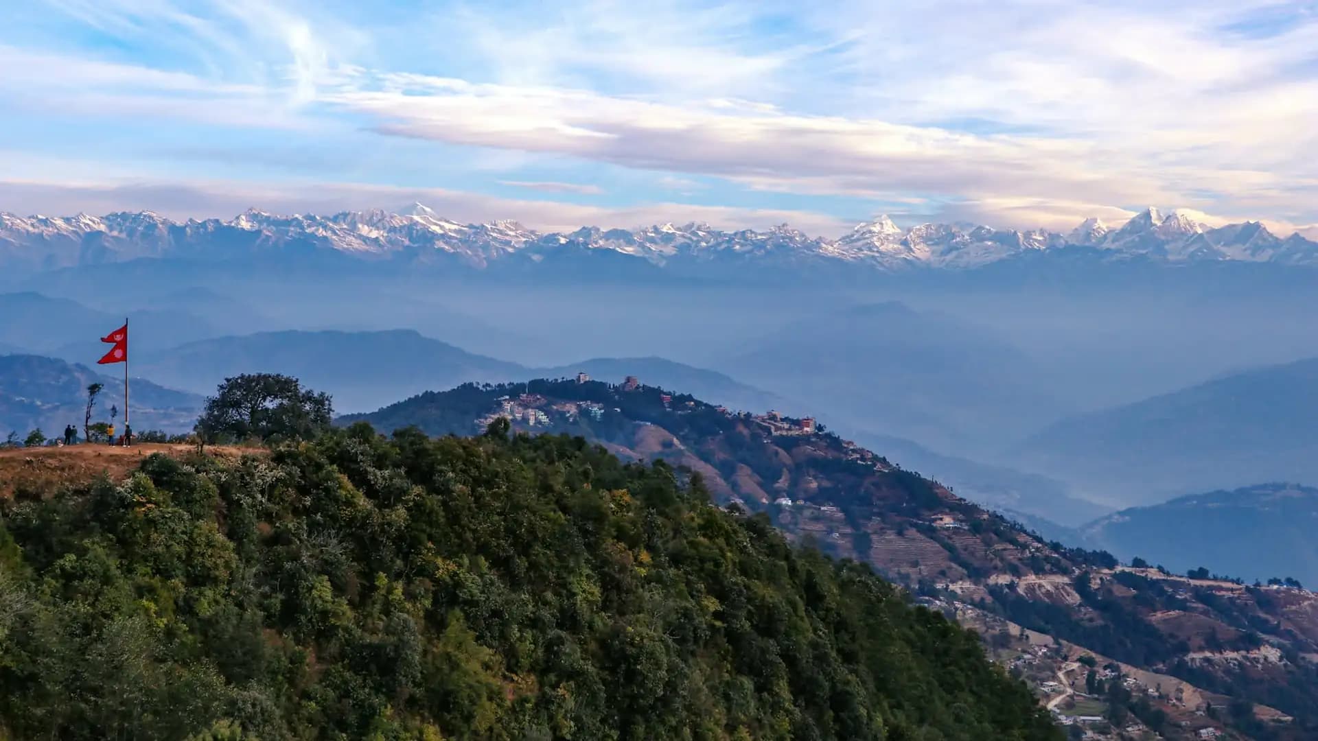
On a clear morning, the ridge looks north and east across a long arc of snow peaks. The closest and most dominant range is Langtang, with Langtang Lirung standing at roughly 7,200 m. Beside it you can pick out Ganesh Himal, Jugal Himal and Dorje Lakpa, and on good days the line extends west toward Manaslu and Annapurna, and east toward Gaurishankar and the peaks of the Rolwaling and Khumbu regions.
Range or peak | Direction | Approximate height | Notes |
|---|---|---|---|
Langtang Lirung | North | About 7,200 m | Usually the biggest and clearest single peak |
Ganesh Himal | North-west | About 7,400 m | Broad white massif |
Jugal Himal and Dorje Lakpa | North-east | Mid 6,000 to 7,000 m | Closer, rugged ridgelines |
Gaurishankar | East | About 7,100 m | Visible on clearer days |
Manaslu and Himalchuli | West of north | Above 7,800 m | Distant, best in the clearest conditions |
Everest | Far east | 8,849 m | Visible only on exceptionally clear days, as a small distant peak |
About Everest, honestly. Yes, Everest can be seen from Nagarkot, but it is far away and appears small, tucked behind closer ranges. It is most likely to show itself on exceptionally clear mornings in the colder, drier months. If Everest is the only reason you are going, set your expectations accordingly, or consider a mountain flight or the Everest region itself. If you are curious about how realistic it is to spot the world's highest peak from the capital region, our article on whether you can see Mt Everest from Kathmandu answers it in detail.
Where Nagarkot shines is the broad scale of the panorama and the changing light. Langtang, in particular, is the highlight, and if the range captures your imagination, the Langtang trek takes you into the valley that you will see glowing on the horizon.
A note on haze. Visibility depends heavily on weather and air quality. Late spring and the monsoon months often bring cloud and haze, while October, November and the clearer winter days tend to deliver the sharpest views. Even on a hazy day, the ridge, forests and villages remain worth the walk.
The Best Nagarkot Hiking Trails at a Glance
Trail | Approx. distance | Approx. walking time | Difficulty | Highlight |
|---|---|---|---|---|
Nagarkot View Tower sunrise walk | Short (a few km each way, depending on where you stay) | 30 to 60 minutes each way | Easy | Sunrise and the widest panorama |
Panoramic loop (nature trail and Tamang village walk) | About 12 km | 3 to 4.5 hours | Easy to moderate | Village life and forest views |
Nagarkot to Changu Narayan | Roughly 9 to 15 km depending on route | 3 to 5 hours | Easy to moderate | UNESCO temple finish |
Nagarkot to Dhulikhel | Roughly 16 km | 5 to 6 hours | Moderate | Ridge panoramas and a longer day |
Chisapani to Nagarkot (multi-day) | Longer, over 1 to 2 days | Varies | Moderate | Forest and national park scenery |
Distances differ between guides and GPS tracks because there are several route variations and starting points. Treat these figures as planning ranges and confirm the exact route with your guide or hotel.
1. The View Tower Sunrise Walk
This is the classic. The Nagarkot View Tower stands on a high point of the ridge, roughly 2,150 to 2,200 m, and offers a wide 360-degree sweep of the mountains and the valley. Depending on where you stay, you can walk to it in 30 to 60 minutes along a road and forest path.
Plan to arrive well before first light. The glow on the peaks builds gradually, and the best color often happens before the sun itself appears. A small entrance fee is generally collected for the tower, and the amount is quoted differently by different visitors, so carry small rupee notes. Wear a warm layer. The exposed platform is windy even on mild days, and the steel stairs can feel steep, so take your time.
After the sunrise, walk back down for a hot breakfast. This short outing alone is a satisfying form of Nagarkot hiking, and for many travelers it is the whole point of the trip.
2. The Panoramic Loop and Tamang Village Walk
If you want a proper walk without leaving the ridge, the panoramic loop is the answer. It runs about 12 km, takes around three to four and a half hours, and combines a nature trail with a walk through nearby Tamang villages.
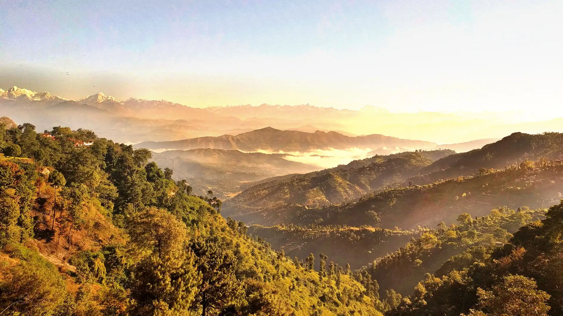
The route winds through forest, terraced hillside and clusters of traditional houses. You will hear more than you will see: goats, children on school paths, women carrying fodder. It is a good option for families, photographers who prefer a slower pace, and anyone who wants to finish back at their hotel without arranging onward transport.
3. Nagarkot to Changu Narayan
This is the most popular Nagarkot day hike, and for good reason. It starts on the ridge, descends through villages and forest, and ends at one of the Kathmandu Valley's most important temples. The descent is roughly 600 m, and the route is mostly downhill with a few short climbs. We cover it step by step in the next section.
4. Nagarkot to Dhulikhel
If you want a longer day, the walk from Nagarkot to Dhulikhel covers roughly 16 km and typically takes five to six hours. It drops from the ridge to about 1,500 m and offers continued views of the mountains along the way. It is more of a full day and suits people with reasonable stamina and good footwear. Dhulikhel is a pleasant town with its own sunrise views and onward transport back to Kathmandu.
5. Chisapani to Nagarkot
For those who want more than a day, the Chisapani to Nagarkot route links two famous viewpoints through the forests of Shivapuri Nagarjun National Park. It is usually done over two or three days, often starting at Sundarijal and finishing with a walk down to Changu Narayan. A national park entry fee applies in the park sections. We explore this as an upgrade later in this guide.
6. Sunset Strolls and Short Ridge Walks
Not every walk needs a name. In the late afternoon, an easy stroll along the ridge, with the light going gold on the peaks and the valley filling with mist, is one of the quieter pleasures of staying overnight. It is also the best option for anyone with limited mobility or children who tire easily.
Nagarkot to Changu Narayan: A Step-by-Step Walkthrough
Because this route is the signature day hike, it deserves a closer look.
Stage | What it feels like | Approx. time |
|---|---|---|
Start near the View Tower or ridge | Cold and clear at first light; short initial climb in some versions | 20 to 30 minutes |
Descent through forest and fields | Gentle downhill on paths and small roads | 1 to 1.5 hours |
Village section through Tamang settlements | Terraces, brick houses, small tea stops | 1 to 1.5 hours |
Telkot area | A natural lunch or tea stop in many itineraries | 30 to 45 minutes |
Final stretch to Changu Narayan | A short uphill with stone steps near the temple | 30 to 45 minutes |
The start. Many hikers begin after watching sunrise and eating breakfast, setting off in the cool of the morning. If you start too late, you will walk the exposed lower sections in midday heat, particularly in spring.
The descent. The route leaves the ridge on a mix of trails and rural roads. Most of the early going is downhill, which feels easy on the lungs but can tire your knees. Trekking poles help if you have sensitive joints.
The villages. This is the heart of the walk. You pass farmland, small shops and homes built in the local style, with people going about their day. A friendly "Namaste" goes a long way. Ask before photographing people, and avoid handing out sweets or money to children.
Telkot. Many groups stop here for lunch or tea before the final push. Prices are modest, and it is a good place to refill water.
The arrival. The approach to Changu Narayan includes a short uphill walk with a set of stone steps. After hours of gentle downhill, the climb can surprise tired legs, but it is brief.
The return. From Changu Narayan, most visitors return to Kathmandu by taxi or private vehicle, often passing through or stopping at Bhaktapur. Changu is roughly 20 minutes by car from Bhaktapur, which makes it easy to combine both in a day.
Total time. Walking time is typically three to five hours, depending on the route variant and your pace. A full day trip from Kathmandu including transport, breakfast and temple time usually takes seven to nine hours.
For readers building a wider plan around the capital, our guides to hiking in the Kathmandu Valley and hiking places in Kathmandu place this route among its neighbors.
Changu Narayan Temple: What You Are Walking Toward
The finish is not an afterthought. Changu Narayan sits on a hilltop in Bhaktapur District, dedicated to Vishnu, and was inscribed as part of the Kathmandu Valley UNESCO World Heritage Site in 1979. The site is traditionally dated to the 4th century, and a stone pillar in the complex carries an inscription from 464 CE by the Licchavi king Manadeva, widely regarded as the oldest known inscription in Nepal.
The two-storey temple stands on a high stone plinth, its roof struts carved with the ten avatars of Vishnu, and its courtyard is filled with stone sculptures of remarkable age and quality. Four entrances are guarded by pairs of lions and other mythical figures. Only the priest enters the inner sanctum, but visitors can walk the courtyard and see the sculptures, the pillar and the surrounding Newar village. A small museum nearby adds historical context.
Dress modestly, move quietly, and ask before photographing worshippers. A small entry fee is usually charged for foreign visitors. If you want a quick reference on the temple's history and status, the Changu Narayan Temple overview is a helpful starting point.
Best Time for Nagarkot Short Hiking
You can walk here nearly all year, but the experience changes dramatically with the season.
Month(s) | Typical conditions | Verdict |
|---|---|---|
October to November | Clearest skies after the monsoon, comfortable days, cold mornings | Best overall |
December to February | Often crisp and clear, but cold mornings and chilly nights | Excellent for views, bring warm layers |
March to April | Warmer, rhododendron and wildflower color in the hills, more haze | Very good, less crisp views |
May | Hot and hazy lower down, pre-monsoon cloud building | Fair, start early |
June to August | Monsoon: cloud, rain, slippery trails and leeches possible | Least recommended for views |
September | Transition month, clearing skies later in the month | Mixed, improving toward the end |
Autumn (October to November). If you can choose, choose this. The air has been washed by months of rain, and the Himalayan panorama is at its sharpest. Mornings can be cold at the ridge, but daytime walking is pleasant.
Winter (December to February). Views can be superb, and the trails are quiet. Nights and early mornings are cold at Nagarkot's elevation, so bring proper layers, a hat and gloves. Lower sections of the Changu Narayan route warm up by mid-morning.
Spring (March to April). Warmer weather and flowering trees make the village sections lovely, although distant views are often softer and hazier than in autumn.
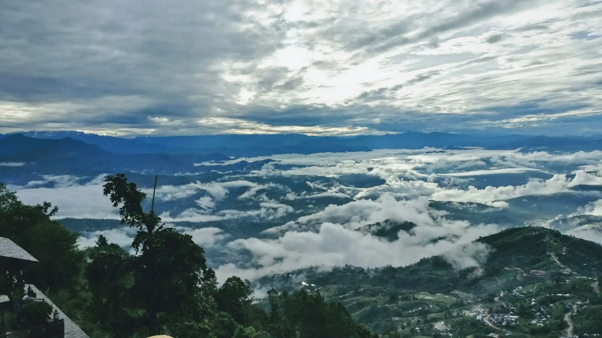
Monsoon (June to August). The hills are intensely green, but clouds frequently hide the mountains, and wet trails can be slippery. Leeches can appear on forest sections. If you must go, accept that the mountain views will be unreliable and focus on the green scenery.
For 2027 planning, the autumn and spring windows will again be the most popular, so book hotels and transport early if you want a sunrise-view room on a peak weekend.
Sunrise or Sunset: Which Should You Choose?
Factor | Sunrise | Sunset |
|---|---|---|
Mountain clarity | Usually clearer, as dust and haze build during the day | Often hazier, though colors can be dramatic |
Crowds | Busy at the tower, especially in peak season | Generally calmer |
Temperature | Cold | Cooler but gentler |
Effort | Requires a very early start | Easy, fits an afternoon arrival |
Best for | Photographers and view-seekers | Relaxed travelers and families |
Sunrise comes as early as roughly 5:15 a.m. in early summer and as late as close to 7 a.m. in midwinter, so check the exact time for your travel date and plan your alarm accordingly. If your schedule allows only one, choose sunrise for clarity. If you can stay overnight, do both.
Sample Itineraries of Nagarkot Hiking
One-Day Itinerary: Sunrise, Hike and Heritage
Time | Activity |
|---|---|
Early morning | Leave Kathmandu by private vehicle |
Before sunrise | Arrive at Nagarkot and head to the viewpoint |
After sunrise | Breakfast on the ridge |
Mid-morning | Begin the Nagarkot to Changu Narayan hike |
Midday | Tea or lunch near Telkot |
Early afternoon | Explore Changu Narayan |
Afternoon | Drive to Bhaktapur or back to Kathmandu |
This is the most efficient way to experience the area, but it demands an early start. Start times vary by season, so confirm with your driver.
Overnight Itinerary: The Relaxed Version
Arrive in the afternoon, walk the ridge at sunset, sleep at a hotel with views, rise for sunrise, then walk to Changu Narayan the next morning with fresher legs and no rush. Many people find this more enjoyable than a pre-dawn drive, and you get two light shows for one trip.
Half-Day Option: For Short Schedules
If you only have a morning, do the View Tower sunrise and a short village loop, then return to Kathmandu by late morning. You will skip the temple, but you will still catch the mountains.
Family-Friendly Option
Stay overnight, do an easy sunset stroll, then take the sunrise walk the next morning. Hire a vehicle for the long Changu Narayan walk and join only the section your children can handle. Ask your guide to include the village stretches and skip the steepest bits.
How to Get to Nagarkot
Option | Pros | Cons |
|---|---|---|
Private car or taxi | Comfortable, flexible, can combine with Changu Narayan and Bhaktapur | Costs more |
Local bus (typically via Bhaktapur) | Very cheap | Slow, crowded, less flexible |
Guided day trip | Transport, guide and logistics handled | Fixed schedule |
Motorbike | Flexible | Not recommended for inexperienced riders on hill roads |
The road climbs through winding sections, and traffic can lengthen the journey considerably, especially around Bhaktapur and during peak weekend times. If you want to catch sunrise, a private vehicle starting very early or an overnight stay is the safest plan. Always check the current departure points and times for local buses before relying on them.
What Does a Nagarkot Day Hike Cost?
Costs depend on how independent you want to be.
Item | Independent | Guided or organized |
|---|---|---|
Transport | Local bus or taxi | Private vehicle included |
View Tower entry | Small fee, carry cash | Often handled by guide |
Changu Narayan entry | Small fee for foreign visitors | Often included or arranged |
Meals | Modest at ridge and village cafes | Often included or recommended |
Guide | None | Included |
Hotel (optional) | Wide range from simple to resort-style | Depends on the package |
As a rough planning guide, a private guided day trip from Kathmandu often falls in the region of a few tens of dollars to a little over a hundred dollars per person, depending on group size, vehicle and what is included. Independent travelers can spend far less, particularly if using public transport. Treat these as broad ranges, not quotes, and confirm what is included before you pay. If you are also planning city sightseeing, it is worth pairing the hike with a separate cultural day in Kathmandu rather than squeezing everything into one.
Do You Need a Guide?
For the View Tower walk, not really. The route is short and obvious. For the Changu Narayan route, many walkers do it independently because there are direction boards at key junctions, and the trail is not remote. That said, route variations, village paths and unmarked turns can create confusion, particularly for first-time visitors.
A local guide adds three things that matter: navigation, cultural context and ease. They can pick the best path, point out details you would miss, arrange transport at the end, and help with conversation in villages. For families, older travelers or anyone short on time, a guide often turns a good day into a smooth one.
If you are curious about how guide rules work across Nepal's trekking regions, our overview of trekking guide basics in Nepal explains the bigger picture. For short hikes like this one, a guide is a choice rather than a requirement, though it is a smart one for many people.
Difficulty and Fitness: How Hard Is It, Really?
The walks here are generally rated easy to moderate. The altitude is modest, the paths are well used, and most routes lose more height than they gain.
The challenge is rarely breathlessness. It is usually one of three things: cold at dawn, tired knees on a long descent, and sun exposure in the lower sections.
Factor | What to expect |
|---|---|
Altitude | Around 2,175 m at the top, which most people handle easily |
Terrain | Dirt paths, forest trails, village lanes, short stone steps |
Ascent | Short climbs, with a brief uphill near Changu Narayan |
Fitness needed | Comfortable walking for 3 to 5 hours |
Beginner friendly | Yes, with sensible pacing and footwear |
If you can walk comfortably for a few hours on uneven ground, you can do this. People with knee problems should consider poles and a slower pace. Anyone with medical conditions should speak to a doctor first.
What to Pack for a Nagarkot Day Hike
For Nagarkot short hiking you do not need technical gear, but a few smart choices make a big difference.
Item | Why it matters |
|---|---|
Layers (fleece or light down) | Mornings at the ridge are cold, afternoons warm up |
Sturdy walking shoes or light boots | Dirt trails, loose stones, steep steps |
Rain jacket or poncho | Weather can change, especially in spring and monsoon |
Hat, sunscreen, sunglasses | Lower sections can be sunny and exposed |
Water (1 to 1.5 liters) and snacks | Shops exist, but supply and timing vary |
Small cash in rupees | View Tower, temple entry, tea stops, tips |
Headlamp or phone light | For pre-dawn walking |
Trekking poles (optional) | Helpful on descents |
Camera and power bank | Cold drains batteries quickly |
Light daypack | Keep it small |
Skip heavy packs and new shoes. Blisters are the most common problem on this walk, and they are easily avoided by wearing footwear you have already used.
Safety, Weather and Trail Etiquette
Weather. Conditions can change quickly in the hills. Check the forecast for both Nagarkot and Kathmandu, and remember the ridge is usually colder and windier than the valley.
Navigation. Do not rely only on one offline map. Trails merge with roads and farm paths, so it is easy to take a wrong turn. If you are unsure, ask villagers. Avoid starting a long walk too late in the day.
Footing. Wet stone steps and monsoon mud can be slippery. Take your time, especially on descents.
Health. Altitude sickness is very unlikely at this height for most people, though a mild headache or tiredness is possible if you are unwell, dehydrated or sleep-deprived. Carry basic first aid, including blister care.
Respect. Dress modestly at temples, ask before taking photos of people, and take litter with you. Avoid giving sweets or money directly to children, which can encourage begging. Support local businesses by eating at village teahouses.
Dogs and livestock. Dogs are common in villages. Stay calm, do not run, and give animals space.
Photography Tips
Arrive at the viewpoint 30 to 45 minutes before sunrise to catch the pre-dawn glow.
Bring a tripod or find a stable surface for low-light shots.
Use the village sections for people and architecture, and the ridge for landscapes.
Keep your phone or camera warm in an inner pocket to protect battery life.
Do not pressure villagers for photos. A smile and a question work better than a lens in the face.
Midday is harsh, so use that time to walk and save photography for early or late light.
Walking Through the Landscape: Villages, Forest and the People You Meet
What separates a memorable Nagarkot walk from a forgettable one is usually attention. The hills around the eastern rim of the Kathmandu Valley are home to a mix of communities, including Tamang and Newar families, and the trail passes through working landscapes rather than a protected wilderness.
Farmland and terraces. The hillsides are shaped into terraces for crops that change with the seasons. Depending on when you walk, you may see rice paddies, maize drying under eaves, mustard, or fields resting after harvest. The pattern of terraces is a good reminder that this is a lived-in landscape, and that the paths you are using exist because people walk them daily.
Houses and daily life. Traditional homes in the area are built with brick, stone, mud and timber, often with small courtyards, stacked firewood and animals nearby. You will see people carrying loads, children walking to school and elders sitting in the sun. Smiling, greeting people with a quiet "Namaste" and keeping your voice low goes a long way.
Forest sections. The ridge and its slopes carry stands of pine and mixed hill forest. These sections are cooler and quieter, and birdsong is common, especially early in the day. In the wetter months the forest floor is damp and leeches can appear, so wear closed shoes and tuck in your trousers if you walk then.
Small teahouses and shops. Along the more popular routes you will find tea stops and tiny shops selling water, biscuits and instant noodles. Buying a cup of tea here is one of the simplest ways to put money directly into the communities you are walking through.
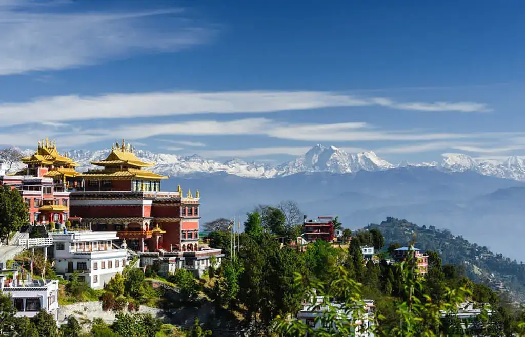
Religious and cultural details. You may notice prayer flags, small shrines, stupas or carved mani stones along some stretches, especially near communities with Buddhist traditions. Walk clockwise around mani walls and stupas, which is the customary direction, and do not touch or remove offerings.
The more slowly you walk, the more you notice. If you rush to tick off a distance, you will miss the best part of Nagarkot hiking, which is the texture of the trail itself.
Staying Overnight: What to Look For in a Nagarkot Hotel
The ridge has a wide range of places to stay, from simple guesthouses to larger resort-style hotels. A few practical points will help you choose well.
What to check | Why it matters |
|---|---|
Distance to the View Tower | A short walk makes pre-dawn starts far easier |
Mountain-facing room or terrace | Lets you watch first light from your window or balcony |
Heating or extra blankets in winter | Nights at the ridge can feel cold, and not every room is well heated |
Hot water and power backup | Reliability varies, so confirm before you book |
Breakfast timing | Some places start serving only after sunrise, which affects your plan |
Transport help | Useful for the return to Kathmandu or onward travel to Changu Narayan |
A room with a view is a bonus, not a necessity, because the best views are from the viewpoints themselves. If you are visiting on a weekend or in the peak autumn and spring windows, book ahead, since popular hotels fill early.
Using Nagarkot as a Gentle Warm-Up Before a Bigger Trek
Many travelers include Nagarkot in their first days in Nepal, and it can be a sensible choice. A night at around 2,175 m is a mild step up from Kathmandu's roughly 1,300 to 1,400 m, and a few hours of walking on uneven ground helps you test your boots, your pack and your pace before you head into the mountains.
It is worth keeping this in perspective. Nagarkot is a useful shakedown, not a substitute for proper acclimatization on a high-altitude route. Real acclimatization is about gradual gains in sleeping altitude over many days, which is why serious treks build in rest days at higher elevations. If you want to understand how elevation changes across Nepal's trekking regions, our Nepal elevation guide lays it out clearly.
There is also a quieter benefit. After a long international flight, a calm night in the hills with fresh air can feel far more restorative than another night in a busy city, and it lets you ease into the rhythm of walking before the pressure of a long trek begins.
Combining Nagarkot With Bhaktapur and Kathmandu Sightseeing
Because the hike ends near Bhaktapur, it combines naturally with cultural sightseeing. A common pattern is to finish at Changu Narayan, then continue to Bhaktapur's old town, another part of the Kathmandu Valley's UNESCO-listed heritage, known for its brick lanes, pottery squares and Newar architecture.
Think carefully about energy. A pre-dawn start, a walk of several hours, and a full afternoon of sightseeing is a long day. Many travelers prefer to split it: hike on one day and visit Bhaktapur separately, or return to Kathmandu after the temple and leave the old town for a fresh morning. If you only have one day, keep Bhaktapur short and focused on a few streets rather than trying to see everything.
If you have a few days in the capital region, a sensible sequence is one day for city sightseeing, one for Nagarkot and Changu Narayan, and a final easy day before any flight or longer trek. This keeps your legs fresh and gives you a buffer if weather affects visibility.
Walking Responsibly: Small Habits That Matter
Popular short hikes can feel the pressure of visitor numbers, so a few habits make a real difference.
Carry out your rubbish. This includes wrappers, tissues and plastic bottles. Where possible, use a refillable bottle and refill it at hotels or shops rather than buying many single-use bottles.
Stay on established paths. Cutting across terraces damages crops and walls.
Ask before photographing. This applies especially to people, religious ceremonies and private homes.
Spend locally. Tea, snacks and meals at village stops support the people who maintain the trails.
Keep noise low in villages and temples. Speakers and loud groups spoil the place for everyone.
Be flexible and patient. Transport delays, closed shops and slow service are part of the experience.
These small choices do not cost anything, and they make the walk better for you and for the people who live along it.
How Nagarkot Short Hiking Compares With Other Short Hikes Near Kathmandu
Hike | Character | Best for | Notes |
|---|---|---|---|
Nagarkot | Ridge viewpoint, villages, heritage finish | Sunrise views plus culture | Easy to moderate, combine with Changu Narayan |
Shivapuri Peak | Forested hill in a national park | Quiet forest walking | Peak about 2,732 m, a more sustained climb |
Phulchoki | Highest hill around the valley | Birdlife and forest | About 2,782 m, usually accessed by road first |
Chisapani | Forest and village ridge | An overnight ridge stay | Part of Shivapuri Nagarjun National Park region |
Champadevi and valley-rim hills | Shorter local hikes | Quick half-day outings | Close to the city |
Nagarkot stands out for the combination of a wide mountain panorama, gentle trails and a culturally important finish. If you want more forest and solitude, Shivapuri or Chisapani may suit you better. If you want the easiest road access and a gentle day, Nagarkot is hard to beat.
Turn a Short Hike Into a Longer Trek
Nagarkot works well as the first step of something longer. Many travelers use it as a test of how they feel about hiking in Nepal.
If you enjoy it and want a bit more, the Chisapani Nagarkot trek extends your time in the hills, linking two famous viewpoints with forest and village scenery. It is a good option for people who want a night or two on the trail without committing to a high-altitude route.
If the mountains have lit a fire, the next step might be a classic short trek in the Annapurna region. Our short Annapurna Base Camp trek offers a taste of the high Himalaya in a compact format. It is a proper mountain experience, so it is worth giving it the respect that its altitude deserves.
Common Mistakes to Avoid
Starting too late. The clearest views happen early, and waiting for "a good time" often means missing it.
Expecting Everest to dominate. It is distant and small. Langtang is the real star.
Wearing new shoes. Blisters ruin a lovely walk.
Underestimating the cold. Dawn at 2,000 meters can be bitterly cold, even in a mild season.
Skipping water and cash. Some stops accept only rupees, and supply can be limited.
Visiting in the monsoon and expecting mountain views. Cloud is common.
Rushing the temple. Changu Narayan deserves at least an hour.
Booking only a day trip when you can stay overnight. Two light shows are better than one.
Frequently Asked Questions about Nagarkot Short Hiking
1. What is Nagarkot short hiking? It refers to day hikes and short walks around Nagarkot, a hill station about 32 km from Kathmandu. Typical options include the sunrise walk to the View Tower, a panoramic loop, and the popular descent from Nagarkot to Changu Narayan.
2. Where is Nagarkot located? Nagarkot is in Bhaktapur District, on a ridge on the eastern rim of the Kathmandu Valley, roughly 32 km from the capital.
3. How high is Nagarkot? Most sources place the main viewpoint area between about 2,150 and 2,200 m, with figures around 2,175 m commonly used.
4. How long does it take to hike from Nagarkot to Changu Narayan? Most people walk for about three to five hours, depending on the route variant and pace. A full day trip from Kathmandu, including transport, breakfast and temple time, usually takes seven to nine hours.
5. How far is the Nagarkot to Changu Narayan hike? Distances range from roughly 9 to 15 km depending on the exact route and starting point. Confirm the route with your guide or hotel.
6. Is Nagarkot short hiking suitable for beginners? Yes. The trails are well used, the altitude is modest, and most routes are easy to moderate. A reasonable level of walking fitness and sturdy shoes are enough.
7. Can you see Mount Everest from Nagarkot? On exceptionally clear days, usually in the cooler, drier months, Everest can be seen far to the east as a small distant peak. Closer ranges such as Langtang look larger.
8. What mountains can you see from Nagarkot? On clear days you can see Langtang Himal, Ganesh Himal, Jugal Himal, Dorje Lakpa and Gaurishankar, with Manaslu, Annapurna and distant Everest range peaks visible in the best conditions.
9. What is the best time of year for a Nagarkot day hike? October to November offers the clearest views, and March to April is also very good. December to February can be crisp and clear but cold. June to August is least reliable for views.
10. Do I need a permit? For a standard Nagarkot to Changu Narayan hike, there is generally no trekking permit required. Park fees apply if you enter protected areas such as Shivapuri Nagarjun National Park on routes like Chisapani. Confirm current requirements before you go.
11. Do I need a guide? Not strictly for short, well-known routes, but a guide helps with navigation, cultural context and logistics, especially for first-timers and families.
12. Is there an entrance fee for the View Tower? A small fee is generally collected at the tower, and reported amounts vary. Carry small rupee notes.
13. Is altitude sickness a risk at Nagarkot? Very unlikely for most people at around 2,175 m. Staying hydrated and rested helps.
14. How difficult is the Nagarkot to Changu Narayan hike? Easy to moderate. It is mostly downhill, with a short uphill near the temple and stone steps. Knees and footwear matter more than fitness.
15. How do I get to Nagarkot from Kathmandu? By private vehicle or taxi (most flexible), local bus via Bhaktapur (cheapest), or a guided day trip. Allow roughly one to two hours each way, depending on traffic.
16. Can I do Nagarkot as a day trip from Kathmandu? Yes. An early start allows sunrise, a hike and a visit to Changu Narayan, returning to Kathmandu the same day.
17. Is it better to stay overnight at Nagarkot? For many people, yes. You can enjoy sunset and sunrise without a pre-dawn drive, and begin your hike with a relaxed morning.
18. What should I wear and bring? Layers, sturdy shoes, rain protection, sun protection, water, snacks, a headlamp for pre-dawn, and small cash in rupees.
19. Can children and older travelers do it? Many can, especially the sunset stroll, the sunrise walk and the shorter village sections. For the full Changu Narayan route, consider a guide and a vehicle for shortcuts.
20. Can I extend Nagarkot into a longer trek? Yes. Popular extensions include Chisapani to Nagarkot over several days, or Nagarkot to Dhulikhel for a longer day. Both go beyond a simple day hike, so plan time and logistics.
Plan Your Nagarkot Hike With Adventure Life Nepal
A good short hike feels effortless, but behind it sits good timing, the right route, a reliable driver and someone who knows which turn to take. If you want help choosing between a sunrise day trip, an overnight stay or a longer ridge trek, our team at Adventure Life Nepal is happy to talk it through.
Whether Nagarkot short hiking is your whole trip or the first step before a bigger Himalayan route, we will match the plan to your pace and your schedule.
Chat with an expert on WhatsApp: +977 9841248242