Hiking Places in Kathmandu 2027: Best Sunrise & Viewpoint Trails
Introduction to Hiking Places in Kathmandu
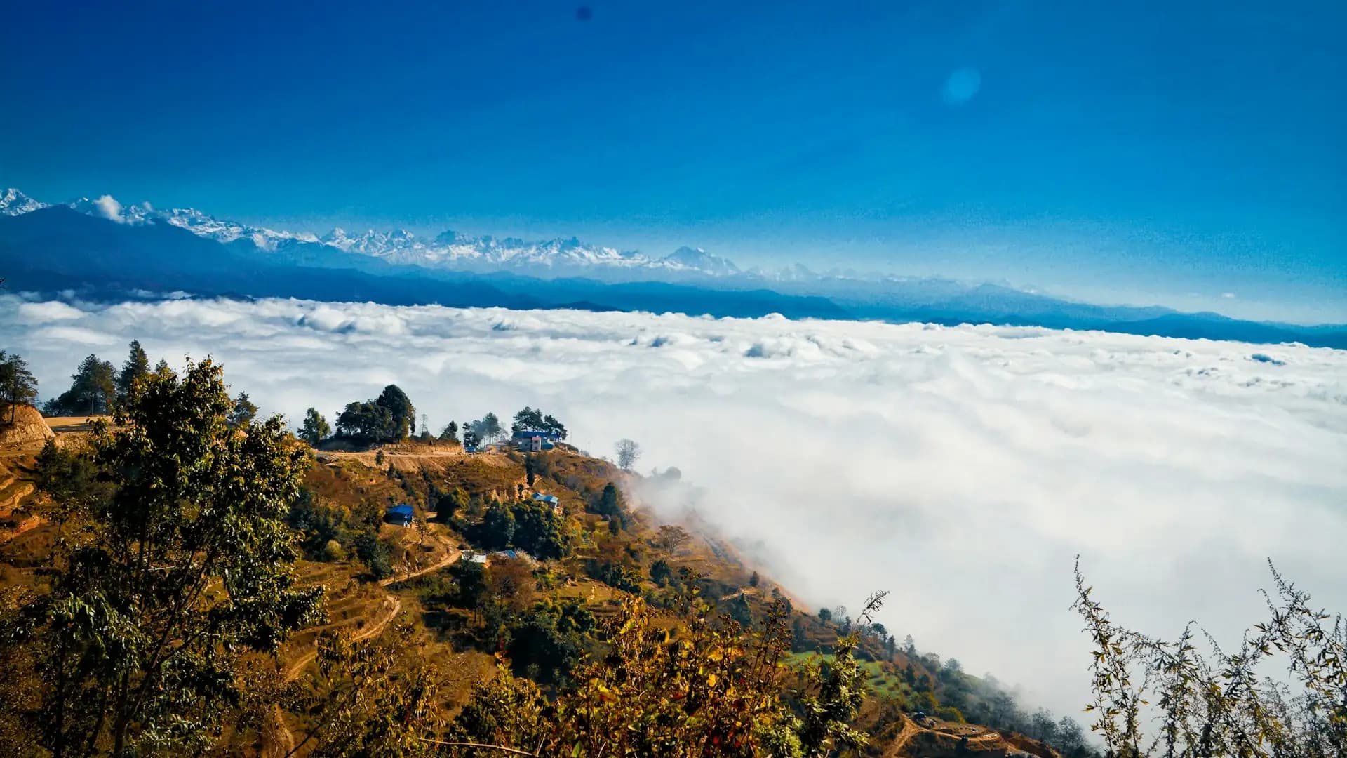
Kathmandu has a reputation for traffic, dust, and temples, so it surprises many visitors to learn how quickly the city gives way to forest trails and Himalayan viewpoints. Ring the Kathmandu Valley with hills, and you find a dozen genuinely good hiking places in Kathmandu within an hour or two of the city center, from a gentle half-day forest walk to a long ridge climb that tops 2,700 meters. On a clear morning, many of these trails reward you with views across the valley and out to peaks such as Ganesh Himal, the Langtang range, and Manaslu.
This guide covers the best hiking places in Kathmandu in 2027, organized by what most hikers actually want to know: how high each hill is, how long the walk takes, how hard it is, what it costs to enter, and which ones deliver the best sunrise or viewpoint. Whether you have a spare half-day before a trek or you are using the valley hills to warm up your legs, there is a trail here for you.
Quick Answer: The Best Hiking Places in Kathmandu at a Glance
Hike | Approx. Elevation | Typical Time | Difficulty | Best For |
|---|---|---|---|---|
Champadevi Hill | About 2,285 m | 5–7 hours round trip | Easy to moderate | Valley and mountain views, first-time hikers |
Chandragiri Hills | About 2,551 m | Half day by cable car, or a full day on foot with Champadevi | Easy (cable car) to moderate | Panoramic views with minimal effort |
Shivapuri Peak | 2,732 m | Full day | Moderate | Forest scenery, wildlife, a longer challenge |
Nagarjun Jamacho | About 2,100–2,150 m | 4–5 hours round trip | Easy to moderate | The closest quick escape from the city |
Phulchoki | Roughly 2,760–2,790 m | Long full day | Moderate to challenging | Highest point on the valley rim, rhododendron forest |
Nagarkot | About 2,175 m | Sunrise visit or half-day walk | Easy | Sunrise Himalayan panorama |
Chisapani–Nagarkot | Around 2,200–2,300 m | 2 days | Moderate | A short overnight trek close to the city |
Namobuddha | About 1,750 m | Half to full day | Easy to moderate | Buddhist pilgrimage and village scenery |
Elevation figures for valley hills vary slightly between sources, so treat them as approximate. The important point is that every hike on this list stays well below 3,000 meters, which means altitude sickness is not a real concern.
How to Choose the Right Hike
With so many options, the best choice depends on your time, fitness, and what you hope to see.
If You Want | Choose |
|---|---|
A quick escape with minimal planning | Nagarjun Jamacho |
Mountain views and a manageable day | Champadevi |
The most effortless viewpoint | Chandragiri by cable car |
A sunrise over the Himalaya | Nagarkot |
A serious full-day forest walk | Shivapuri Peak |
A long, challenging ridge | Phulchoki |
A cultural hike with a monastery | Namobuddha |
A taste of trekking with an overnight stay | Chisapani–Nagarkot |
Champadevi Hill: The Best All-Round Day Hike
Champadevi is widely regarded as the best day hike in Kathmandu for mountain views and accessibility. Located roughly 18 kilometers southwest of the city, it is the third-highest hill around the Kathmandu Valley, after Phulchoki and Shivapuri, at about 2,285 meters. A small shrine to the goddess Champa Devi sits at the top, and local belief holds that she protects the valley.
Detail | Information |
|---|---|
Typical starting point | Hattiban or Pharping |
Distance | Roughly 12–14 km round trip, depending on the route |
Time to the top | About 2.5–3 hours |
Total time | Typically 5–7 hours including breaks |
Difficulty | Easy to moderate |
Entry fee | None reported for the hill itself |
The trail climbs through mixed forest with viewpoints along the way, and the summit offers a wide panorama across the valley with the Himalayan range on the horizon on clear days. Many hikers extend the walk along the Bhasmasur ridge, at around 2,460 meters, toward Chandragiri, which creates a longer and more varied day.
Chandragiri Hills: Cable Car or Ridge Walk
Chandragiri rises to about 2,551 meters on the western edge of the valley, making it one of the highest accessible viewpoints near Kathmandu. There are two ways to experience it. The easy option is the cable car from Thankot, which carries visitors close to the summit in a matter of minutes. The more rewarding option is to walk the ridge from Champadevi to Chandragiri, a full day that combines forest, religious sites, and long views.
Option | Effort | Best For |
|---|---|---|
Cable car to the summit area | Very low | Families, short schedules, anyone wanting views without a long walk |
Champadevi to Chandragiri ridge walk | Moderate, full day | Hikers wanting more distance and variety |
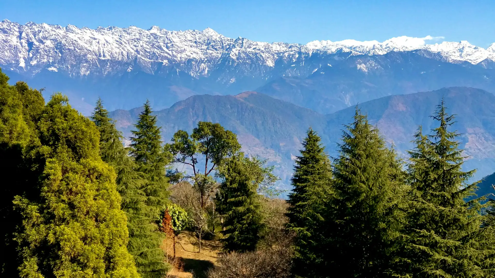
Views from the summit stretch across the valley and out to a long line of snow peaks, including Ganesh Himal, Langtang, and Manaslu on clear days. Cable car pricing and operating hours change, so check current details before you go.
Shivapuri Peak: The Classic Forest Hike
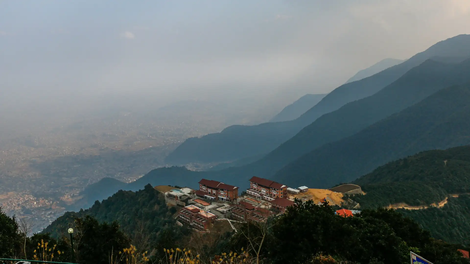
Shivapuri Peak stands at 2,732 meters and is the highest point of Shivapuri Nagarjun National Park, as well as the second-highest hill on the Kathmandu Valley rim. The park was established in 2002 and covers roughly 159 square kilometers of forest on the northern edge of the valley, home to birds, monkeys, and a variety of wildlife.
Detail | Information |
|---|---|
Common starting points | Budhanilkantha or Sundarijal |
Distance | Around 16 km round trip from Budhanilkantha, per commonly cited figures |
Time | A full day |
Difficulty | Moderate |
Entry fee for foreigners | NPR 1,000 per person |
This is a longer, more serious hike than Champadevi or Jamacho, and it works well as a training day before a big trek. The forest is dense and shaded for much of the route, which makes it pleasant even in warm weather, and the summit rewards you with a broad view over the valley and, in good conditions, the mountains beyond. Because the hike sits inside a national park, you need to pay the entry fee at the gate.
Nagarjun Jamacho: The Nearest Quick Escape
If you only have half a day, Nagarjun Jamacho is the nearest serious hiking option to Thamel. The trailhead at Fulbari Gate is roughly 5 kilometers from the tourist district, inside Shivapuri Nagarjun National Park. The Jamacho Gumba (a small Buddhist monastery) sits at around 2,100 to 2,150 meters depending on the source, with the trailhead at about 1,400 meters, which means a climb of roughly 700 meters.
Detail | Information |
|---|---|
Starting point | Fulbari Gate, Goldhunga |
Time up | Roughly 3–4 hours |
Total time | About 4–5 hours round trip |
Difficulty | Easy to moderate, with some steep stair sections |
Entry fee for foreigners | NPR 1,000 per person |
The trail climbs a staircase and then enters forest, with birds, butterflies, and often monkeys along the way. At the top, you get a clear view of the valley, and on a sharp morning the snow peaks appear to the north. Because it is so close to the city, it is also a popular choice for locals on weekends, so go early if you want quiet.
Phulchoki: The Highest Point on the Valley Rim
Phulchoki is the highest hill on the Kathmandu Valley rim, with elevation figures commonly cited between roughly 2,760 and 2,790 meters depending on the source. It sits to the southeast of the valley near Godavari and is known for its rhododendron forests, which bloom in spring, and for the botanical diversity found on its slopes.
This is one of the longest and most demanding day hikes near the city, best suited to hikers who are comfortable with a full day on the trail. The summit area has a small temple, and in clear weather the views extend across the valley and to the Himalayan range. If you are planning a larger trek soon, Phulchoki is an excellent test of your fitness and your boots.
Nagarkot: The Classic Sunrise Viewpoint
Nagarkot is the best-known sunrise destination near Kathmandu, a hill station about 32 kilometers from the city at around 2,175 meters. People come here for the dawn light on the Himalayan range, and on exceptionally clear days it is one of the few places within day-trip distance of the capital where a distant Everest can be seen. Our guide on whether you can see Mount Everest from Kathmandu explains why visibility depends so much on altitude and weather.
Detail | Information |
|---|---|
Distance from Kathmandu | About 32 km |
Elevation | Around 2,175 m |
Best time for views | Sunrise, in clear seasons |
Walking options | Nagarkot panoramic trail and eco trail |
Fees | A small local entry fee may apply |
The panoramic hiking trail and the nature walk along the ridge are the most popular short walks. If you want the sunrise without much walking, stay overnight, rise before dawn, and walk to the viewpoint tower. For general background on the hill station, the Wikipedia page on Nagarkot gives a helpful overview.
Chisapani–Nagarkot: A Short Overnight Trek
For hikers who want a real taste of trekking without committing to a multi-day expedition, the Chisapani to Nagarkot route is a classic. It follows ridges and forest through Shivapuri Nagarjun National Park and out toward Nagarkot, usually over two days with an overnight stop in a village lodge. Hikers need to pay the national park fee, and a local fee may apply at Nagarkot. Our Chisapani Nagarkot Trek package covers this route in full, and it is a popular choice for travelers who have two spare days near Kathmandu.
Namobuddha: Culture and Village Scenery
Namobuddha, at about 1,750 meters southeast of the valley, is an important Buddhist pilgrimage site associated with a story of compassion and sacrifice. The walk combines village paths, terraced fields, and a monastery on the hilltop, making it as much a cultural outing as a hike. It is often combined with a visit to the historic town of Panauti. The terrain is gentler than the higher hills, which makes Namobuddha a good option for a relaxed day or for hikers who prefer culture to climbing.
Kakani: A Relaxed Hill-Station Walk
Kakani is a quieter hill-station area northwest of Kathmandu, at roughly 2,000 meters, known for its views of the Ganesh Himal and Langtang ranges and for the gentle walks around its ridge. It is less visited than Nagarkot, which makes it appealing for travelers who prefer a calmer morning. The walks here are easy, so Kakani suits families, older hikers, and anyone who wants a viewpoint without a steep climb. Check the weather before you commit, since the views depend heavily on clear skies.
Which Hikes Are Best for Sunrise?
Sunrise hikes reward early starts, and the best option depends on whether you want to walk to the viewpoint or simply arrive.
Sunrise Option | Effort | Notes |
|---|---|---|
Nagarkot | Low | The most popular sunrise spot; stay overnight for the easiest dawn |
Champadevi | Moderate | A pre-dawn climb with headlamps rewards you with first light on the ridge |
Chandragiri | Low to moderate | Cable car timing may limit sunrise access, so check operating hours |
Shivapuri Peak | High | A very early start is needed; best for experienced day hikers |
Whichever you choose, check the weather forecast the night before. Clear mornings are common in autumn and spring, while winter can bring valley haze that thins out higher up.
Difficulty Ranking: From Easiest to Hardest
If you are deciding between several of the best hiking places in Kathmandu, this ranking helps you match a hike to your fitness.
Rank | Hike | Why |
|---|---|---|
1 (easiest) | Chandragiri by cable car | Almost no walking required |
2 | Nagarkot panoramic trail | Gentle ridge walking at a comfortable pace |
3 | Kakani ridge walks | Easy, short, and quiet |
4 | Namobuddha | Village paths with moderate ups and downs |
5 | Nagarjun Jamacho | Roughly 700 m of climbing, with stair sections |
6 | Champadevi | A longer distance with steady climbing |
7 | Shivapuri Peak | A full day of sustained forest climbing |
8 (hardest) | Phulchoki | The longest and highest of the valley-rim hikes |
None of these require technical skills, but the top-ranked hikes need real stamina, so build up gradually if you are new to hiking.
How to Plan a Sunrise Hike Step by Step
A good sunrise starts the night before. Here is a simple timeline that works for most viewpoint hikes near the valley.
Time | What to Do |
|---|---|
The evening before | Check the forecast, charge your phone and headlamp, pack layers and water, and confirm your transport |
About 3:30–4:30 a.m. | Wake up, dress warmly, and eat something light |
Before first light | Reach the trailhead or viewpoint, allowing extra time for the drive |
Sunrise window | Arrive 20–30 minutes before sunrise so you are settled when the light starts to change |
After sunrise | Stay a little longer, since the light keeps changing and the views often improve |
Sunrise times shift through the year, so check the exact time for your date rather than relying on a fixed hour. Clear, cold mornings in autumn and winter usually give the sharpest mountain views, while spring mornings can be hazier but warmer.
How Much Does a Guided Day Hike Cost?
Prices vary with group size, transport, and what is included, but guided day hikes around Kathmandu are generally affordable. Operators commonly price them from roughly USD 50 to 95 per person, with the lower end applying to larger groups and the higher end to solo hikers or very small groups. The quoted price often includes private transport, a guide, and the national park entry fee, but always confirm what is covered so you can compare offers fairly. If you plan to hike independently, your main costs are transport and any park fees.
Best Viewpoint Trails and What You Can See
The views from Kathmandu's hill trails vary by season and by hill, but the pattern is consistent: the northern and eastern hills look toward the Langtang and Ganesh Himal ranges, while the western hills open toward Manaslu and the Annapurna side on clear days.
Hill | Typical Views |
|---|---|
Shivapuri and Jamacho | Valley panorama, Langtang and Ganesh Himal direction |
Nagarkot | A broad Himalayan sweep, with Everest possible on very clear days |
Champadevi and Chandragiri | Valley, Ganesh Himal, Langtang, and Manaslu on clear days |
Phulchoki | Valley and distant range views from the highest rim point |
If you want a deeper introduction to how these day trips fit into a wider Nepal itinerary, our Kathmandu day tour guide and guide to Nepal's tourist places cover the cultural and sightseeing side of the valley.
Combining a Morning Hike with Afternoon Sightseeing
One of the best things about hiking near Kathmandu is how easily it pairs with the valley's cultural sites. A morning hike gets you the clearest views, and the afternoon is free for temples and old towns once the haze rolls in. A few combinations work especially well.
Morning Hike | Afternoon Sightseeing |
|---|---|
Nagarkot sunrise | Bhaktapur Durbar Square or Changu Narayan |
Champadevi | Pharping's monasteries and cave temples |
Shivapuri via Budhanilkantha | The reclining Vishnu at Budhanilkantha Temple |
Jamacho | Swayambhunath or a relaxed lunch in Thamel |
Namobuddha | Panauti's old temples and village streets |
For ideas on what to see once you come back down, our guide to sightseeing places in Nepal lists the main attractions, and the Nepal Tourism Board is a good official source for current visitor information.
Seasonal Highlights on the Valley Hills
Each season gives the hills a different character, which is worth knowing if you are choosing between hikes.
Spring. Rhododendrons bloom on the higher hills, especially around Phulchoki, turning the forest red and pink in the right weeks. Temperatures are pleasant, though haze can soften distant views.
Autumn. This is the clearest and most popular season. Skies are crisp after the monsoon, the air is dry, and the Himalayan range stands out sharply at dawn.
Winter. Mornings are cold, but the air above the valley is often very clear, so ridges and summits can be a pleasant escape from city haze. Dress warmly for early starts.
Monsoon. Trails turn green and lush, but rain, cloud, and leeches make it a poor season for views. If you must hike, choose shorter, lower trails and wear proper footwear.
Photography Tips for Viewpoint Hikes
If you are carrying a camera or phone, a few habits improve your results. Arrive before first light so you can compose shots as the colors change. Include foreground elements such as prayer flags, trees, or a ridge line to add depth to a mountain panorama. Keep batteries warm in an inner pocket, since cold drains them quickly. And do not rush away after the sun clears the horizon, because the best light often comes in the following half hour.
Entry Fees and Permits
Most hiking places in Kathmandu are inexpensive, but the national park hikes require an entry fee.
Park or Site | Foreigners | SAARC Nationals | Nepali Citizens |
|---|---|---|---|
Shivapuri Nagarjun National Park (covers Shivapuri, Jamacho, Chisapani routes) | NPR 1,000 | NPR 600 | NPR 100 |
Champadevi hill | No national park fee reported | No fee reported | No fee reported |
Nagarkot | Small local fee may apply | Varies | Varies |
Rules about guides for day hikes inside the national park have varied over time, and many operators arrange a guide for foreign visitors as standard practice, so confirm the current requirement at the gate or with your operator before you go. Park management information is available from Nepal's Department of National Parks and Wildlife Conservation.
Best Time to Hike Near Kathmandu
Season | Conditions | Verdict |
|---|---|---|
Autumn (September–November) | Clear skies, stable weather, the best views | Excellent |
Winter (December–February) | Cold mornings, crisp air, some valley haze | Good, especially for views above the haze |
Spring (March–May) | Warm, rhododendrons blooming on higher hills | Very good, with some haze later in the season |
Monsoon (June–August) | Rain, clouds, slippery trails, leeches in forest | Not recommended for views |
Start early in every season. Morning air is clearer, trails are quieter, and afternoon clouds often build over the hills.
Getting to the Trailheads
Most of these hikes can be reached by taxi or a hired car within an hour or two of Thamel, though traffic can add time. Fulbari Gate for Jamacho is about 5 kilometers from the tourist district, Champadevi is roughly 18 kilometers southwest of the city, and Nagarkot is around 32 kilometers to the east. Many visitors prefer to book a driver or join a guided day hike so they do not have to manage transport, entry fees, and navigation themselves. For guided options and other ways to spend time around the valley, our trekking and day-hike options show what we arrange.
What to Pack for a Kathmandu Day Hike
Item | Why It Matters |
|---|---|
Sturdy walking shoes or light boots | Trails can be steep and slippery |
Layers and a light rain jacket | Mornings are cool and weather changes quickly |
Water and snacks | Few facilities on forest trails |
Sun protection | Open ridges are exposed |
Headlamp for sunrise starts | Early starts are dark |
Small cash in rupees | Entry fees and tea stops |
Leech protection in monsoon | Forest trails are leech-prone when wet |
Using Day Hikes as Training for Bigger Treks
One of the best reasons to spend a day on Kathmandu's hills is preparation. All of these hikes stay below 3,000 meters, so they are safe from altitude illness, but they still build the leg strength, cardiovascular fitness, and boot-testing experience that bigger treks demand. A back-to-back weekend of Shivapuri and Champadevi, for example, is a realistic way to test how your body handles consecutive hiking days.
If you are planning one of Nepal's shorter classics, hiking around Kathmandu is a natural warm-up for a trek like Mardi Himal. For a longer, more demanding objective, our Manaslu Circuit preparation and training guide lays out a structured approach, and the valley hills are a good place to put it into practice. For context on how these elevations compare with Nepal's bigger mountains, our Nepal elevation guide is a useful reference.
Hiking Around Kathmandu with Kids or Older Hikers
Many of the valley's hikes work well for families and older travelers if you pick the right trail. Chandragiri's cable car, Nagarkot's gentle ridge walk, and Kakani's short paths all involve little climbing. For children who like to walk, Jamacho and Namobuddha are manageable with plenty of breaks. Shivapuri Peak and Phulchoki are better left until children are older and more experienced, since both are long days. Whatever you choose, bring extra water, snacks, and layers, and set a relaxed pace.
Hiking Alone vs. Going with a Guide
Hiking independently on well-marked hills such as Champadevi is common among locals and experienced visitors. However, trails inside the national park and on the longer ridges can branch in confusing ways, and a guide adds local knowledge, helps with entry fees, and improves safety if the weather turns. For first-time visitors, a guide also makes it easier to learn about the forest, the religious sites, and the history of each hill. If you do go alone, tell someone your route, carry a charged phone, and start early so you finish in daylight.
Common Mistakes Hikers Make Around Kathmandu
Starting too late. Clouds build by midday, and views fade, so aim to be on the trail early.
Underestimating the stairs. Sections of Jamacho and Champadevi involve long stone staircases that tire the legs more than expected.
Skipping water and snacks. Facilities on forest trails are limited.
Ignoring the season. Monsoon hikes are slippery and leech-prone, and views are often hidden.
Wearing the wrong shoes. Smooth-soled sneakers are a poor choice on wet or steep trails.
Forgetting the fee. National park gates expect payment, and small cash in rupees makes it easier.
Safety and Trail Etiquette
Kathmandu's hiking trails are generally safe, but a few common-sense habits make the day smoother.
Start early so you finish before afternoon clouds and fading light.
Stay on marked trails inside the national park, and respect wildlife by keeping your distance and never feeding monkeys.
Carry out your trash. Plastic waste is a persistent problem on popular hills.
Respect religious sites. Remove shoes where requested, dress modestly at shrines and monasteries, and walk clockwise around stupas and mani walls.
Watch for leeches in the wet season and for slippery stairs after rain.
Tell someone your plan if you are hiking independently, and carry a charged phone.
Sample Itineraries
Time Available | Suggested Plan |
|---|---|
Half day | Nagarjun Jamacho hike in the morning |
One day | Champadevi, with the Chandragiri cable car as an extension |
One day, more adventurous | Shivapuri Peak from Budhanilkantha |
Two days | Chisapani to Nagarkot overnight route, finishing with a Nagarkot sunrise |
Three days | Day 1 Jamacho, Day 2 Champadevi–Chandragiri, Day 3 Nagarkot sunrise and Bhaktapur |
Planning Your Kathmandu Hikes with Adventure Life Nepal
We can arrange guided day hikes and short overnight walks around the valley, matched to your fitness, schedule, and how much you want to see. Many travelers add a day hike before or after a longer trek to ease into the trip or to recover afterward, and we are happy to build that into your itinerary. If you are not sure which hill suits you, tell us how much time you have and whether you care most about sunrise, forest, or culture, and we will recommend the right trail.
Frequently Asked Questions about Hiking Places in Kathmandu
1. What are the best hiking places in Kathmandu? Champadevi, Shivapuri Peak, Nagarjun Jamacho, Chandragiri, Phulchoki, Nagarkot, and Namobuddha are among the most popular and rewarding options.
2. What is the easiest hike near Kathmandu? Nagarjun Jamacho and Nagarkot's panoramic walk are among the easiest, while the Chandragiri cable car offers a viewpoint with almost no walking.
3. Which hike has the best sunrise near Kathmandu? Nagarkot is the best-known sunrise spot, and Champadevi and Chandragiri also offer good dawn views for hikers willing to start early.
4. How high is Shivapuri Peak? Shivapuri Peak is 2,732 meters, the highest point of Shivapuri Nagarjun National Park and the second-highest hill on the Kathmandu Valley rim.
5. How high is Champadevi hill? About 2,285 meters, though some sources cite figures slightly lower, around 2,278 meters.
6. Is altitude sickness a risk on Kathmandu day hikes? No. All the major hikes around the valley stay below 3,000 meters, where altitude sickness is not a realistic concern.
7. How much is the Shivapuri Nagarjun National Park entry fee? NPR 1,000 per person for foreigners, NPR 600 for SAARC nationals, and NPR 100 for Nepali citizens.
8. How long does the Jamacho hike take? Roughly 3 to 4 hours up and 4 to 5 hours round trip, starting from Fulbari Gate.
9. Can I see Everest from Nagarkot? On exceptionally clear days, a distant Everest can be seen from Nagarkot, though visibility depends heavily on season and weather.
10. What is the highest hill around Kathmandu? Phulchoki, at roughly 2,760 to 2,790 meters depending on the source, is the highest point on the Kathmandu Valley rim.
11. Is there a cable car in Kathmandu for viewpoints? Yes. A cable car runs from Thankot to the Chandragiri Hills viewpoint area, offering valley and mountain views without a long climb.
12. Do I need a guide for hikes near Kathmandu? Guide requirements for day hikes inside the national park have varied, and many operators arrange a guide for foreign visitors, so confirm current rules at the gate or with your operator.
13. What is the best time of year to hike near Kathmandu? Autumn (September to November) offers the clearest views, followed by spring and winter. The monsoon months are generally not recommended.
14. How far is Nagarkot from Kathmandu? About 32 kilometers by road, with travel time depending on traffic.
15. Can I do a Kathmandu day hike as training for a bigger trek? Yes. Hikes like Shivapuri and Champadevi are excellent for building fitness and testing gear before treks such as Mardi Himal or Manaslu.
16. Is the Chisapani to Nagarkot hike worth doing? Yes, for hikers who want a short overnight trek near the city. It passes through forest and ridgeline scenery and typically takes two days.
17. What should I wear for a sunrise hike? Warm layers, sturdy shoes, a headlamp, and a rain layer, since mornings are cold and conditions change quickly.
18. Are there leeches on Kathmandu hiking trails? In monsoon season, yes, particularly on forested trails. Leech socks or repellent and avoiding wet-season hiking reduce the problem.
19. What is Namobuddha known for? Namobuddha is a Buddhist pilgrimage site at about 1,750 meters, associated with a story of compassion, and the hike combines village paths with a hilltop monastery.
20. How many days should I plan for hiking around Kathmandu? One to three days is enough to cover several of the best hikes, depending on how many you want to combine with sightseeing.
Talk to an Expert to Book
Ready to explore the hills around Kathmandu? Message us on WhatsApp at +977 9841248242 and our team will help you choose the right trail.
Author: Dil Bahadur Karki