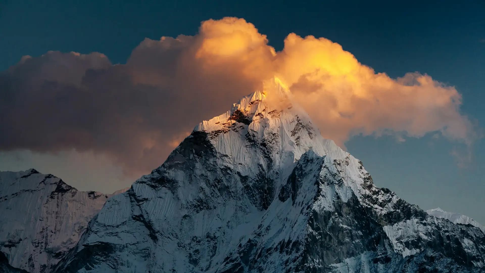
Peaks Near Everest | Lhotse, Nuptse, Pumori, & More
Introduction to Peaks Near Everest
Stand at Kala Patthar on a clear morning and the first thing you notice is that Everest is not the most dramatic mountain in front of you. It is a dark, modest-looking pyramid half-hidden behind a vast wall of rock and ice. The peaks around it do most of the shouting: Nuptse's long ramparts, Lhotse's steep face, Pumori's sharp triangle right beside you, and far behind, the silhouette of Ama Dablam.
Most visitors come to Nepal to see Everest. What they remember afterwards is the whole skyline. This guide is built to help you understand that skyline before you get there: which mountains are which, how high they are, how they relate to Everest, where on the trail you can actually see them, and which ones you can realistically climb. If you are still choosing a route, our overview of trekking in Nepal gives you the wider picture, and the sections below match each peak to the trek that shows it best.
The Quick Answer: The Main Mountains Around Everest
The principal peaks near Everest are Lhotse (8,516 m), Makalu (8,485 m), Cho Oyu (8,188 m), Nuptse (7,861 m), Changtse (7,543 m), Pumori (7,161 m) and Ama Dablam (6,812 m). Lower but still spectacular neighbours include Thamserku, Kangtega, Taboche and Cholatse, while Island Peak, Lobuche East and Mera Peak are the best-known climbing objectives in the region.
Peak | Height | Position relative to Everest | First ascent | Notes |
|---|---|---|---|---|
Mount Everest | 8,848.86 m | The centre of the massif | 1953 | Official height agreed by Nepal and China in December 2020 |
Lhotse | 8,516 m | Joined to Everest by the South Col | 1956 | Fourth highest mountain on Earth |
Makalu | 8,485 m | Roughly 19 km east-south-east | 1955 | Fifth highest, pyramid-shaped |
Cho Oyu | 8,188 m | About 30 km to the west-north-west | 1954 | Sixth highest, name means "Turquoise Goddess" |
Nuptse | 7,861 m | About 2 km west-south-west | 1961 | Name means "West Peak" |
Changtse | 7,543 m | North of Everest, in Tibet | Not covered here | Name means "North Peak" |
Pumori | 7,161 m | About 8 km west | 1962 | Kala Patthar is its outlier |
Ama Dablam | 6,812 m | South of the main trail, near Imja valley | 1961 | Often called the Matterhorn of the Himalaya |
Thamserku | 6,623 m | East of Namche Bazaar | 1964 | Among the first big peaks you see |
Mera Peak | 6,476 m | Southern Khumbu | Not covered here | Highest of the popular trekking peaks |
Island Peak | 6,189 m | Near Chhukhung | Not covered here | One of Nepal's most climbed trekking peaks |
Lobuche East | 6,119 m | Above Lobuche village | Not covered here | Classified as a trekking peak |
Heights vary slightly between surveys, especially for subsidiary summits, so treat the table as a reliable guide rather than a surveyor's final word. Where sources disagree, I note it below.
How the Everest Massif Is Laid Out
Before the individual summits make sense, it helps to picture the geography. Everest sits on the border between Nepal and Tibet in the Mahalangur Himal, a section of the Himalaya in the Khumbu region of Solukhumbu district. The Nepal side lies inside Sagarmatha National Park, which was established in 1976 and inscribed as a UNESCO World Heritage Site in 1979. The park's own description explains that Sagarmatha is a Nepali name meaning "forehead of the sky."
Three features organise the whole area:
The Western Cwm. A high, glaciated valley that runs between the walls of Nuptse, Everest and Lhotse. It is the classic approach used by climbers on the south side.
The South Col. The high saddle that connects Everest to Lhotse. It is the reason Lhotse is described as Everest's closest major neighbour.
The Khumbu Glacier. The river of ice that flows down from the base of the massif and that trekkers follow towards Gorak Shep and Everest Base Camp.
On the Tibetan side lies the Qomolangma National Nature Preserve, and to the east of the park is Makalu Barun National Park. Everest, Lhotse, Nuptse, Pumori and many smaller peaks therefore belong to one connected mountain system, rather than being isolated neighbours.
A note on Everest's height. For decades the accepted figure was 8,848 m, measured by the Survey of India in 1954. On 8 December 2020, Nepal and China jointly announced a new official height of 8,848.86 m after separate surveys by both countries. That is the figure used throughout this guide.
The Giants: Eight-Thousanders and High Neighbours
Four mountains above 8,000 m stand within roughly 30 km of Everest's summit: Everest, Lhotse, Makalu and Cho Oyu. They can often be seen together from high viewpoints in good weather, which is one reason the Khumbu is regarded as one of the greatest mountain landscapes anywhere.
Lhotse: The Fourth Highest Mountain on Earth
Lhotse rises to 8,516 m and is the fourth highest mountain in the world after Everest, K2 and Kangchenjunga. Its name is Tibetan for "South Peak," a nod to its position just south of Everest. The summit sits on the border between Tibet and Nepal's Khumbu region.
What surprises many people is that Lhotse is not a single summit. Its main ridge carries several distinct high points:
Summit | Height |
|---|---|
Lhotse Main | 8,516 m |
Lhotse Middle (also called Lhotse Central I or Lhotse East) | About 8,414 m (some sources give 8,410 m) |
Lhotse Central II | 8,372 m |
Lhotse Shar | 8,383 m |
Lhotse Shar was first climbed in 1970 by Austrians Sepp Mayerl and Rolf Walter, although some sources give a different date, and Lhotse Middle held out until 23 May 2001, when a Russian expedition made the first ascent. It had been the highest unclimbed named summit on Earth for decades. The main summit was first reached in 1956 by Swiss climbers Fritz Luchsinger and Ernst Reiss.
Lhotse is also known for its Lhotse Face, the steep ice slope that climbers on the standard Everest route must ascend between the high camps. If you want to understand how these mountains connect, imagine Lhotse as the south-eastern anchor of the same giant wall that Everest and Nuptse form together.
Nuptse: The Wall Behind Base Camp
If you have ever seen a photograph of Everest Base Camp, the huge ridge of rock and ice behind the tents is Nuptse. Its main summit, Nuptse I, stands at 7,861 m and lies about 2 km west-south-west of Everest. The name means "West Peak," because it forms the western end of the Lhotse–Nuptse massif.
Nuptse is not ranked among the world's highest mountains because it has relatively low prominence, but nobody standing beneath it would call it modest. It is a long ridge with several summits, including Nuptse Shar I at 7,804 m. The first ascent of the main peak took place on 16 May 1961, by Dennis Davis and the Sherpa climber Tashi, as part of a British expedition led by Joe Walmsley. A day later a second group of the same expedition also reached the summit.
One practical detail: because Nuptse's ridge hides Everest's upper pyramid from base camp, you cannot see Everest's summit from Everest Base Camp itself. That is the single most common surprise on the trek, and it is the reason Kala Patthar matters so much.
Makalu: The Pyramid to the East
Makalu is the fifth highest mountain in the world at 8,485 m, roughly 19 km east-south-east of Everest on the Nepal–Tibet border. It is famous for its four-sided pyramid shape and was first climbed in 1955 by a French expedition including Jean Couzy and Lionel Terray. The mountain lies inside Makalu Barun National Park, which is why it is usually approached from a separate trekking route rather than from the main Everest trail. You can still spot it on the horizon from high Khumbu viewpoints on a clear day.
Cho Oyu: The Turquoise Goddess
Cho Oyu is the sixth highest mountain on Earth at 8,188 m, sitting about 30 km west-north-west of Everest on the border with Tibet. Its name means "Turquoise Goddess" in Tibetan. It was first climbed on 19 October 1954 by Austrians Herbert Tichy and Joseph Jöchler with Sherpa Pasang Dawa Lama. Cho Oyu is generally regarded as one of the more approachable eight-thousanders because of its relatively moderate slopes on the standard northwest ridge route, although "approachable" is a relative term at that altitude.
Trekkers see it best from the Gokyo valley, where it dominates the northern skyline.
Changtse: Everest's Northern Companion
Changtse, meaning "North Peak," rises to 7,543 m just north of Everest and lies on the Tibetan side. Most Nepal-side trekkers will not see it as a separate mountain, but it is an important part of the massif's structure and appears in many climbing histories of the north route.
The Beautiful Neighbours: Pumori, Ama Dablam and Friends
The mountains below 8,000 m are often the ones that capture people's hearts, because you walk beneath them for days rather than glimpsing them from a distance.
Pumori: The Daughter of Everest
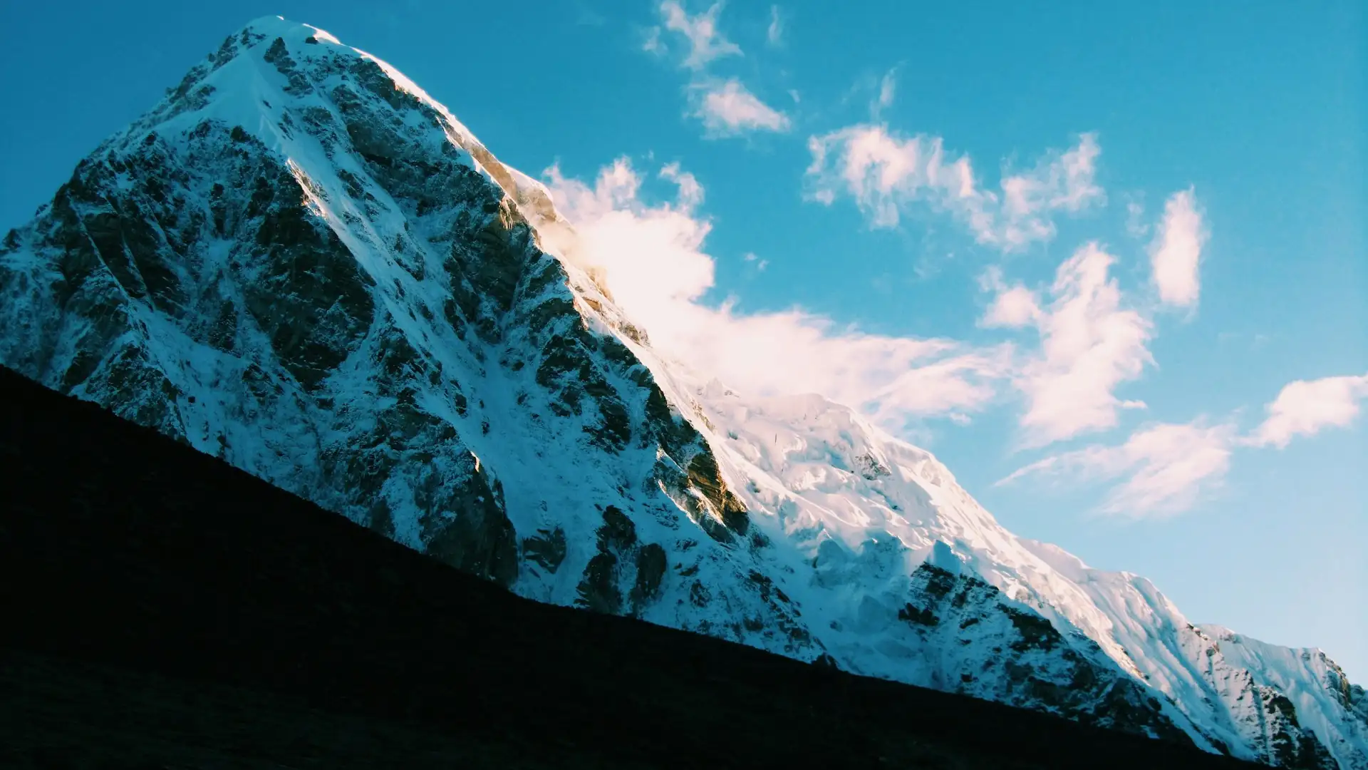
Pumori is a 7,161 m peak about 8 km west of Everest. Its name is commonly translated as "Mountain Daughter." Its sharp, symmetrical pyramid dominates the view as you approach Gorak Shep, and Kala Patthar is technically an outlier of Pumori, which means the famous viewpoint sits on its flank.
Pumori was first climbed on 17 May 1962 by Gerhard Lenser on a German-Swiss expedition. It is a popular objective for experienced mountaineers, but it is a serious technical climb rather than a trekking peak.
Ama Dablam: The Mountain Everyone Photographs
Ama Dablam stands at 6,812 m and is the mountain most people point to when they say the Everest trek was beautiful. It dominates the eastern sky for days of the approach, from the Namche area through Tengboche and up the Imja valley. The name is generally translated as "Mother's Necklace," referring to its protective ridges and the hanging glacier on its face. Its steep ridges and pyramid form have earned it the nickname "the Matterhorn of the Himalaya."
The first ascent was on 13 March 1961 by Mike Gill, Barry Bishop, Mike Ward and Wally Romanes via the Southwest Ridge, during Sir Edmund Hillary's Silver Hut expedition. Ama Dablam requires a climbing permit and a liaison officer, and it is considered a technical objective rather than a trekking peak.
Thamserku, Kangtega, Taboche and Cholatse
These four peaks form a "second tier" of the Khumbu skyline:
Peak | Height | Where you see it |
|---|---|---|
Thamserku | 6,623 m | East of Namche Bazaar, one of the first big peaks of the trek |
Kangtega | About 6,782 m | Beside Thamserku, connected by a ridge |
Taboche | 6,495 m | Across the Imja valley from Ama Dablam, above Pheriche and Dingboche |
Cholatse | 6,440 m | Connected to Taboche by a long ridge, prominent near the Gokyo approach |
Thamserku was first climbed on 4 November 1964, and Taboche in 1974 by a French expedition. None of them are crowded, which is part of their charm.
Lobuche: Two Peaks, Two Classifications
Lobuche has an East peak at 6,119 m and a West peak at 6,145 m. The Nepal Mountaineering Association classifies Lobuche East as a trekking peak and Lobuche West as an expedition peak. Many climbers aim for the East summit, though the real summit is further than the first false top.
Which Peaks Near Everest Can You Actually Climb?
This is where intent splits. Some readers only want to see the mountains. Others want to stand on one. Nepal separates climbable peaks into trekking peaks and expedition peaks, and the difference matters for permits, cost and risk.
Peak | Height | Type | What it demands |
|---|---|---|---|
Mera Peak | 6,476 m | Trekking peak | Often described as technically the least demanding of the three, but a long, high, cold climb |
Island Peak (Imja Tse) | 6,189 m | Trekking peak | Glacier travel, a steep headwall and fixed ropes; one of Nepal's most climbed peaks |
Lobuche East | 6,119 m | Trekking peak | More technical than Island Peak, with a long summit day |
Ama Dablam | 6,812 m | Expedition peak | Technical rock, snow and ice; requires a permit and liaison officer |
Lobuche West | 6,145 m | Expedition peak | Steeper ridges and greater objective hazard |
Pumori | 7,161 m | Expedition peak | Serious high-altitude mountaineering |
Lhotse and Nuptse | 8,516 m / 7,861 m | Expedition peaks | Elite or very experienced climbers only |
Two honest points about this list. First, the label "trekking peak" is a government classification, not a promise of ease. These are real glaciated mountains above 6,000 m and need fitness, instruction and proper equipment. Second, permit rules and fees change, so confirm requirements and costs with a registered operator before you book. If this is a new world for you, consider doing a standard trek first to learn how your body handles altitude, and add a climbing objective on a later trip.
Where to See Each Peak: A Viewpoint Guide
One of the most useful things you can know before you go is what you will see where. Here is how the major viewpoints on the classic route line up. Heights of places are approximate and vary slightly by source.
Place | Altitude (approx.) | What you can see |
|---|---|---|
Namche Bazaar | 3,440 m | Thamserku, Kongde Ri and the first views of the Khumbu; Everest View Hotel above town offers a first glimpse of Everest, Lhotse and Ama Dablam |
Tengboche | About 3,860 m | Everest, Lhotse, Nuptse and Ama Dablam, with the monastery in the foreground |
Dingboche | 4,410 m | Ama Dablam up close; Lhotse's long south face and Taboche nearby |
Lobuche | About 4,900 m | Nuptse, Pumori and Lobuche peaks |
Gorak Shep | 5,164 m | Pumori, Nuptse and the Khumbu Glacier |
Everest Base Camp | 5,364 m | Khumbu Icefall, Nuptse wall; Everest's summit is not visible |
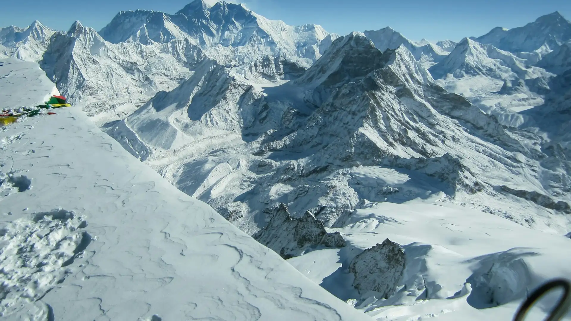
Kala Patthar | About 5,550 to 5,650 m (sources vary) | Everest framed by Nuptse and Lhotse; Pumori beside you; wider views of Changtse |
Gokyo Ri | 5,357 m | Everest, Lhotse, Makalu and Cho Oyu in clear weather |
Gokyo Ri is often described as one of the finest viewpoints in Nepal because four of the six highest mountains in the world are within sight: Everest, Lhotse, Makalu and Cho Oyu. On the classic Everest Base Camp route, Kala Patthar plays a similar role. Our guide to Everest Base Camp elevation explains exactly how the altitude builds along this trail, and for people wondering whether they can see the mountain without trekking at all, we have also answered whether you can see Mount Everest from Kathmandu.
How to Tell the Peaks Apart: A Field Guide for Kala Patthar
Nearly every first-time visitor asks the same questions at the summit of Kala Patthar. Here is how to read the skyline.
Nuptse is the long jagged wall in front, to the west of Everest. It looks as if it should be the tallest thing around, because it is closest.
Everest is the dark, rounded pyramid peeking above and behind that wall. Its upper section often looks black because the slopes are too steep and wind-scoured for snow to settle.
Lhotse sits to the right of Everest as you look at it, connected through the South Col. Its steep, pale face rises well above the glacier.
Changtse appears as a snowy dome to the north of Everest, partly hidden by the nearer ridges.
Pumori is the sharp pyramid immediately beside Kala Patthar. It looks close enough to touch.
Ama Dablam appears in the opposite direction, far to the south, as a slender fin of rock and ice.
Look for the sharp plume of snow blowing off Everest's summit in strong winds. That is a good sign for the climbers above and a reminder that conditions at the top are nothing like what you feel at Kala Patthar.
Which Trek Shows You Which Peaks?
Different routes put you under different mountains, so it is worth deciding what you most want to see.
Everest Base Camp trek. The classic route is the best choice if you want Ama Dablam, Lhotse, Nuptse, Pumori and a view of Everest itself from Kala Patthar. Our Everest Base Camp Trek follows the traditional Lukla, Namche, Tengboche, Dingboche, Lobuche and Gorak Shep route and includes time to acclimatise.
Gokyo Lakes and Everest Base Camp. If you want turquoise lakes plus the Cho Oyu and Makalu views from Gokyo Ri, the Everest Base Camp with Gokyo Lakes Trek combines both valleys and gives you the widest panorama of the region.
Three High Passes. For trekkers with more time and stamina, the Everest Three High Pass Trek loops the entire region over Kongma La, Cho La and Renjo La. All three passes sit well above 5,000 m, so this is a demanding route that rewards experience and good acclimatisation.
When Is the Best Time to See These Mountains?
The mountains do not move, but visibility does. Clear skies are what matter most.
Season | Months | What to expect |
|---|---|---|
Autumn | September to November | The most reliable window: stable weather, clear mornings, sharp views |
Spring | March to May | Warmer, with rhododendrons lower down; also the main climbing season on Everest, so you may see expedition activity |
Winter | December to February | Very cold at altitude, but crisp air and quiet trails |
Monsoon | June to August | Frequent cloud and rain hide the peaks; flights to Lukla are more likely to be delayed |
For the best chance of seeing Nuptse, Lhotse and Everest together without cloud, aim for October or November, and plan extra buffer days because mountain flights can be delayed by weather in any season. Start early on summit-viewpoint mornings, because cloud often builds from the valleys by midday.
Permits and Rules for the Everest Region
Most of the peaks described above lie inside or beside Sagarmatha National Park, so you need an entry permit to visit. According to the Nepal Tourism Board's park entry fee table, the Sagarmatha National Park fee is NPR 3,000 per person per entry for foreign nationals, NPR 1,500 for SAARC nationals and NPR 100 for Nepali citizens, with children under 10 free.
Beyond the park fee, the Everest region also charges a separate local entry fee collected by the local municipality. Reported amounts have been in the NPR 2,000 to 3,000 range, and the rules have shifted in recent years, so confirm the current figure when you book.
On guiding rules, Nepal has been moving towards requiring foreign trekkers in national parks and conservation areas to use a licensed guide arranged through a registered trekking agency. Enforcement has reportedly varied, and details changed again in 2026, so ask your operator to confirm what applies on your dates. We explain the latest changes in our Nepal trekking guide requirement for 2026. For the park itself, the official Sagarmatha National Park website has background on its history and management.
Peak climbing is a separate layer. Trekking peaks and expedition peaks each require their own permits through Nepal's mountaineering authorities, and expedition peaks such as Ama Dablam require a liaison officer. Do not assume your trekking permit covers a summit attempt.
Altitude and Safety: Respecting the Skyline
The views around the Everest massif come with real altitude. Lukla sits at about 2,860 m, Namche at 3,440 m, Dingboche at 4,410 m, Gorak Shep at 5,164 m and Everest Base Camp at 5,364 m. Altitude sickness is not a sign of weakness, and it can affect fit and experienced people as easily as beginners.
Climb slowly and rest properly. Acclimatisation days at Namche and Dingboche exist for a reason, so do not skip them to save time.
Know the warning signs. Persistent headache, nausea, dizziness, unusual breathlessness and poor sleep mean you stop ascending. If symptoms worsen, you descend.
Plan for the weather. Flights into Lukla are regularly delayed, so leave a few spare days before your international departure.
Insure properly. Make sure your policy covers trekking at altitude and emergency helicopter evacuation, and check the maximum altitude it covers.
Be careful about early starts. Kala Patthar sunrise hikes begin in the dark and the cold can be severe, so carry warm layers, a headlamp and enough water.
If you want a simple reference for how these altitudes compare with other Nepal destinations, our Nepal elevation guide sets them side by side.
The Cultural Side: Mountains Are Not Just Scenery
It is easy to treat the peaks as trophies. For the Sherpa communities of the Khumbu, many of them are sacred. Khumbila, the pointed mountain above Khumjung, is regarded as the home of a protective deity and is not climbed. Prayer flags, mani walls and chortens are placed with purpose, and the monastery at Tengboche is the largest in the Khumbu region.
When you walk past a mani stone, pass it on the left, keep your voice low near monasteries, and ask before photographing people. Choose lodges and guides from the region whenever possible so tourism income stays with the communities who live beneath these mountains. Climbing seasons also begin with ceremonies that ask permission from the mountain, and understanding that context makes the whole trek feel different.
Planning Your Own Trip Around the Peaks
A few practical principles will help you build a trip that matches what you actually want to see:
Decide your priority. Do you want Everest itself, or the surrounding skyline? The classic Base Camp route gives you both, while Gokyo gives you wider panoramas of the eight-thousanders.
Match time to ambition. Rushing the altitude is the biggest avoidable mistake. Give yourself a realistic number of days with acclimatisation built in.
Pick the season for visibility. October, November, April and May are the favourites for good reason.
Separate trekking from climbing. Decide whether you want to view the mountains or summit one. A climb needs extra time, training, permits and equipment.
Check the paperwork early. Park fees, local fees and guide rules shift, so confirm them with a registered agency rather than relying on an old blog post.
Frequently Asked Questions About the Peaks Near Everest
1. What are the highest peaks near Everest? The tallest are Lhotse (8,516 m), Makalu (8,485 m) and Cho Oyu (8,188 m). Nuptse at 7,861 m, Changtse at 7,543 m and Pumori at 7,161 m follow, with Ama Dablam at 6,812 m the best known of the lower peaks.
2. How tall is Mount Everest officially? The official height is 8,848.86 m, jointly announced by Nepal and China on 8 December 2020. Many sources still round it to 8,848 m.
3. What is the tallest mountain next to Everest? Lhotse, at 8,516 m. It is the fourth highest mountain in the world and is connected to Everest by the South Col.
4. Is Lhotse part of Everest? No, it is a separate mountain, but the two share the same massif and are linked by the high saddle called the South Col. Lhotse's name means "South Peak" in Tibetan.
5. Which peak is the huge wall behind Everest Base Camp? That is Nuptse, a long ridge with a main summit of 7,861 m. Its name means "West Peak."
6. Can you see Everest from Everest Base Camp? No. The summit is hidden behind the ridge of Nuptse. For a clear view of Everest, trekkers climb Kala Patthar, which sits above Gorak Shep.
7. Which pyramid-shaped peak is beside Kala Patthar? That is Pumori, at 7,161 m. Kala Patthar is an outlier of Pumori, which is why it looks so close.
8. Why is Ama Dablam called the Matterhorn of the Himalaya? Because of its steep, soaring ridges and pyramid-like form, which remind many people of the Matterhorn in the Alps. Its name is generally translated as "Mother's Necklace."
9. How high is Ama Dablam, and has it been climbed? It is 6,812 m high and was first climbed on 13 March 1961 by Mike Gill, Barry Bishop, Mike Ward and Wally Romanes. It requires a climbing permit and a liaison officer.
10. Which peaks can you see on the Everest Base Camp trek? Typically Thamserku, Ama Dablam, Everest, Lhotse, Nuptse, Pumori, Taboche and Cholatse, with views of Changtse from Kala Patthar. Exact views depend on weather and where you stand.
11. Can you see Makalu and Cho Oyu from the Everest region? Yes, in clear conditions from high viewpoints such as Gokyo Ri, which is usually described as offering views of Everest, Lhotse, Makalu and Cho Oyu together.
12. How many 8,000 m peaks are near Everest? Four main ones: Everest, Lhotse, Makalu and Cho Oyu. Lhotse also has subsidiary summits such as Lhotse Middle and Lhotse Shar that exceed 8,000 m.
13. What is the highest trekking peak near Everest? Mera Peak, at 6,476 m, is commonly cited as the highest of Nepal's popular trekking peaks. Island Peak (6,189 m) and Lobuche East (6,119 m) are also well known.
14. Can a beginner climb Island Peak or Lobuche East? They are classified as trekking peaks, but they involve glacier travel, steep sections and long summit days. A good fitness base, prior trekking at altitude and proper instruction are strongly recommended.
15. Do I need a permit to climb the mountains around Everest? Yes. Climbing requires peak permits through Nepal's mountaineering authorities in addition to your trekking permits, and expedition peaks like Ama Dablam require a liaison officer. Confirm current rules and fees with a registered operator.
16. How much is the Sagarmatha National Park entry fee? According to the Nepal Tourism Board, foreign nationals pay NPR 3,000 per entry, SAARC nationals NPR 1,500 and Nepali citizens NPR 100, with children under 10 free. A separate local entry fee also applies in the Everest region.
17. Do I need a guide for the Everest region? Nepal's rules point towards foreign trekkers in national parks needing a licensed guide arranged through a registered agency, though enforcement has reportedly varied. Ask your operator to confirm the current requirement for your dates.
18. What is the best time to see the peaks near Everest? October and November offer the most stable, clear conditions. March to May is the other favourite season, with warmer days and a lively atmosphere on the trail.
19. How many days do I need to see these mountains on trek? A typical Everest Base Camp trek takes around two weeks including flights and acclimatisation days. Adding the Gokyo valley or the high passes lengthens the trip.
20. Which trek is best for seeing the most peaks near Everest? Combining Everest Base Camp with the Gokyo Lakes gives the widest panorama, including Cho Oyu and Makalu from Gokyo Ri. The Three High Passes route covers the most ground but is much more demanding.
Ready to Walk Beneath the Giants?
Seeing the peaks near Everest well is about more than reaching a base camp. It is about arriving at the right viewpoint on the right morning, acclimatised enough to enjoy it, with someone beside you who knows which ridge is which. If you would like help choosing between the classic Base Camp route, the Gokyo valley or the high passes, or you are weighing a climbing objective, our team can shape an itinerary around your dates, fitness and budget.
Talk to an expert on WhatsApp: +977 9841248242
You can also reach us through our contact page and we will reply with route options, permit guidance and a clear, itemised quote.
Author: Dil Bahadur Karki