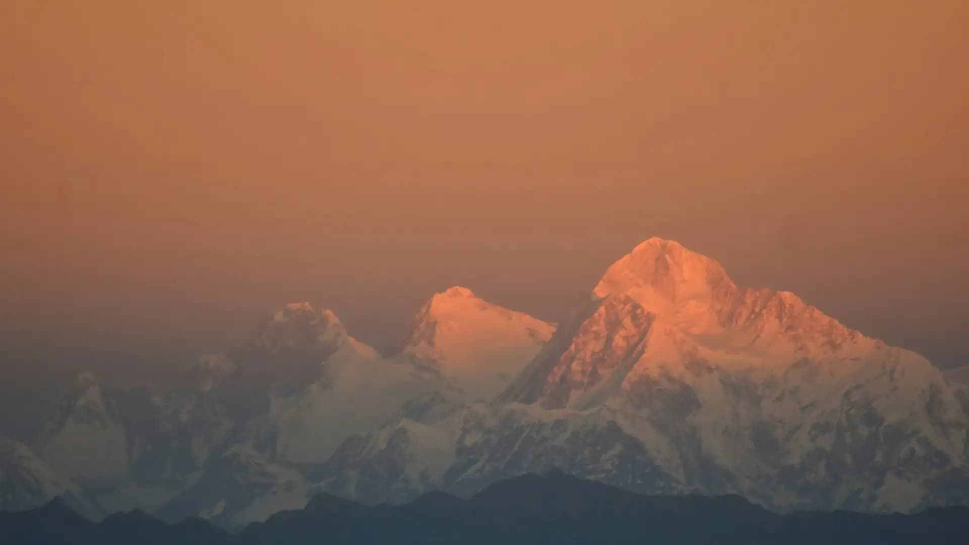
Lhotse Face Everest Location, Altitude, Dangers & Climbing
Introduction to Lhotse Face Everest
Ask a mountaineer which part of the south-side Everest climb they remember most, and many will not say the summit. They will say the wall. After the Khumbu Icefall and the long, hot silence of the Western Cwm, there is a slope of hard blue ice that does not stop. It tilts above you for hours, a single fixed rope running up it, and every step on it has to be earned. That wall is the Lhotse Face Everest climbers have to cross to reach the South Col, and it is arguably the most underrated chapter of the whole expedition.
Most online explanations are thin. They give you one height, one angle and a sentence about rockfall. This guide goes further. It explains where the face is, how it connects to Everest and Lhotse, what each section of it is like, why it is genuinely dangerous, how climbers manage oxygen and acclimatization on it, and what you, as a trekker or an armchair mountaineer, can realistically see from the trail.
The Quick Answer
The Lhotse Face is the steep western flank of Lhotse (8,516 m), the fourth highest mountain in the world. It rises roughly 1,125 m (about 3,700 ft) from the top of the Western Cwm towards the South Col, and it is made mostly of hard glacial ice. Anyone climbing Everest by the standard south-east ridge route must go up it. Camp 3 is pitched on the face at around 7,100 to 7,160 m, and two rocky sections, the Yellow Band and the Geneva Spur, interrupt the ice higher up before climbers reach the South Col at roughly 7,900 m.
Quick fact | Detail |
|---|---|
What it is | The western flank of Lhotse, forming the headwall of the Western Cwm |
Height of the wall | About 1,125 m (about 3,700 ft) |
Typical steepness | Commonly described as 40 to 50 degrees, with short bulges steeper still; some operators quote 30 to 45 degrees for the routed line |
Surface | Hard glacial ice, often blue and bare, especially in dry seasons |
Camp 3 | About 7,100 to 7,160 m, depending on the source |
Top of the face (route) | The South Col, at around 7,900 m |
Rock bands above Camp 3 | The Yellow Band, then the Geneva Spur |
Used by | Everest and Lhotse climbers on the Nepal side |
Who does not use it | Trekkers: the face is not on any trekking route |
Where the Lhotse Face Is, and How It Fits Into the Mountain
To picture the face, start from Everest Base Camp. The Khumbu Glacier flows down from the north-east. Above base camp the Khumbu Icefall guards the entrance to the Western Cwm, a broad glacial valley whose name uses the Welsh word cwm, meaning a glacial hollow. It is often nicknamed the Valley of Silence. It runs up between the great wall of Nuptse on one side and the western shoulder of Everest on the other, and at its head it ends against a vast sheet of ice. That sheet is the Lhotse Face.
Three landmarks help you hold the geography in your mind:
Everest's summit sits to the north of the Cwm's head, with the route to it leaving the face on the left.
Lhotse's summit rises above the face, and the Lhotse climbing route leaves the Everest route on the right.
The South Col is the high saddle between the two, at the top of the Lhotse Face route. It is the site of the last high camp for Everest climbers on this side.
One point that confuses a lot of readers: the Lhotse Face is not the same as Lhotse's famous South Face. The South Face is a separate, far more severe wall on the other side of the mountain, and it is a serious expedition objective in its own right. The Lhotse Face is the western flank, and because it faces the Western Cwm, it has become the gateway for the standard route. Trekkers walking towards Chhukhung or the Imja valley are looking at Lhotse's south side, not at the face that Everest climbers use.
Section by Section: What the Face Is Actually Like
Describing the face as a single slope hides how different its sections feel. Here is how it breaks down for a climber moving up the fixed lines.
Section | Approx. altitude | What it feels like |
|---|---|---|
Camp 2 (Advanced Base Camp) | About 6,400 m | A tented village at the head of the Western Cwm, with a mess tent, kitchen and a clear view of the face above |
Base of the face and bergschrund | Roughly 6,500 to 6,700 m (sources vary) | The crack where the glacier ice separates from the steeper slope; climbers cross it at the start of the climb |
Lower and middle face | Roughly 6,700 to 7,000 m | The long, steady, steep ice, with the fixed line running directly up |
Camp 3 | About 7,100 to 7,160 m | A cluster of small tents on platforms cut into the slope, with a vast drop below |
Yellow Band | Above Camp 3 | A band of pale rock (reported to include marble, phyllite and schist) that climbers cross using fixed ropes |
Geneva Spur | Between the Yellow Band and the South Col | A rib of darker rock, named after the Swiss expedition from Geneva, mixed rock and snow |
South Col (Camp 4) | About 7,900 m | A wind-swept saddle between Everest and Lhotse |
Altitudes are approximate. Different expedition operators and surveys quote slightly different figures for camps, because the exact positions of camps shift from season to season with ice and snow conditions.
The bergschrund and the first steps
The face starts with a bergschrund, a crevasse that forms where the moving glacier pulls away from the steeper slope above it. Climbers clip into the fixed line, cross the lip of the crack, and begin the long ascent. Experienced climbers say the early part of the face is where you settle into a rhythm, because there is nothing to think about but the next step, the next breath and the rope.
Hard blue ice
The defining character of the face is its surface. Depending on the season and recent snowfall, it can be a bare, glassy blue ice that is hard to bite into with crampons. The steepness is steady rather than technical, but fatigue and thin air turn a moderate angle into an exhausting climb. Many climbers describe the last stretch into Camp 3 as the hardest part of the lower mountain, because it is where altitude begins to bite and oxygen is usually only just coming into use.
Camp 3: the shelf in the sky
Camp 3 exists because climbing from Camp 2 all the way to the South Col in one push would be an enormous undertaking. The tents are pitched on small ledges cut into the slope, and the view looks straight down the face and out over the Western Cwm. It is one of the most dramatic campsites on Earth, and one of the least comfortable. The slope is steep, the camp is exposed to snow and ice avalanches from above, and many climbers use supplemental oxygen to sleep there.
The Yellow Band and the Geneva Spur
Above Camp 3, the ice gives way to rock. The Yellow Band is a stripe of yellowish rock that cuts across the upper face, and climbers cross it by following fixed ropes over steep, awkward ground at an altitude where every movement is slow. Above it, the route traverses left over the Geneva Spur, a rib of dark rock and snow, and the angle finally eases as it approaches the South Col.
At the Yellow Band, the two great routes part. Everest climbers go left over the Geneva Spur towards the South Col. Lhotse climbers go right, further up the face, towards a narrow couloir known as the Reiss Couloir that leads to the summit of Lhotse.
A Short History: How the Face Became the Route
The story of the Lhotse Face Everest route starts with the Swiss. In 1952, a Swiss expedition from Geneva, working from the Nepal side after the country had opened to foreign climbers, found a way up from the head of the Western Cwm to the South Col. The South Col was first reached on 12 May 1952 by Swiss climbers including Raymond Lambert, who went on to attempt the summit with the Sherpa Tenzing Norgay and reached about 8,595 m on the south-east ridge, a new altitude record at the time. The Geneva Spur takes its name from that expedition.
Their experience shaped what came next. The Swiss showed that the route up the Lhotse Face to the South Col was workable, and the British team that followed in 1953 chose it for their own attempt. George Lowe, the New Zealand climber, was among the lead climbers who forged the route up the face without oxygen. On 29 May 1953, Edmund Hillary and Tenzing Norgay reached the summit of Everest, having used the South Col as their high camp.
The face also played a part in the first ascent of Lhotse itself. In May 1956, a Swiss expedition used the Geneva Spur as the site of its last high camp, and on 18 May 1956, Fritz Luchsinger and Ernst Reiss made the first ascent of Lhotse's main summit, with supplemental oxygen, by the west face route. That route is still the normal way up Lhotse today. As of spring 2021, 933 people had stood on the main summit of Lhotse, 183 of them without supplemental oxygen, according to a published tally.
Why the Lhotse Face Everest Route Is More Dangerous Than It Looks
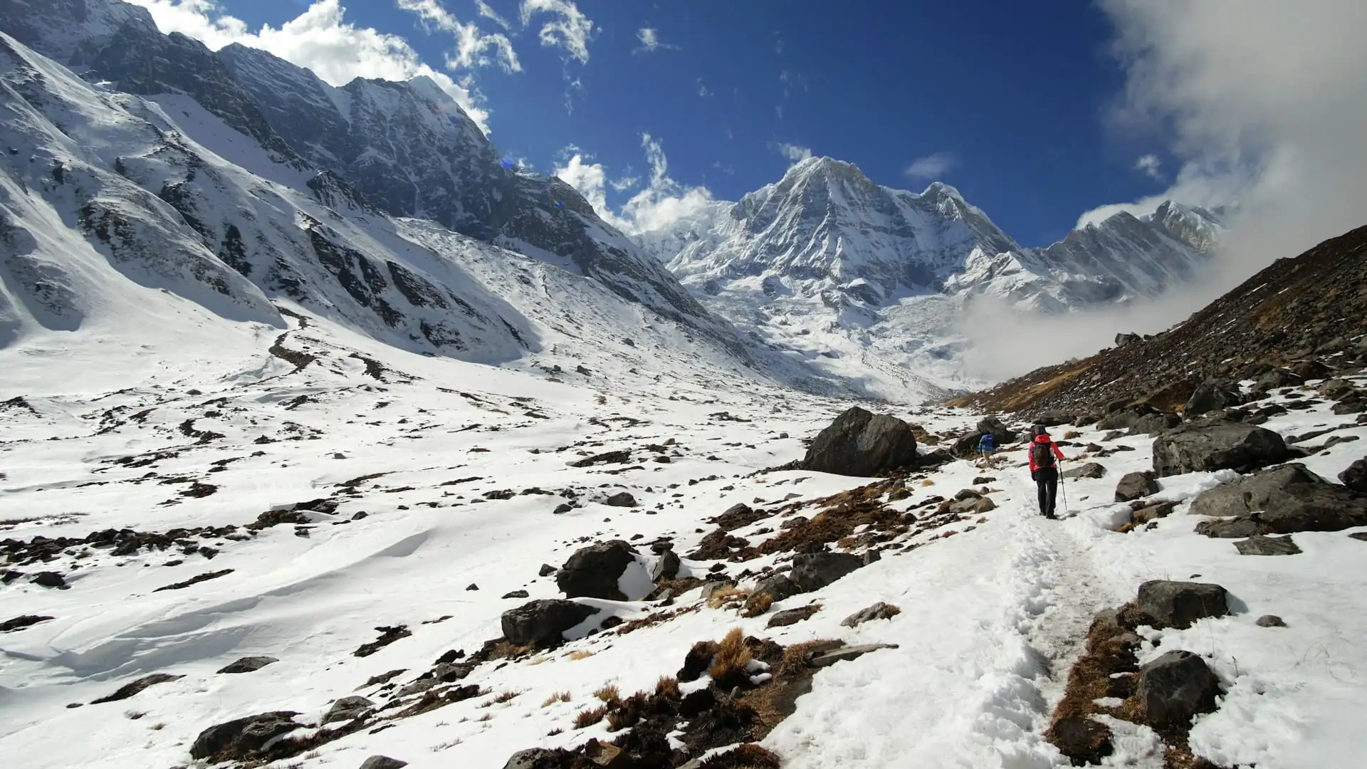
The face does not have the dramatic reputation of the Khumbu Icefall, but experienced climbers treat it with real respect. It is steep, it is high enough that thin air begins to impair judgment, and it is crowded in the busy weeks of May. The main hazards fall into a few groups.
Rockfall
Rock and ice fall from above, particularly in dry seasons when there is little snow to hold loose material in place. In late April 2012, continuous rockfall injured six people on the direct variation of the face, and one climber was nearly killed by a large falling rock. In response, expedition leaders shifted the route towards the right side of the face, onto the shoulder of Nuptse, which was safer from rockfall. Routes on the face are adjusted from year to year by the rope-fixing teams according to conditions.
Falls on hard ice
When the surface is bare blue ice, a slip can be very difficult to arrest. Climbers rely on fixed ropes, and the golden rule is never to be off the rope. Accidents often happen at transitions: clipping and unclipping at anchors, passing other climbers, or moving while exhausted. Deaths on the face still occur. In May 2026, a 20-year-old Sherpa climber from Thame, carrying loads from Camp 2, slipped and fell at around 7,000 m just below Camp 3 during the night. That reminder is part of why the Sherpa community, and the climbing community, treat the face with such seriousness.
Avalanches and ice fall at Camp 3
Camp 3 sits on a steep slope below the Yellow Band and is exposed to small avalanches and ice fall, especially in fresh-snow conditions. In 2012, a small ice avalanche hit the camp, destroying several tents and injuring a Sherpa. Climbers still talk about the damaged tents and bent ice pickets left from earlier events.
Altitude, cold and slow decisions
At the altitude of Camp 3, the air pressure is only roughly 40 percent of the sea-level value. Appetite fades, sleep becomes difficult, and the simplest tasks take much longer than usual. That is why acclimatization, oxygen strategy and judgment matter as much as strength.
Crowding on the fixed lines
When many teams want to climb during the same weather window, the single fixed line can become a queue. Waiting in the cold on a steep slope at 7,000 m is draining and dangerous. Good expedition leaders plan rotations and timing carefully to avoid it.
Hazard | When it is worst | How teams reduce the risk |
|---|---|---|
Rockfall | Dry, windy seasons with little snow | Adjusting the route; climbing early; wearing helmets; keeping moving through exposed sections |
Falls on ice | Bare blue ice and poor visibility | Staying clipped in at all times; good crampon technique; double-checking anchors |
Avalanche at Camp 3 | After fresh snow | Careful timing of camp use; monitoring forecasts; short stays |
Altitude illness | Poor acclimatization, rushed schedules | Staged rotations, supplemental oxygen, willingness to descend |
Crowding | Narrow summit windows in May | Staggered departures; strong logistics; flexible plans |
Cold and wind | Late in the day and in poor weather | Layering, early starts, sound turnaround rules |
Lhotse Face Everest Altitude, Oxygen and Acclimatization
The face is not just an obstacle; it is the main tool climbers use to prepare their bodies for the summit push. Nearly every south-side expedition builds its schedule around what happens between Camp 2 and the South Col.
The general logic is simple. The body adapts to thin air slowly, by producing more oxygen-carrying red blood cells, and it only does that if it spends time at altitude. So teams make a series of "rotations": they climb up from base camp to a higher camp, spend a night or a few hours there, then descend to recover. For most climbers, a night or a brief stay at Camp 3 is the highest sleeping point before the summit push. Camp 3 is typically the last stage of that conditioning.
The air at the height of Camp 3 contains only about two-fifths of the oxygen available at sea level, so the stakes are real. Sleeping there without oxygen is miserable for most people; those who have done it describe a very different experience on a night when they used supplemental oxygen, feeling relatively normal by comparison. Some commercial teams offer an extra-oxygen programme where climbers begin using bottled oxygen as soon as they leave Camp 2, while others start at Camp 3. Elite climbers attempting Everest or Lhotse without bottled oxygen spend more nights high to compensate, and they accept a much higher margin of risk.
Stage | Approx. altitude | Typical oxygen approach |
|---|---|---|
Base Camp | About 5,300 m | None |
Camp 1 | About 6,000 m | None |
Camp 2 (ABC) | About 6,400 m | None for most climbers; sometimes for sleeping on extra-oxygen programmes |
Camp 3 on the face | About 7,100 to 7,160 m | Commonly used for sleeping and climbing on guided expeditions |
South Col (Camp 4) | About 7,900 m | Used by the great majority of climbers |
The exact plan varies by company. If you are comparing operators, the oxygen policy, flow rates and number of spare bottles are among the most important details to understand.
A Day on the Face: What Climbers Actually Do
Because nobody outside the expedition world sees this, a walk-through helps. This is a general description rather than any single team's schedule.
Pre-dawn departure from Camp 2. Climbers leave early, usually in the dark, to take advantage of colder, firmer conditions and to be off the exposed slope before the day warms up. Headlamps trace a line of light up the wall.
Crossing the bergschrund and clipping in. Climbers attach an ascender (a jumar) to the fixed line, and a safety carabiner as a backup, and they move one section at a time between anchors.
The long middle section. The slope is steady, steep and repetitive. Climbers move in a pattern of step, breathe, step, breathe, pausing at anchors. Passing another climber means unclipping and reclipping carefully, which is a point of risk.
Arriving at Camp 3. For many, the last few hundred feet are the hardest. The tents are on small platforms and everything must be done carefully, because dropped gear and a clumsy step both have consequences.
Rest, melt snow and sleep (if staying). Melting snow for water takes a long time at this altitude, and appetite is poor, but staying hydrated is essential.
Summit push or descent. On a rotation, climbers return to Camp 2 the next morning. On the summit push, they continue above Camp 3, crossing the Yellow Band and the Geneva Spur towards the South Col, where they rest briefly before the final night climb.
Between Camp 2 and Camp 3 is commonly reported as a long, strenuous day, often somewhere in the range of four to eight hours depending on pace, conditions, crowding and fitness. Treat any single figure with caution.
The Rope Fixers: The People Who Make the Route Possible
None of this would be possible without the Sherpa climbers who prepare the mountain. Before the main wave of climbers arrives, experienced Sherpa teams set the fixed ropes up the face and across the rock bands, placing anchors into ice and rock. This is physically brutal and technically demanding work, and it happens early in the season, before the main wave of climbers moves up the mountain. Throughout the season, Sherpa climbers continue to carry loads, repair ropes and respond to emergencies.
The 2026 season was another reminder of the personal cost. A young Sherpa from Thame, the grandson of the renowned climber Ang Rita Sherpa, died after a fall below Camp 3 while carrying gear from Camp 2. Anyone who reads about the face should hold that in mind. The route you see in a photograph exists because people did the hardest work first.
The Choice at the Yellow Band: Everest or Lhotse
Both Everest and Lhotse expeditions share the same route up to the Yellow Band. This is why many teams run combined Everest-Lhotse programmes and why the face is such an efficient place to acclimatize for either mountain.
Decision point | Everest climbers | Lhotse climbers |
|---|---|---|
After the Yellow Band | Go left over the Geneva Spur to the South Col | Go right, higher up the face |
Route to the summit | Across the South Col, up the south-east ridge | Towards the Reiss Couloir and the summit |
Summit height | 8,848.86 m | 8,516 m |
Final stage | Across the South Col and up the south-east ridge on a long summit day | A steep couloir to the summit |
Because the South Col links the two summits, it is physically possible to climb Lhotse and then traverse to Everest in less than 24 hours, a feat known as the "Double Crown." It is reserved for a small number of exceptional, very well-acclimatized mountaineers and is not a goal to casually consider. If you are curious about how big a leap climbing Everest really is, our honest breakdown of how hard it is to climb Everest goes into fitness, risk and preparation, and the timeline is covered in our guide to how long it takes to climb Mount Everest.
When Is the Best Time to Climb the Face?
On the Nepal side, most Everest and Lhotse expeditions take place in the spring season, from March to May, when the weather windows for the summit are most reliable. Autumn (September to November) is a much quieter season on the mountain, and winter and monsoon climbs are rare and very demanding.
The conditions on the face change with the season and with the year:
Dry, windy years tend to expose bare ice and loose rock, and rockfall becomes more of a concern.
Snowier periods can bury the ice and make the climbing easier underfoot, but raise avalanche hazard, particularly around Camp 3.
Warm afternoons can loosen debris, which is why early starts matter.
Permit rules reflect this seasonal difference. According to Nepal's revised fee schedule, which came into effect on 1 September 2025, the royalty for foreign climbers on the standard south route of Everest is US$15,000 in spring, US$7,500 in autumn and US$3,750 in winter and monsoon, as reported by The Kathmandu Post.
Can You See the Lhotse Face Everest Climbers Use From the Trail?
This is the question most trekkers actually care about, and the honest answer is: not properly, and not on any standard trek.
The face sits at the head of the Western Cwm, tucked behind the long wall of Nuptse and the western shoulder of Everest as seen from the trekking route. Even from Everest Base Camp, the upper reaches of Everest are hidden, and the Cwm itself is not visible from the trail. What you can see from the trek is the surrounding skyline: Everest, Lhotse and Nuptse appear together from Kala Patthar, and the Khumbu Glacier winds back towards the Cwm. In clear conditions, a telephoto lens can pick out features high on Lhotse, but the face in detail, Camp 3 and the fixed lines are best appreciated from inside the Cwm, which is only accessible to climbers.
What the trek does give you is the context. Standing at Kala Patthar and looking from Nuptse to Everest to Lhotse lets you understand where the route goes, and that makes every expedition photograph make sense afterwards.
Viewpoint | What you can realistically see |
|---|---|
Everest Base Camp | The Khumbu Icefall and the Nuptse wall; Everest's summit is hidden |
Kala Patthar | Everest framed by Nuptse and Lhotse; the glacier leading up towards the Western Cwm |
Gokyo Ri | Everest, Lhotse, Makalu and Cho Oyu on a clear day |
Chhukhung and the Island Peak approach | Lhotse's steep south side, which is a different wall from the Lhotse Face |
If you want to experience this landscape without a climbing permit, our Everest Base Camp Trek takes you to Gorak Shep and Kala Patthar, and our Everest Base Camp with Gokyo Lakes Trek adds the Gokyo valley's wider panorama. For the numbers behind the trail, see our guide to Everest Base Camp elevation.
Permits, Costs and Rules for Climbing Beyond the Trail
A trekking permit does not cover a climb. Anyone planning to climb Everest, Lhotse or any other peak in Nepal needs a climbing permit issued through Nepal's mountaineering authorities, and expedition peaks require a registered operator.
Item | What has been reported |
|---|---|
Everest permit (south route, foreigners) | US$15,000 in spring, US$7,500 in autumn, US$3,750 in winter and monsoon, in effect from 1 September 2025 |
Lhotse permit (foreigners) | Reported at US$3,000 in spring after the 2025 revision, up from US$1,800; confirm the current figure |
Guides | Reported rules say every two climbers on 8,000 m peaks must hire a guide |
Experience requirement | A proposal to require a prior 7,000 m summit in Nepal has been reported as under review; check its current status |
Total expedition cost | Far above the permit alone: guides, oxygen, ropes, camps, food, logistics, insurance, helicopter cover |
Regulations in this area change often, and some details are reported differently by different outlets, so use this table as a starting point and have a licensed operator confirm what applies on your dates. Most of the cost of a real expedition is not the permit; it is oxygen, Sherpa support, equipment and logistics.
For a broader look at climbable peaks that are not Everest, our guide to peak climbing in Nepal explains the trekking peak and expedition peak categories and how to build up to bigger objectives.
The Skills the Face Demands
The face is not a technical climb in the way an alpine ice route is. It is a long, steep slope where you stay clipped to a fixed line. But that does not mean it is easy. The skills that matter are:
Crampon and ice-axe technique on steep, hard ice, practised until it is automatic.
Fixed-rope handling: attaching and moving an ascender, switching at anchors, passing other climbers and managing a backup.
Pacing and breathing at altitude: moving at a sustainable rhythm instead of racing.
Cold-weather self-care: managing hands, feet, hydration and clothing layers while barely able to think.
Honest self-assessment: knowing the difference between hard and unsafe, and being willing to turn around.
Most reputable guides expect climbers to have prior high-altitude experience, such as 6,000 m or 7,000 m peaks, before attempting an 8,000 m mountain.
Building Up to It: A Realistic Progression
Nobody should treat the face as a first Himalayan climb. A sensible progression looks like this:
Trek at altitude. The classic Everest Base Camp route, or something more demanding like the Three High Passes route, shows you how your body responds above 5,000 m.
Climb a trekking peak. Island Peak (6,189 m), Lobuche East (6,119 m) or Mera Peak (6,476 m) introduce glacier travel, ascenders and crampons.
Climb a bigger mountain. Higher peaks of 6,500 to 7,000 m teach you to manage camps, cold and fatigue.
Then consider an 8,000 m peak, with a strong team, proper oxygen planning and enough time.
Skipping steps is how experienced guides end up making difficult descent decisions. If you are at step one or two, our team can help you choose a route that builds your skills at the right pace.
Respecting the Mountain and the People Who Work on It
A few principles are worth keeping in mind whether you trek or climb.
The Sherpa and Khumbu communities carry the greatest risk and the most expertise. Choose operators that pay fair wages, provide insurance, and treat their staff as partners.
Mountains here are sacred to many. Climbing seasons begin with ceremonies, and respect for them is not optional politeness.
Leave no trace. Garbage, discarded oxygen bottles and abandoned gear on the upper mountain are a serious environmental problem that regulations are trying to address.
Turn around when you should. The summit is optional. Coming home is not.
Lhotse Face vs Khumbu Icefall: Which Is the Bigger Test?
Climbers love to argue about this, and the honest answer is that they are different kinds of danger. The Khumbu Icefall is a moving, fractured glacier, a maze of tilting ice blocks, some as large as houses, and its risk is unpredictable collapse. You pass through it quickly, usually before dawn, because the danger is about being in the wrong place at the wrong moment.
The Lhotse Face is slower and steadier. Nothing about it is unstable in the same way, but it asks more of your body for longer. You are higher, the air is thinner, the slope is relentless and the risk accumulates through fatigue, cold and small mistakes rather than through one dramatic hazard. Rockfall and Camp 3 avalanches add the element of chance, but the face is mostly a test of endurance and discipline.
Khumbu Icefall | Lhotse Face | |
|---|---|---|
Type of terrain | Fractured, moving glacier with crevasses and ice towers | Long, steep, hard ice slope with rock bands above |
Main danger | Sudden ice collapse | Falls, rockfall, avalanche at camp, altitude and fatigue |
How it is crossed | Fixed ropes and ladders, moving fast | Fixed ropes, moving steadily with rest at anchors |
Altitude range | Roughly Base Camp to Camp 1 | Roughly Camp 2 to the South Col |
What it demands | Speed, timing and nerve | Endurance, pacing and judgment |
Neither is a place for hurry or ego. Many experienced climbers say that if you respect both, the mountain gives you a chance.
What the Face Means for Your Trek: Seeing the Route in Context
You do not need a climbing permit to enjoy the landscape around the Lhotse Face Everest climbers cross. The trek gives you something different and, for many people, more satisfying: the chance to understand the mountain from below, at your own pace, with a warm lodge waiting at the end of each day.
Here is how to get the most from the Everest Base Camp route when you are interested in the climbing side of the story:
At Gorak Shep (5,164 m), you are close to the foot of the Khumbu Glacier, the river of ice that flows down from the Western Cwm. Looking up-valley, you are looking at the approach to the Icefall.
At Everest Base Camp (5,364 m), you can see the Icefall tumbling out of the Cwm and the Nuptse wall beside it. This is where the expedition begins, and in spring you will often see tents and expedition activity.
At Kala Patthar, the viewpoint above Gorak Shep, wait for a clear morning and look from Nuptse on the left, to Everest in the middle, to Lhotse on the right. The col between Everest and Lhotse is the South Col, the high saddle at the top of the climbing route.
With a telephoto lens, you may pick out the upper parts of Lhotse. A good zoom and patience matter more than expensive kit.
If you only take away one idea, make it this: the best views of the climbing route come on clear, cold mornings, so build a spare day into your itinerary rather than rushing the viewpoint days. Weather decides everything up here.
Altitude Lessons Every Trekker Can Borrow From the Face
Climbers have to manage altitude with more rigour than anybody, and their habits are worth borrowing even if you will never go above Kala Patthar.
Go up slowly and sleep low when you can. Climbers use rotations to adapt gradually; trekkers do the same with acclimatization days, including a rest day around Namche and Dingboche.
Hydrate deliberately. Thin, dry air leaves you dehydrated without noticing. Drink regularly even when you do not feel thirsty.
Eat even when you have no appetite. Appetite drops with height, but your body still needs fuel.
Learn the warning signs. A headache that does not go away, nausea, dizziness, unusual breathlessness and disturbed sleep are signals to stop climbing. If symptoms get worse, you go down.
Respect the weather. Cloud, wind and cold arrive fast at altitude. Flexibility in your schedule is a safety tool.
Carry the right insurance. Make sure your policy covers trekking at altitude and emergency helicopter evacuation, and check the maximum altitude it covers.
These are the same habits that keep climbers alive high on the face, scaled for the trail.
A Mini Glossary for Reading Expedition Dispatches
If you follow Everest season updates, the vocabulary can be confusing. Here are the terms you will meet most often when the Lhotse Face Everest route is being discussed.
Term | Meaning |
|---|---|
Western Cwm | The glacial valley between the Khumbu Icefall and the base of the Lhotse Face, often called the Valley of Silence |
Camp 2 / ABC | The Advanced Base Camp at the head of the Cwm, at about 6,400 m |
Bergschrund | The crevasse at the foot of the face where the moving glacier separates from the steeper slope |
Fixed line | A rope anchored into the ice and rock that climbers clip into for protection |
Ascender (jumar) | A mechanical device that slides up the fixed rope and locks when you pull down |
Rotation | A trip to a higher camp and back to help the body acclimatize |
Yellow Band | The pale rock band above Camp 3 |
Geneva Spur | The dark rib of rock and snow below the South Col |
South Col | The high saddle between Everest and Lhotse, site of Camp 4 |
Reiss Couloir | The narrow couloir that leads Lhotse climbers to the summit, named after Ernst Reiss |
Supplemental oxygen | Bottled oxygen used to reduce the effect of altitude |
Double Crown | Climbing both Lhotse and Everest in less than 24 hours |
Common Myths About the Lhotse Face
Myth | Reality |
|---|---|
It is the same as Lhotse's South Face | No. The Lhotse Face is the western flank; the South Face is a separate, far more severe wall |
You can see it from Everest Base Camp | Not properly. The Western Cwm and the face are hidden behind the surrounding ridges |
It is technical rock climbing | It is mostly a steep ice slope climbed on fixed ropes, though the Yellow Band and Geneva Spur add rock |
It is easy because it has ropes | The ropes protect you from falls but not from altitude, rockfall or avalanches |
Only Everest climbers use it | Lhotse climbers share the same route as far as the Yellow Band |
Trekkers can walk up it | No. It is a climbing route, not a trekking route |
Frequently Asked Questions About the Lhotse Face Everest
1. What is the Lhotse Face on Everest? It is the steep western flank of Lhotse, rising from the head of the Western Cwm to the South Col. Climbers on the standard south-side Everest route must ascend it.
2. How high is the Lhotse Face Everest route? The wall rises about 1,125 m (roughly 3,700 ft). Camp 3 sits on it at around 7,100 to 7,160 m, and the route ends near the South Col at about 7,900 m.
3. How steep is the Lhotse Face? Commonly described as 40 to 50 degrees in general, with short sections that are steeper. Some operators describe the routed line as 30 to 45 degrees, so figures vary by source and section.
4. Where is the Lhotse Face located? It lies at the head of the Western Cwm in Nepal's Khumbu region, on the Nepal side of the Everest–Lhotse massif, between Camp 2 and the South Col.
5. Why is the Lhotse Face dangerous? The main hazards are rockfall, falls on hard ice, small avalanches and ice fall near Camp 3, altitude-related illness, crowding on the fixed lines, and cold and wind.
6. Where is Camp 3 on Everest? Camp 3 is on the Lhotse Face, on small platforms cut into the slope. Sources place it at about 7,100 to 7,162 m.
7. What are the Yellow Band and the Geneva Spur? They are two rocky sections above Camp 3. The Yellow Band is a stripe of pale rock; the Geneva Spur is a darker rib of rock and snow named after the Swiss expedition from Geneva.
8. Do you need oxygen to climb the Lhotse Face? Not strictly, but most climbers use supplemental oxygen at some point on or above the face, commonly for sleeping at Camp 3. A small number of elite climbers go without.
9. How long does it take to climb the Lhotse Face? It varies. The stretch from Camp 2 to Camp 3 is commonly reported as a long day of roughly four to eight hours, depending on conditions, crowding and pace.
10. Is the Lhotse Face the same as the Lhotse South Face? No. The Lhotse Face is the western flank used by the standard Everest route. The South Face is a separate, much more severe wall and a major expedition objective.
11. Can trekkers see the Lhotse Face? Not properly. It is hidden behind surrounding ridges from Everest Base Camp. From Kala Patthar you can see Everest, Nuptse and Lhotse together, which helps you understand where the route goes.
12. Who first climbed the Lhotse Face? The Swiss expedition of 1952 found the route to the South Col, and the 1953 British expedition used it on the way to the first ascent of Everest on 29 May 1953.
13. When was Lhotse first climbed? On 18 May 1956, by Swiss climbers Fritz Luchsinger and Ernst Reiss, using supplemental oxygen via the west face route.
14. Do Everest and Lhotse climbers use the same route? Yes, as far as the Yellow Band above Camp 3. After that, Everest climbers go left over the Geneva Spur to the South Col, while Lhotse climbers go right towards the Reiss Couloir.
15. How much does it cost to climb Everest from Nepal? The government royalty for foreigners on the standard south route is US$15,000 in spring, US$7,500 in autumn and US$3,750 in winter and monsoon. The total cost of an expedition is far higher once guides, oxygen and logistics are included.
16. How much is a Lhotse permit? Reports put the spring royalty at US$3,000 after the 2025 revision, up from US$1,800. Confirm the current figure with a licensed operator.
17. Do you need a guide to climb 8,000 m peaks in Nepal? Reported revised rules require every two climbers on 8,000 m peaks to hire a guide. Check the current regulations with your operator.
18. What is the best time to climb the face? Spring, from March to May, is the main climbing season on the Nepal side, with autumn much quieter.
19. Is the Lhotse Face Everest route used on both sides of the mountain? No. It is part of the Nepal-side south-east ridge route. The north side from Tibet uses a different approach and does not cross the face.
20. What should I do before attempting a climb like this? Build experience gradually: altitude trekking, then trekking peaks, then bigger mountains, with proper training and a reputable operator. Our guides on how hard it is to climb Everest and on peak climbing in Nepal are good places to start.
Standing Beneath the Wall
The Lhotse Face is the part of Everest that photographs never quite explain. From a distance it is a pale slope in a sea of white. Up close it is a long, cold test of patience, rope work and judgment, and it is where an expedition is quietly won or lost. Whether you want to climb one day or simply to understand the mountain you are walking beneath, the best start is the same: see the skyline with your own eyes, learn what each ridge is, and build experience at the pace your body allows.
If you would like to walk into that skyline, whether on the classic Base Camp route, the Gokyo valley or the high passes, our team can shape the trip around your dates, fitness and ambitions. If you are weighing a climbing goal, we can also help you plan the steps that lead there. For a wider technical reference on the route, Alan Arnette's account of climbing the Lhotse Face is a respected first-hand overview, and Wikipedia's Lhotse entry gives a concise summary of the mountain's routes and heights.
Ready to Plan Your Everest Region Trip?
Talk to a real person who knows the Khumbu before you book anything. Tell us what you want to see, how much time you have and what your fitness is like, and we will help you choose a route, a season and a pace that works.
Talk to an expert on WhatsApp: +977 9841248242
You can also reach us through our contact page, and we will reply with route options, permit guidance and a clear, itemised quote.
Written by Dil Bahadur Karki