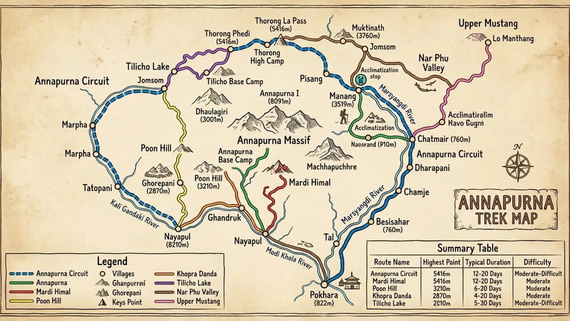
Annapurna Trek Map: Complete Route Guide for 2026
Annapurna Trek Map
The Annapurna region isn't a single trail — it's a network of interconnected routes spread across the Annapurna Conservation Area, Nepal's largest protected area at 7,629 square kilometers, all radiating outward from Pokhara toward the Annapurna massif's various flanks.
Understanding how these routes fit together on the map — where they start, where they cross paths, which junctions connect one trek to another — is the difference between picking a single trek in isolation and understanding the full geography of one of the most trekked regions on Earth.
This guide maps out every major Annapurna route: the classic Circuit, Annapurna Base Camp, Poon Hill, Mardi Himal, Khopra Danda, Tilicho Lake, Nar Phu Valley, and the Upper Mustang extension — how each is structured, where they connect, and how to think about combining them.
Annapurna region routes at a glance
Route | Highest point | Typical duration | Difficulty |
|---|---|---|---|
Annapurna Circuit | 5,416 m (Thorong La) | 12–20 days | Moderate–difficult |
Annapurna Base Camp (ABC) | 4,130 m | 7–12 days | Moderate |
Poon Hill Trek | 3,210 m | 4–5 days | Easy–moderate |
Mardi Himal Trek | 4,500 m (Base Camp) | 4–7 days | Moderate |
Khopra Danda / Khayer Lake | 3,660 m (4,500 m at Khayer Lake) | 6–9 days | Moderate |
Tilicho Lake (add-on) | 4,919 m | +3–4 days onto Circuit | Moderate–difficult |
Nar Phu Valley | ~5,320 m (Kang La Pass) | 12–17 days | Difficult, restricted area |
Upper Mustang | 3,840 m (Lo Manthang) | 10–14 days | Moderate, restricted area |
The Annapurna Conservation Area: The Map's Foundation
Every route covered in this guide sits within the Annapurna Conservation Area (ACA), Nepal's largest protected area, spanning approximately 7,629 square kilometers across the districts of Kaski, Manang, Mustang, Myagdi, and Lamjung.
Established in 1986 and managed by the National Trust for Nature Conservation (NTNC), the ACA encircles the entire Annapurna massif — Annapurna I (8,091 m), Annapurna II, III, and IV, Annapurna South, Gangapurna, Machhapuchhre, and Dhaulagiri sit at or near its edges — meaning virtually every trekking route in the region either crosses through or begins and ends within this single protected area boundary.
Picturing the ACA as a rough circle with Pokhara sitting just south of its edge is the most useful mental map for understanding how these treks relate to each other:
Routes heading north-northeast from Pokhara through the Marsyangdi valley lead toward Manang and eventually Thorong La — this is the Annapurna Circuit's eastern leg.
Routes heading north-northwest through the Kali Gandaki valley lead toward Muktinath, Jomsom, and further north into Upper Mustang — this is the Circuit's western leg and Mustang's approach corridor.
Routes heading due north from Pokhara through the Modi Khola valley lead directly into the Annapurna Sanctuary and Annapurna Base Camp.
Shorter routes branching from these same lower valleys — Poon Hill, Mardi Himal, and Khopra Danda — offer quicker, lower-commitment ways to reach genuine high-altitude Himalayan viewpoints without the multi-week commitment of the Circuit or the technical demands of a full ABC trek.
Region of the ACA | Route(s) found there |
|---|---|
Marsyangdi valley (east) | Annapurna Circuit (eastern leg), Nar Phu Valley |
Kali Gandaki valley (west) | Annapurna Circuit (western leg), Upper Mustang |
Modi Khola valley (south-central) | Annapurna Base Camp, Mardi Himal (branch) |
Ghorepani/Ghandruk hub (south) | Poon Hill, Khopra Danda, connecting trails to both ABC and the Circuit's western descent |
Manang side valleys | Tilicho Lake (branch from Manang) |
Route 1: The Annapurna Circuit — The Region's Backbone
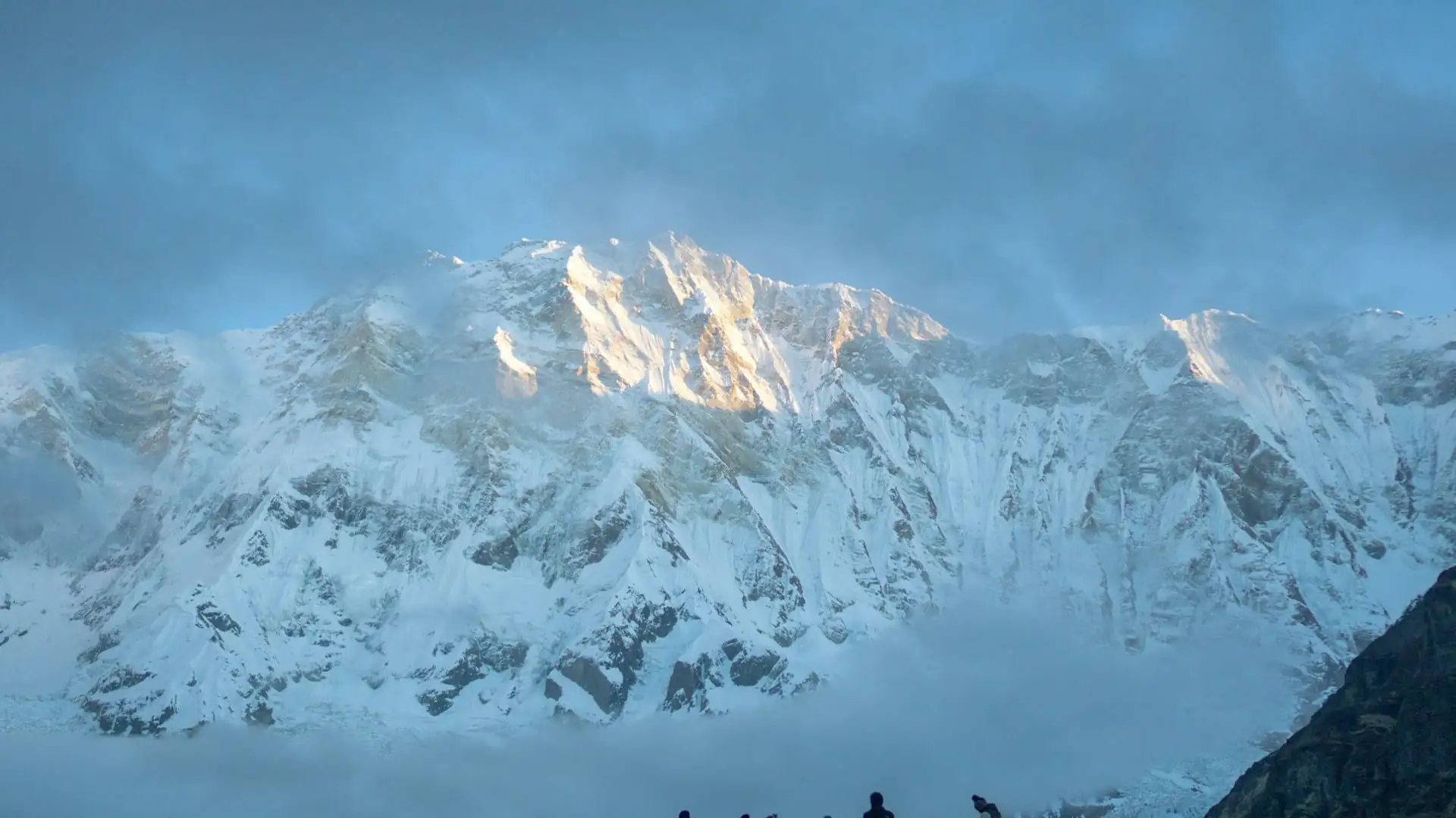
The Annapurna Circuit is the longest and most complete of the region's routes, and functions almost like the map's spine — a full loop around the Annapurna massif connecting the Marsyangdi valley on the east to the Kali Gandaki valley on the west, crossing between them at Thorong La Pass (5,416 m), the highest point on the standard route.
Standard route structure:
Stage | Villages | Elevation range |
|---|---|---|
Lower Marsyangdi approach | Besisahar → Bahundanda → Chamje → Tal | 760 m–1,700 m |
Mid-valley | Dharapani → Chame → Pisang | 1,860 m–3,300 m |
Manang side | Manang (acclimatization) | 3,519 m |
High approach | Yak Kharka → Thorong Phedi/High Camp | 4,050 m–4,850 m |
The pass | Thorong La | 5,416 m |
Western descent | Muktinath → Jomsom → Marpha | 2,670 m–3,760 m |
Lower Kali Gandaki | Tatopani → Ghorepani → Poon Hill | 1,190 m–3,210 m |
Final descent | Ghandruk → Nayapul | 1,940 m–1,070 m |
The Circuit's defining feature on the map is that it doesn't simply climb to a single destination and turn around — it crosses an entire massif via a genuine high mountain pass, connecting two river valleys that would otherwise require a long detour around the mountains to reach from each other.
This is also why the Circuit is measured differently from every other route in this guide: total distance runs 160 to 230 kilometers (100 to 145 miles) for the classic version, though modern road development into Manang and Muktinath has allowed many trekkers to shorten the walking distance to roughly 100 to 120 kilometers (62 to 75 miles) using jeep transport through the least scenic lower sections.
Key junction points on the Circuit map:
Chame: Where a side route toward Nar Phu Valley branches off, for trekkers with a restricted-area permit seeking a longer, more remote detour.
Manang: The hub for the Tilicho Lake side trip, and the last major village before the high-altitude push toward Thorong La.
Ghorepani: Where the Circuit's western descent leg intersects directly with the Poon Hill Trek and the Khopra Danda route — meaning a trekker finishing the Circuit here can, with extra days, extend into either of those shorter routes rather than heading straight down to Nayapul.
Nayapul/Birethanti: The Circuit's traditional endpoint, which is also the starting trailhead for the Annapurna Base Camp trek and the standalone Poon Hill trek — making this junction the single busiest convergence point on the entire regional map.
Route 2: Annapurna Base Camp — The Sanctuary Route
Where the Circuit loops around the outside of the massif, the Annapurna Base Camp trek drives straight into its heart, following the Modi Khola valley north from Nayapul directly into the Annapurna Sanctuary — a natural amphitheater ringed by Annapurna I (8,091 m), Annapurna South (7,219 m), Hiunchuli (6,441 m), Gangapurna (7,455 m), and Machhapuchhre (6,993 m).
Standard route structure:
Stage | Villages | Elevation range |
|---|---|---|
Lower approach | Nayapul → Tikhedhunga → Ghandruk | 1,070 m–1,940 m |
Mid valley | Chhomrong → Sinuwa → Bamboo | 2,170 m–2,360 m |
Upper valley | Dovan → Himalaya → Deurali | 2,600 m–3,230 m |
Sanctuary entrance | Machhapuchhre Base Camp (MBC) | ~3,700 m |
Destination | Annapurna Base Camp (ABC) | 4,130 m |
Unlike the Circuit, ABC is an out-and-back route on the map rather than a loop — trekkers walk in via Ghandruk and Chhomrong, reach Base Camp, then largely retrace their steps back down, sometimes varying the return via Jhinu Danda's natural hot springs as a rewarding side stop on the descent.
Key junction points on the ABC map:
Chhomrong: The single most important junction on this route — this is where the trail to ABC diverges from the trail leading toward Khopra Danda and, further on, toward the Circuit's western leg via Tadapani and Ghorepani, meaning Chhomrong functions as a genuine crossroads for three of the region's major routes.
Ghandruk: Also connects directly to the Mardi Himal trail system via Landruk and Tadapani, and to Khopra Danda via the same general Tadapani corridor.
Jhinu Danda: A short detour off the main trail (not directly on it) offering natural hot springs, popular as a descent-day stop.
Route 3: Poon Hill — The Region's Most Accessible Viewpoint
Poon Hill (3,210 m) is the shortest, most accessible high-altitude viewpoint trek in the entire Annapurna region, and sits at a genuinely central position on the regional map — close enough to Pokhara for a short, focused trip, yet directly connected to the trail networks feeding into both the Annapurna Circuit's western descent and the Khopra Danda route.
Standard route structure:
Stage | Villages | Elevation range |
|---|---|---|
Approach | Nayapul → Tikhedhunga | 1,070 m–1,540 m |
Ascent | Ulleri → Ghorepani | 2,070 m–2,860 m |
Summit | Poon Hill (pre-dawn hike) | 3,210 m |
Descent | Tadapani → Ghandruk → Nayapul | 2,610 m–1,070 m |
Poon Hill's sunrise viewpoint offers one of the widest and most celebrated panoramic mountain views in Nepal achievable on a short trek — a sweep that includes Dhaulagiri (8,167 m), Annapurna I, Annapurna South, Nilgiri, Machhapuchhre, and, on clear days, a substantial stretch of the wider Annapurna range, all visible from a single viewpoint reachable in as little as four to five days round trip from Pokhara.
Key junction points on the Poon Hill map:
Ghorepani: The shared hub connecting Poon Hill directly to the Annapurna Circuit's western descent leg and to the Khopra Danda route — a trekker standing in Ghorepani has effectively arrived at the meeting point of three separate Annapurna region treks.
Tadapani: Connects onward to Ghandruk and the ABC/Mardi Himal trail network, making it possible to combine a Poon Hill visit with an extension toward Ghandruk or further into the Sanctuary.
Route 4: Mardi Himal — The Quieter Ridge Trek
Mardi Himal offers a genuinely different geographic experience from the other Annapurna routes: rather than following a river valley, it climbs a single exposed ridge system east of the main Modi Khola valley, delivering close, dramatic views of Machhapuchhre from an angle most other treks in the region don't offer.
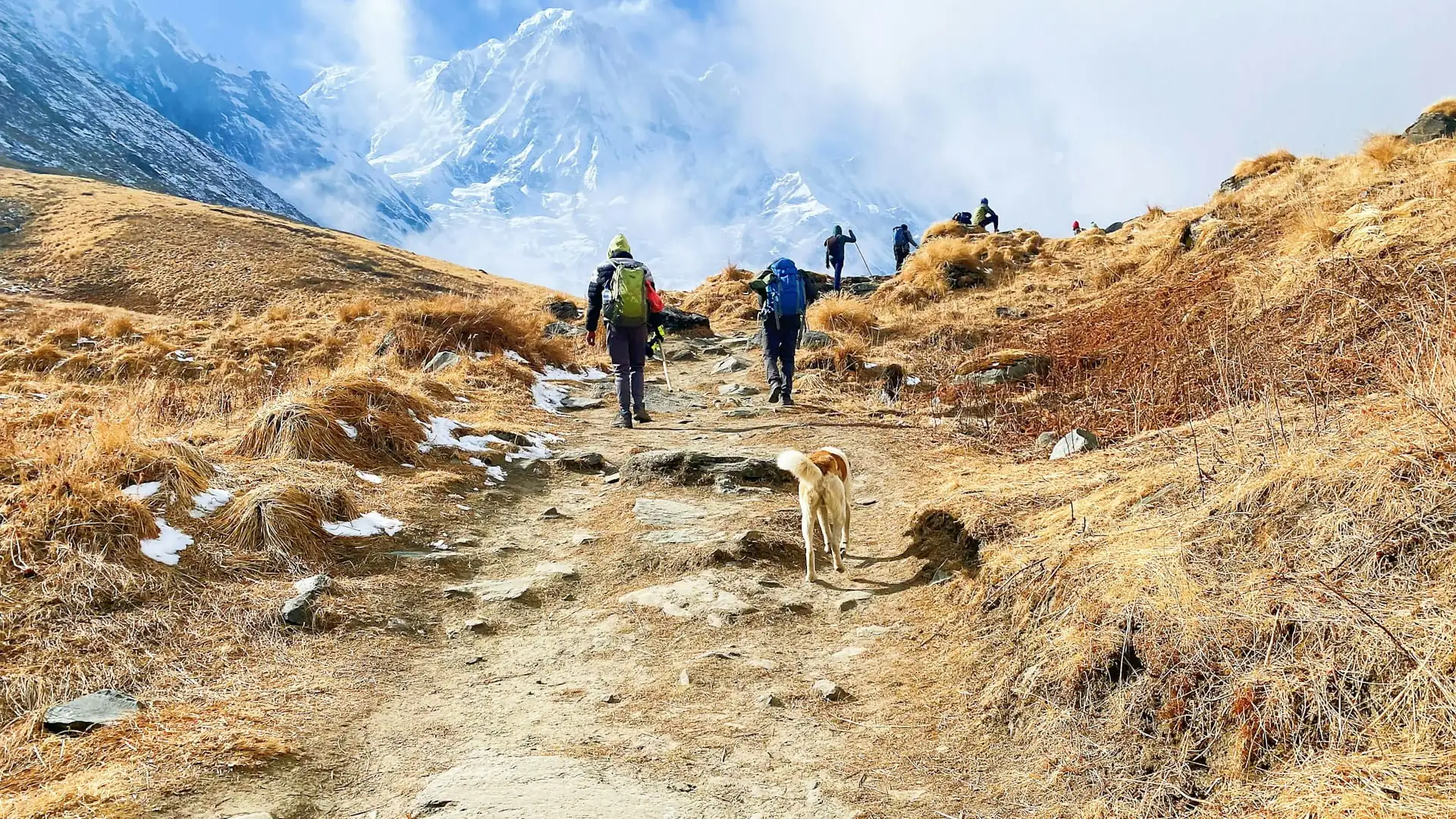
Standard route structure:
Stage | Villages/Camps | Elevation range |
|---|---|---|
Approach | Kande or Dhampus → Pothana/Deurali | 1,770 m–2,100 m |
Ridge ascent | Forest Camp → High Camp | 2,600 m–3,600 m/3,900 m |
Destination | Mardi Himal Base Camp | 4,500 m (with an optional push to a viewpoint around 4,200–4,700 m) |
Descent | Low Camp → Landruk | 3,050 m–1,565 m |
A typical Mardi Himal itinerary runs a compact four to seven days, making it — alongside Poon Hill — one of the two shortest genuinely high-altitude options in the entire Annapurna region, and a popular choice for trekkers with limited time who still want to reach above 4,000 meters.
Key junction points on the Mardi Himal map:
Landruk: On the descent, Mardi Himal's trail rejoins the broader trail network used by ABC trekkers, meaning it's possible to link a Mardi Himal descent directly into a Ghandruk or Chhomrong-bound continuation for trekkers wanting to combine both routes into a single, longer trip.
Route 5: Khopra Danda and Khayer Lake — The Quiet Western Balcony
Khopra Danda (3,660 m) sits on a long ridge facing Dhaulagiri across a wide gorge, offering a genuinely different vantage point from the more commonly photographed Poon Hill or ABC views — a 270-degree panorama that includes Dhaulagiri, Annapurna South, and Nilgiri, with meaningfully fewer trekkers than the busier classic routes nearby.
An optional extension from Khopra Danda reaches Khayer Lake at approximately 4,500 meters, a site considered sacred by both Hindu and Buddhist tradition.
Standard route structure:
Stage | Villages/Camps | Elevation range |
|---|---|---|
Approach (via Ghandruk/Tadapani) | Ghandruk → Tadapani | 1,940 m–2,610 m |
Ridge approach | Bayeli Kharka → Dobato | 3,410 m–3,450 m |
Destination | Khopra Danda | 3,660 m |
Optional extension | Khayer Lake | ~4,500 m |
Descent options | Swanta → Ghorepani, or onward to Tatopani | 2,214 m–2,880 m |
The core Khopra Danda route runs roughly six to nine days, often extending longer once the Poon Hill approach and Khayer Lake side trip are added — and its flexible descent options mean it can be finished either back toward Ghorepani (linking into the Poon Hill/Circuit network) or down toward Tatopani (linking into the Circuit's western leg directly).
Key junction points on the Khopra Danda map:
Tadapani: Shared with the ABC trail network and the descent legs of both Poon Hill and Mardi Himal — genuinely one of the busiest minor trail junctions in the region despite Khopra Danda itself remaining comparatively quiet.
Ghorepani or Tatopani (depending on chosen descent): Both link directly back into the Circuit's western corridor, making Khopra Danda one of the more flexible routes on the map for trekkers wanting to combine it with either Poon Hill or a partial Circuit segment.
Route 6: Tilicho Lake — The High-Altitude Detour
Tilicho Lake, at 4,919 meters, is one of the highest lakes in the world and the most popular single-side-trip addition to the Annapurna Circuit, branching off from Manang rather than functioning as a standalone trek in most cases.
Standard route structure:
Stage | Villages/Camps | Elevation range |
|---|---|---|
Branch point | Manang | 3,519 m |
Approach | Khangsar → Tilicho Base Camp | 3,734 m–4,150 m |
Destination | Tilicho Lake | 4,919 m |
Reconnection | Return to Manang or continue toward Yak Kharka | Rejoins main Circuit trail |
Adding Tilicho Lake to a Circuit itinerary typically adds 25 to 30 kilometers (15 to 18 miles) and 3 to 4 extra days, and most trekkers either return to Manang to rejoin the standard Circuit route toward Thorong La, or, for more experienced trekkers, continue via a higher, more technical connecting trail directly toward the Thorong La approach without fully backtracking — a route variant that requires greater experience and is typically only recommended with a guide who knows current trail conditions.
Route 7: Nar Phu Valley — The Restricted, Remote Branch
Nar Phu Valley branches off the main Annapurna Circuit near Koto (just before Chame), leading into a genuinely remote, restricted-area valley system culturally and geographically closer to Tibet than to the villages along the main Circuit route. It requires a separate Restricted Area Permit beyond the standard ACAP, reflecting its more sensitive, less-visited status.
Standard route structure:
Stage | Villages | Elevation range |
|---|---|---|
Branch point | Koto (near Chame) | ~2,600 m |
Lower valley | Meta → Phu Gaon | 3,560 m–4,080 m |
Upper valley | Nar village | 4,110 m |
High pass (optional connection back to main Circuit) | Kang La Pass | ~5,320 m |
Nar Phu adds substantially more distance and time to a standard itinerary — often 40-plus kilometers (25-plus miles) and 4 to 7 extra days — and is generally recommended only for trekkers specifically seeking a quieter, more culturally distinct extension beyond the main Circuit's increasingly developed and road-affected lower sections.
Route 8: Upper Mustang — The Northern Extension
Upper Mustang, the former Kingdom of Lo, sits north of the standard Circuit's Kali Gandaki leg, accessible via Kagbeni (just past Muktinath) and requiring its own separate Restricted Area Permit given its sensitive proximity to the Tibetan border.
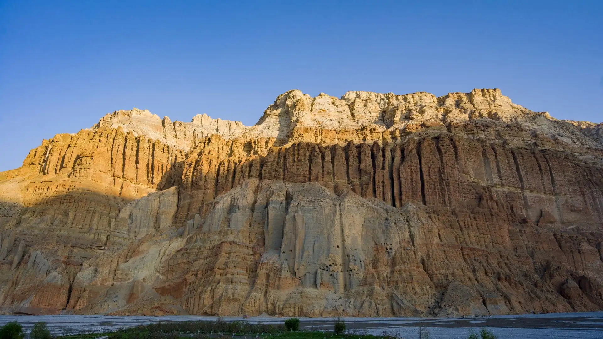
Standard route structure:
Stage | Villages | Elevation range |
|---|---|---|
Branch point | Kagbeni | ~2,810 m |
Approach | Chele → Syangboche → Ghami | 3,050 m–3,520 m |
Destination | Lo Manthang (walled capital) | 3,840 m |
Upper Mustang is typically treated as either a standalone trip from Jomsom/Kagbeni rather than a direct Circuit extension, or occasionally combined with a partial Circuit itinerary for trekkers with extended time and the additional restricted-area permit already arranged.
Comparing All Annapurna Region Routes
Putting every route side by side on a single comparison table makes the overall regional map easier to hold in mind when deciding which trek — or combination of treks — fits a given trip.
Route | Distance (approx.) | Max elevation | Duration | Technical difficulty | Permit type |
|---|---|---|---|---|---|
Annapurna Circuit | 160–230 km (100–145 mi) | 5,416 m | 12–20 days | Moderate–difficult | ACAP |
Annapurna Base Camp | 90–115 km (56–71 mi) | 4,130 m | 7–12 days | Moderate | ACAP |
Poon Hill | 35–45 km (22–28 mi) | 3,210 m | 4–5 days | Easy–moderate | ACAP |
Mardi Himal | ~40–55 km (25–34 mi) | 4,500 m | 4–7 days | Moderate | ACAP |
Khopra Danda / Khayer Lake | ~60–80 km (37–50 mi) | 3,660 m (4,500 m at lake) | 6–9 days | Moderate | ACAP |
Tilicho Lake (Circuit add-on) | +25–30 km (+15–18 mi) | 4,919 m | +3–4 days | Moderate–difficult | ACAP (included) |
Nar Phu Valley | +40+ km (+25+ mi) | ~5,320 m (Kang La) | 12–17 days (as extension) | Difficult | ACAP + Restricted Area Permit |
Upper Mustang | Varies, standalone or Circuit extension | 3,840 m (Lo Manthang) | 10–14 days | Moderate | ACAP + Restricted Area Permit |
How These Routes Connect: Combination Itineraries
Because so many of these routes share physical trail junctions — particularly around Ghorepani, Tadapani, and Chhomrong — combining two or more into a single extended trip is genuinely common, not just theoretically possible. Some of the most popular combinations:
Mardi Himal + Khopra Danda (12–14 days): Completing the Mardi Himal ridge first through Forest Camp, High Camp, and Mardi Himal Base Camp, then crossing via Landruk and Ghandruk to the Khopra Ridge section via Tadapani, Dobato, and Khopra Danda, before finishing through Ghorepani and Poon Hill.
This combination is genuinely popular precisely because it delivers two distinct mountain panoramas from two different ridge systems — Mardi Himal facing east toward Machhapuchhre, Khopra Danda facing west toward Dhaulagiri — without repeating any of the same trail on the return leg, and covers considerably more of the conservation area than either route alone.ABC + Khopra Danda/Khayer Lake extension (16–20+ days): Combining a full Annapurna Base Camp trek with the Khopra Danda ridge and Khayer Lake side trip, often run as an extended 24-day itinerary for trekkers with significant time available, using the shared Chhomrong/Tadapani junction to link the two routes without needing to return to Pokhara in between.
Circuit + Tilicho Lake + Poon Hill (18–20 days): The most complete version of the classic Circuit, adding the Tilicho Lake detour from Manang and finishing with the Poon Hill sunrise hike near Ghorepani before descending to Nayapul — using two of the region's most popular side-trip junctions in a single extended trip.
Circuit + Upper Mustang (20+ days): For trekkers with the additional restricted-area permit arranged in advance, branching north from Kagbeni into Upper Mustang before returning to complete the standard Circuit's remaining western descent.
Combination | Total duration | Why it works |
|---|---|---|
Mardi Himal + Khopra Danda | 12–14 days | Two distinct ridge panoramas, no trail repetition |
ABC + Khopra Danda/Khayer Lake | 16–20+ days | Shared Chhomrong/Tadapani junction links both smoothly |
Circuit + Tilicho Lake + Poon Hill | 18–20 days | Uses Manang and Ghorepani junctions for the two most popular add-ons |
Circuit + Upper Mustang | 20+ days | Kagbeni junction opens the restricted northern extension |
Permits: What Covers Which Routes
Understanding the permit map alongside the trail map matters, since not every route in the region requires the same documentation.
Permit | Covers | Cost (2026, foreign nationals) |
|---|---|---|
ACAP (Annapurna Conservation Area Permit) | Annapurna Circuit, ABC, Poon Hill, Mardi Himal, Khopra Danda, Tilicho Lake | NPR 3,000 (~USD 23–30) |
TIMS Card | Same routes as ACAP, though 2026 enforcement varies by checkpoint and agency | NPR 2,000 (~USD 15–20) |
Restricted Area Permit — Nar Phu | Nar Phu Valley specifically | Additional fee beyond ACAP, arranged through a registered agency |
Restricted Area Permit — Upper Mustang | Upper Mustang specifically | USD 50/person/day from Kagbeni onward, plus ACAP |
Licensed guide | Mandatory for all Annapurna Conservation Area routes since April 2023 | Varies, typically bundled into packages |
A single ACAP permit covers the overwhelming majority of routes described in this guide — the Circuit, ABC, Poon Hill, Mardi Himal, Khopra Danda, and the Tilicho Lake detour all fall under the same conservation area permit, meaning a trekker combining several of these routes into one trip doesn't need to apply for separate permits for each.
Only Nar Phu Valley and Upper Mustang require an additional Restricted Area Permit on top of the standard ACAP, reflecting their more sensitive locations near Nepal's border regions.
Elevation Comparison Across the Region's Peaks
Since so much of the Annapurna region's appeal comes from the mountains visible along these various routes rather than the routes' own elevations alone, it's worth mapping the major peaks that different treks bring trekkers close to.
Peak | Elevation | Best viewed from |
|---|---|---|
Annapurna I | 8,091 m | Annapurna Base Camp, Khopra Danda (distant) |
Dhaulagiri | 8,167 m | Poon Hill, Khopra Danda, Circuit's western leg |
Annapurna II | 7,937 m | Circuit (Manang side), Sarangkot (Pokhara) |
Machhapuchhre (Fishtail) | 6,993 m | Mardi Himal, ABC, Phewa Lake (Pokhara) |
Annapurna South | 7,219 m | Poon Hill, ABC, Khopra Danda |
Gangapurna | 7,455 m | ABC, Manang |
Nilgiri | 7,061 m | Poon Hill, Khopra Danda, Muktinath area |
Hiunchuli | 6,441 m | ABC |
Notice that several peaks — Dhaulagiri, Annapurna South, and Nilgiri in particular — are visible from multiple different routes, which is part of why combining shorter treks (Poon Hill with Khopra Danda, for instance) doesn't necessarily mean seeing entirely different mountains each time, but rather seeing familiar peaks from genuinely different angles and distances.
Seasonal Considerations Across the Region's Routes
Timing matters differently depending on which part of the regional map a given route occupies, since the Annapurna massif's own bulk creates a meaningful rain-shadow effect between its eastern and western sides.
Season | Circuit (Marsyangdi/east side) | Circuit (Kali Gandaki/west side, Mustang) | ABC / Mardi Himal / Khopra Danda / Poon Hill |
|---|---|---|---|
Spring (Mar–May) | Good, warming | Good, drier due to rain shadow | Good, rhododendron blooms |
Autumn (late Sep–Nov) | Best overall | Best overall | Best overall |
Winter (Dec–Feb) | Cold, possible pass closure at Thorong La | Cold but generally drier | Cold at higher points, generally trekkable lower down |
Monsoon (Jun–Aug) | Wet, landslide risk on lower approach | Considerably drier (rain shadow effect) | Wet, reduced visibility, leeches on lower trails |
The Kali Gandaki side of the Circuit, and by extension Upper Mustang, sits in a genuine rain shadow created by the Annapurna and Dhaulagiri massifs, meaning it receives meaningfully less monsoon rainfall than the Marsyangdi side or the routes closer to Pokhara — a detail worth factoring in for trekkers considering a monsoon-season trip specifically to that part of the region, even though monsoon travel generally isn't recommended for most of the other routes covered here.
How Adventure Life Nepal Uses This Map
Given how interconnected these routes genuinely are on the ground, Adventure Life Nepal builds itineraries around the specific junctions described throughout this guide rather than treating each trek as an entirely isolated product.
A trekker interested primarily in Annapurna Base Camp who has extra time available might be offered a Khopra Danda extension via the shared Chhomrong/Tadapani junction; a Circuit trekker with strong acclimatization and extra days might be offered the Tilicho Lake detour from Manang; a trekker with a shorter window might be steered toward the Mardi Himal or Poon Hill routes specifically because they deliver genuine high-altitude Himalayan views without the multi-week commitment of the Circuit or ABC.
This map-first approach to itinerary planning — understanding not just where a single trek goes, but how it connects to everything else in the region — is what allows for genuinely customized trip lengths, from a compact four-day Poon Hill visit up to a full month-plus combination covering the Circuit, Tilicho Lake, and an Upper Mustang extension, all within the same broad Annapurna Conservation Area.
Frequently Asked Questions
What's the difference between the Annapurna Circuit and Annapurna Base Camp treks on the map?
The Circuit is a loop route crossing the massif via Thorong La Pass, connecting the Marsyangdi valley (east) to the Kali Gandaki valley (west). ABC is an out-and-back route following the Modi Khola valley directly into the Annapurna Sanctuary at the massif's southern side — the two routes don't overlap except near their shared trailhead region close to Pokhara.Can I combine multiple Annapurna treks into one trip?
Yes, and it's genuinely common. Routes like Mardi Himal, Khopra Danda, Poon Hill, and the Circuit's western leg share physical trail junctions (particularly at Ghorepani, Tadapani, and Chhomrong), making combination itineraries a well-established option rather than an improvised workaround.Which Annapurna route is shortest?
Poon Hill, typically completed in 4 to 5 days, is the shortest standard route in the region, followed closely by Mardi Himal at 4 to 7 days.Which Annapurna route is longest?
The Annapurna Circuit, particularly when extended with the Tilicho Lake detour, Nar Phu Valley, or an Upper Mustang extension, can run well past 20 days for the most complete combined itineraries.Do all these routes require the same permit?
Most do — the Circuit, ABC, Poon Hill, Mardi Himal, Khopra Danda, and Tilicho Lake all fall under the standard ACAP permit. Nar Phu Valley and Upper Mustang each require an additional Restricted Area Permit due to their sensitive border-adjacent locations.Which route offers the best views of Annapurna I specifically?
Annapurna Base Camp offers the closest, most direct view, since the route terminates almost directly beneath the peak. Khopra Danda and Poon Hill offer more distant but still genuine views as part of wider panoramas that also include Dhaulagiri and other major peaks.Is Mardi Himal or Khopra Danda better for a quieter trekking experience?
Both are considerably quieter than the Circuit, ABC, or Poon Hill. Mardi Himal is the shorter, steeper option facing east toward Machhapuchhre; Khopra Danda is the longer, more gradual ridge trek facing west toward Dhaulagiri, with the optional Khayer Lake extension adding a genuine high-altitude highlight.Can I do Poon Hill as part of a longer Circuit or ABC trip rather than as a standalone trek?
Yes — Poon Hill's Ghorepani junction connects directly to both the Circuit's western descent and the broader ABC/Khopra Danda trail network, making it a very common add-on rather than a strictly separate trip.What's the highest point reachable across all these routes?
Kang La Pass on the Nar Phu Valley extension, at approximately 5,320 meters, though this requires the restricted-area permit and considerably more trekking experience than the standard routes. Among non-restricted routes, Thorong La Pass on the Annapurna Circuit, at 5,416 meters, is the highest standard point reachable.Do I need different guides for different routes in the region?
Not necessarily — a licensed guide familiar with the Annapurna Conservation Area can typically lead trekkers across multiple connected routes within the same trip, since they share the same conservation area permit and much of the same trail infrastructure, though Nar Phu and Upper Mustang require guides specifically experienced with those restricted-area routes.
Conclusion
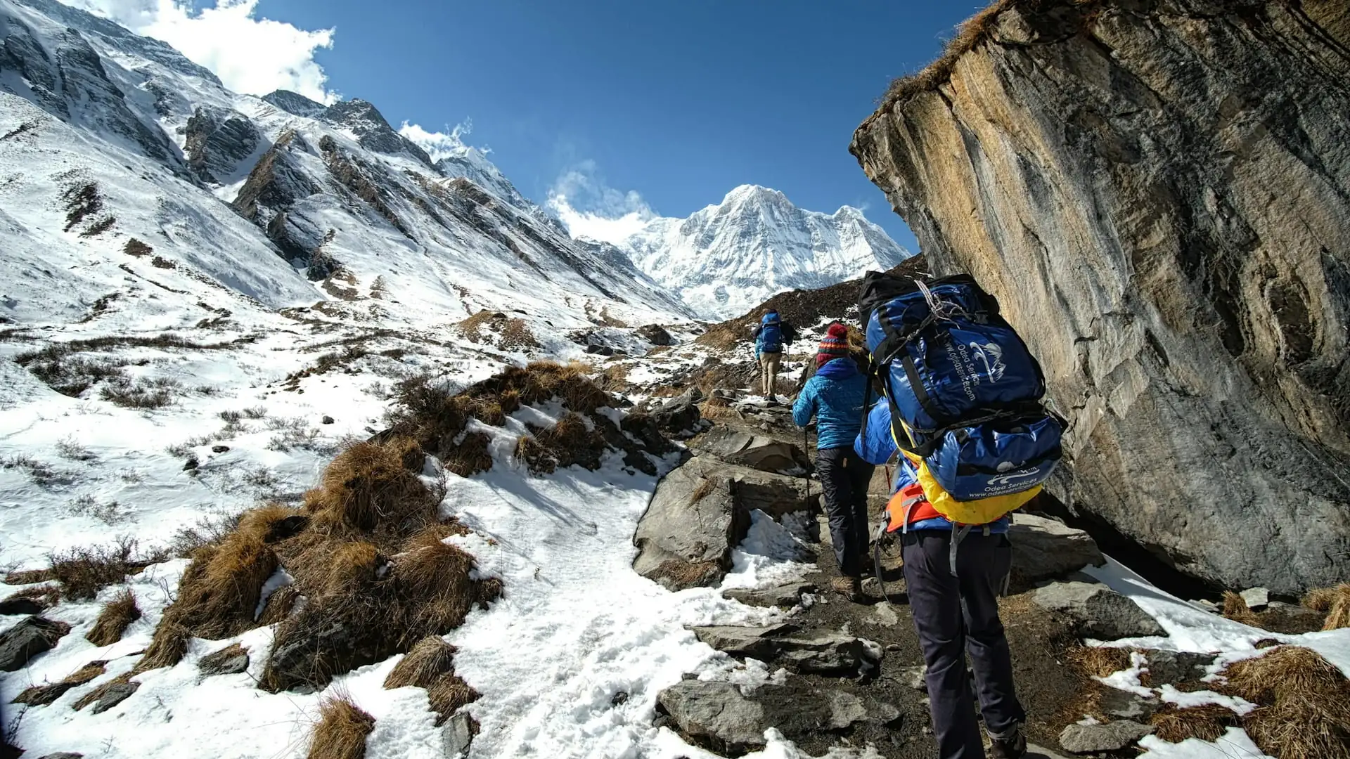
The Annapurna region's trekking network isn't a collection of unrelated destinations — it's a genuinely interconnected map, built around a handful of key junctions (Ghorepani, Tadapani, Chhomrong, Manang, Chame, Kagbeni) that link the Circuit, Annapurna Base Camp, Poon Hill, Mardi Himal, Khopra Danda, Tilicho Lake, Nar Phu Valley, and Upper Mustang into a single, flexible system covering one of the most geographically diverse trekking regions on Earth.
Understanding that map — not just which single trek to book, but how the routes around it connect — opens up genuinely customized trip planning, whether that means a focused four-day Poon Hill sunrise trip, a complete three-week Circuit with every major side trip attached, or a quieter, less-trafficked combination like Mardi Himal and Khopra Danda that most first-time visitors to the region never realize is an option.
Adventure Life Nepal plans every Annapurna itinerary with this full regional map in mind, matching the routes, junctions, and combinations covered here to whatever time, fitness level, and sense of adventure a trekker brings to Pokhara.