Gosaikunda Lake Nepal: Trek Guide, Altitude, Cost & Facts
Introduction to Gosaikunda Lake Nepal
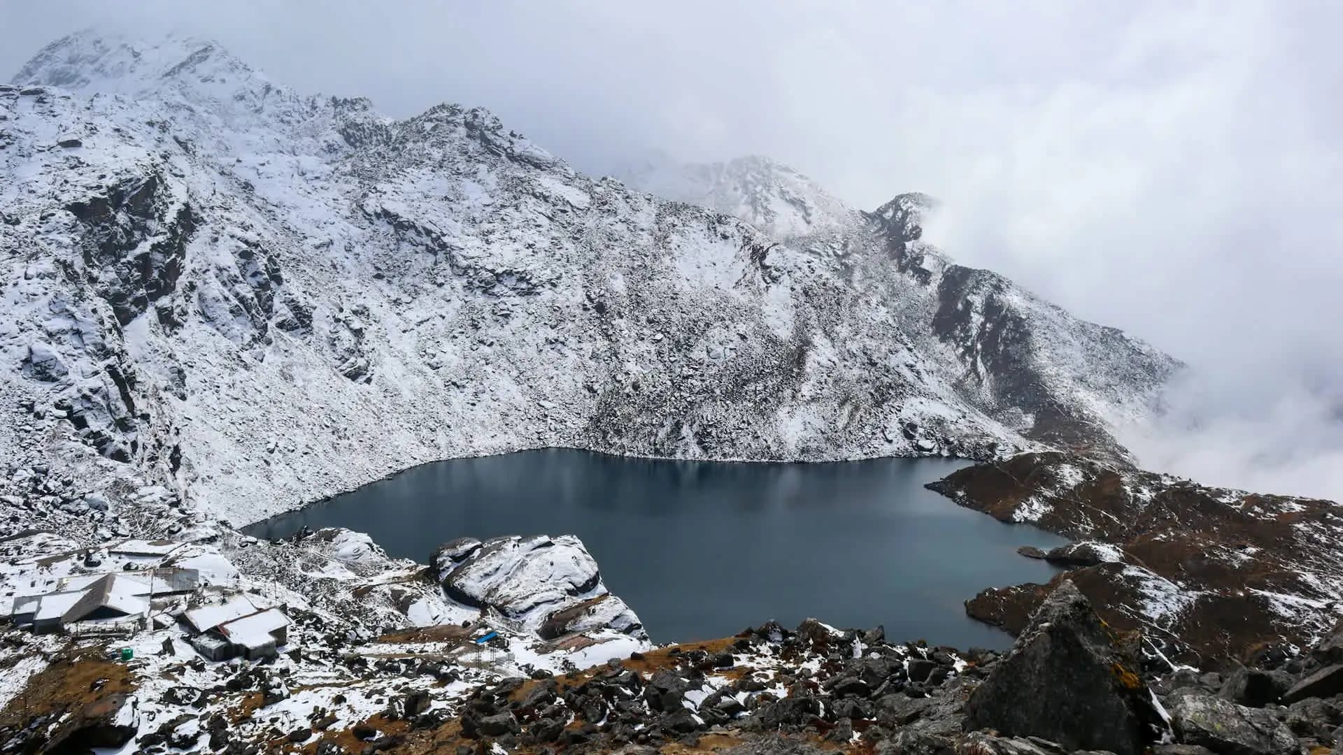
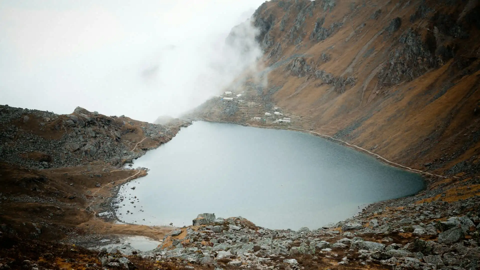
Gosaikunda Lake Nepal sits at about 4,380 meters in the Langtang region, a deep alpine lake ringed by rock and snow that Hindus and Buddhists have walked to for generations. It is one of the few places in the Himalaya where a serious mountain trek and a living pilgrimage meet in the same landscape: trekkers carry daypacks up the same stone paths as families who have come to bathe in the lake's cold water during the August festival of Janai Purnima.
For travelers, it is also one of the most rewarding short treks out of Kathmandu, with a standard route that can be done in about a week. This guide covers everything people usually want to know before they commit: where the lake is, how high it really is, the best routes, the realistic cost, the altitude risk, the best season, and the sacred traditions that make it special.
Quick Facts: Gosaikunda Lake at a Glance
Detail | Information |
|---|---|
Elevation | About 4,380 m (14,370 ft); the Ramsar information sheet lists 4,381 m |
Location | Rasuwa District, inside Langtang National Park, Bagmati Province |
Surface area | About 13.8 hectares |
Wetland designation | Part of the "Gosaikunda and Associated Lakes" Ramsar site, designated in 2007 |
Highest nearby point | Laurebina La Pass, about 4,610 m |
Religious significance | Sacred to Hindus and Buddhists; associated with Lord Shiva |
Major festival | Janai Purnima, held on the August full moon |
Typical trek length | 5–8 days for the shorter routes; 10–13+ days when combined with Langtang Valley |
Permits | Langtang National Park entry permit and TIMS card; a licensed guide is required for foreign trekkers |
Difficulty | Moderate to challenging, mainly because of the altitude |
Where Is Gosaikunda Lake?
Gosaikunda lies in the Rasuwa District of Bagmati Province, within Langtang National Park, Nepal's first Himalayan national park. The park was established in 1976, covers roughly 1,710 square kilometers, and carries a buffer zone of about 420 square kilometers added in 1998. It is also the Himalayan national park closest to Kathmandu. By our calculation from published coordinates, the lake sits roughly 40 kilometers north of the capital in a straight line, although the real journey by road and trail is far longer because the route winds around deep valleys and ridges.
Most trekkers reach the region by driving to Dhunche or Syabrubesi, the gateway towns of Rasuwa, which typically takes around six to eight hours from Kathmandu depending on road conditions and traffic.
Why Gosaikunda Lake Nepal Is Sacred
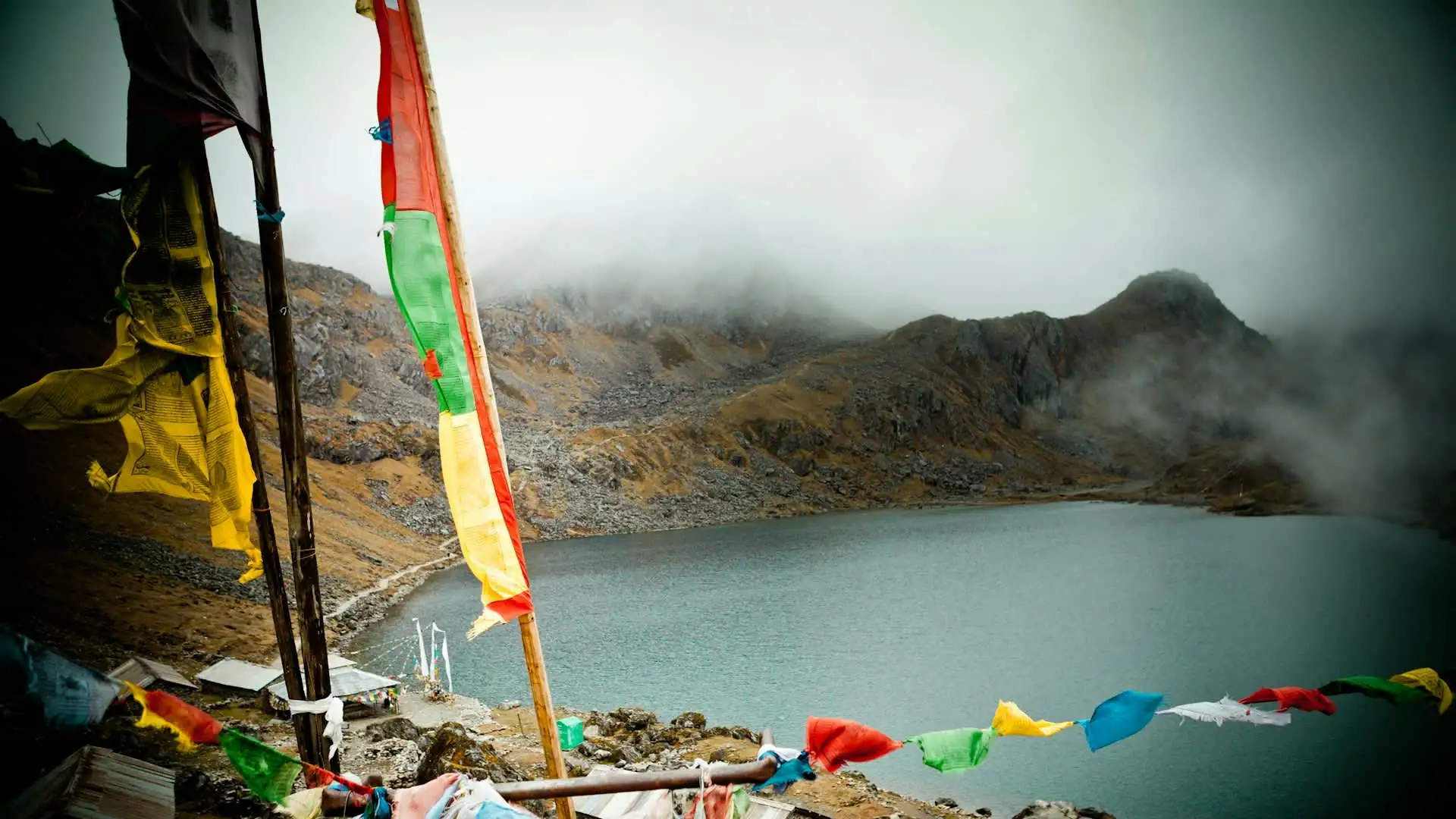
The significance of Gosaikunda goes well beyond scenery. According to Hindu tradition, Lord Shiva created the lake by thrusting his trident into the mountain to draw out water, which he used to cool his throat after swallowing poison. A large rock in the lake is said to represent Shiva reclining in the water, and the lake is widely regarded as a source of the Trishuli River in local belief.
Pilgrims come throughout the year, but two occasions draw the largest crowds: Janai Purnima in August, when thousands walk up to bathe, perform rituals, and renew the sacred thread, and Gangadashahara, another festival associated with holy water. Buddhist communities of the region also hold the lake sacred, which is why it is a rare site shared in reverence by both traditions.
The Lake System: More Than a Single Lake
Gosaikunda is not one lake but the centerpiece of a cluster. Local tradition counts 108 lakes in the area, and many trek guides repeat that number. The official Ramsar information sheet gives a more measured picture: a wetland complex of about 1,030 hectares, with roughly 16 lakes making up around 54 hectares of open water.
Lake | Approx. Elevation | Notes |
|---|---|---|
Gosaikunda | About 4,381 m | The main lake, about 13.8 ha |
Bhairab Kunda | About 4,261 m | Larger in area than Gosaikunda itself, at roughly 16.75 ha according to the Ramsar sheet |
Saraswati Kunda | Near the main lake | A short walk from Gosaikunda |
Ama Kunda | About 4,560 m | Smaller, higher lake |
Surya Kunda | About 4,609 m | One of the higher lakes in the group |
The Ramsar designation recognizes the area as a wetland of international importance. You can read the official record on the Ramsar Sites Information Service, and general background on the lake is easy to find in public encyclopedias and park publications.
Altitude Profile: How High Does the Trek Go?
Altitude is the single most important fact to understand before you go. Figures for individual stops vary a little between operators, but the pattern is consistent: a steady, fairly quick climb from roughly 2,000 meters to the lake and the pass.
Stop | Approx. Altitude |
|---|---|
Dhunche | Roughly 2,000 m |
Chandanbari (Sing Gompa) | About 3,250–3,330 m |
Laurebina Yak | About 3,700–3,910 m |
Gosaikunda Lake | 4,380 m |
Laurebina La Pass | About 4,610 m |
Ghopte | About 3,440–3,640 m |
The maximum point of most Gosaikunda trekking routes is not the lake itself but the Laurebina La Pass, which sits about 230 meters higher at roughly 4,610 meters. If you are comparing trek altitudes across Nepal, our Nepal elevation guide is a useful companion reference.
Main Trek Routes to Gosaikunda
There is more than one way to reach the lake, and the route you choose shapes the length, the scenery, and how gradually you climb.
Route | Typical Length | Character |
|---|---|---|
Dhunche to Chandanbari to Gosaikunda (out-and-back or onward) | About 5–7 days | The most direct approach, with a fast altitude gain |
Gosaikunda with the Helambu exit (via Laurebina Pass, Ghopte, Tharepati, Kutumsang, Chisapani to Sundarijal) | About 7–10 days | A one-way crossing that ends near Kathmandu |
Langtang Valley plus Gosaikunda | About 10–13 days | The most comprehensive Langtang experience, adding the valley's villages and Kyanjin Gompa |
Our Langtang Gosaikunda Trek package covers the combined route, while the standard Langtang Trek focuses on the valley itself if you prefer a lower-altitude trip.
A Typical 7-Day Itinerary
Exact itineraries differ by operator, but this is a representative structure for the Dhunche route that exits through Helambu toward Kathmandu.
Day | Route | Notes |
|---|---|---|
1 | Kathmandu to Dhunche by road | A long drive, typically six to eight hours |
2 | Dhunche to Chandanbari | A steady climb through forest to about 3,250 m or more |
3 | Chandanbari to Gosaikunda | A shorter but higher day, reaching 4,380 m |
4 | Gosaikunda to Ghopte via Laurebina Pass | A long day crossing the pass at about 4,610 m |
5 | Ghopte to Kutumsang | Long descent through Helambu terrain, via Tharepati |
6 | Kutumsang to Chisapani | Ridge and forest walking |
7 | Chisapani to Sundarijal, then Kathmandu | Final descent and drive back |
The first stage climbs quickly, so a more cautious plan adds an extra night at Chandanbari or Laurebina Yak before going up to the lake. The Chisapani end of this route is also the starting point of a popular shorter excursion, which you can explore in our Chisapani Nagarkot Trek package.
How Difficult Is the Gosaikunda Trek?
The trek is generally rated moderate to challenging. There is no technical climbing, and the trails are well established, but altitude and cold are real factors.
What makes it harder than it looks. The shortest itineraries climb from roughly 2,000 meters to well over 3,000 meters in the first full day, then past 4,000 meters within another day or two. That pace is faster than many trekkers' bodies can comfortably handle.
What makes it manageable. The distances each day are modest, the teahouse network is reliable, and a gradual itinerary with an acclimatization stop reduces risk considerably.
Altitude Sickness Considerations
Common guidance for trekkers above 3,000 meters is to keep the daily gain in sleeping altitude modest, often around 300 to 500 meters, and to schedule a rest day every few days of ascent. Many short Gosaikunda itineraries exceed that rate, which is why a slower plan is worth choosing if you are not already acclimatized.
Watch for headache, nausea, dizziness, and unusual fatigue. These are common and often manageable with rest and fluids, but confusion, loss of coordination, or breathlessness at rest are warning signs that require immediate descent. For general medical guidance before any high-altitude trip, the CDC's travel health page on high elevation is a useful independent reference.
A Longer 12-to-13 Day Itinerary: Langtang Valley Plus Gosaikunda
If you have more time, combining the valley and the lake gives you a fuller picture of the region and a more gradual altitude profile. A representative structure looks like this, though exact stops and timings vary between operators.
Day | Route | Notes |
|---|---|---|
1 | Kathmandu to Syabrubesi by road | A long drive into Rasuwa |
2 | Syabrubesi to Lama Hotel | Forest trail beside the Langtang River |
3 | Lama Hotel to Langtang Village | Opening valley and views of the high peaks |
4 | Langtang Village to Kyanjin Gompa | Reaching the head of the valley |
5 | Rest or hike to Kyanjin Ri or Tserko Ri | Acclimatization with a high viewpoint |
6 | Kyanjin Gompa back to Lama Hotel | A fast, downhill day |
7 | Lama Hotel to Thulo Syabru | Climb to a Tamang village on a ridge |
8 | Thulo Syabru to Sing Gompa (Chandanbari) | Forest ridge walking toward the lake basin |
9 | Sing Gompa to Gosaikunda | The big altitude day, reaching 4,380 m |
10 | Gosaikunda to Ghopte via Laurebina Pass | A long day over the pass at about 4,610 m |
11 | Ghopte to Kutumsang | Descent through Helambu terrain |
12 | Kutumsang to Chisapani | Ridge and forest walking |
13 | Chisapani to Sundarijal, then Kathmandu | Final descent and drive back |
The advantage of this longer plan is that you spend several nights between roughly 2,500 and 3,900 meters in the valley before you go up to the lake, which gives your body a head start on acclimatization. The valley itself is also one of the most scenic corners of the region, and you can read more about its costs and structure in our Langtang Valley trek cost guide.
A Sensible Acclimatization Plan for Shorter Routes
If you are doing the shorter Dhunche route, a slower schedule makes a real difference. A cautious version might look like this.
Stage | Suggested Approach |
|---|---|
Night before the trek | Sleep in Dhunche or Syabrubesi rather than rushing to higher ground |
Chandanbari | Take a full afternoon and, if possible, an extra night to adjust |
Laurebina Yak or the approach to the lake | Walk up slowly, drink plenty of water, and avoid alcohol |
Gosaikunda | Spend the night at the lake; do not push on if symptoms appear |
Pass crossing | Start early, and turn back or wait if weather or symptoms worsen |
Some trekkers discuss preventive medication with a doctor before the trip, which is a decision to make with a medical professional rather than on the trail. The most reliable protection remains pacing, hydration, and honesty about how you feel. A guide who monitors the group daily is a major safety asset on this route.
Landscape and Culture Along the Trail
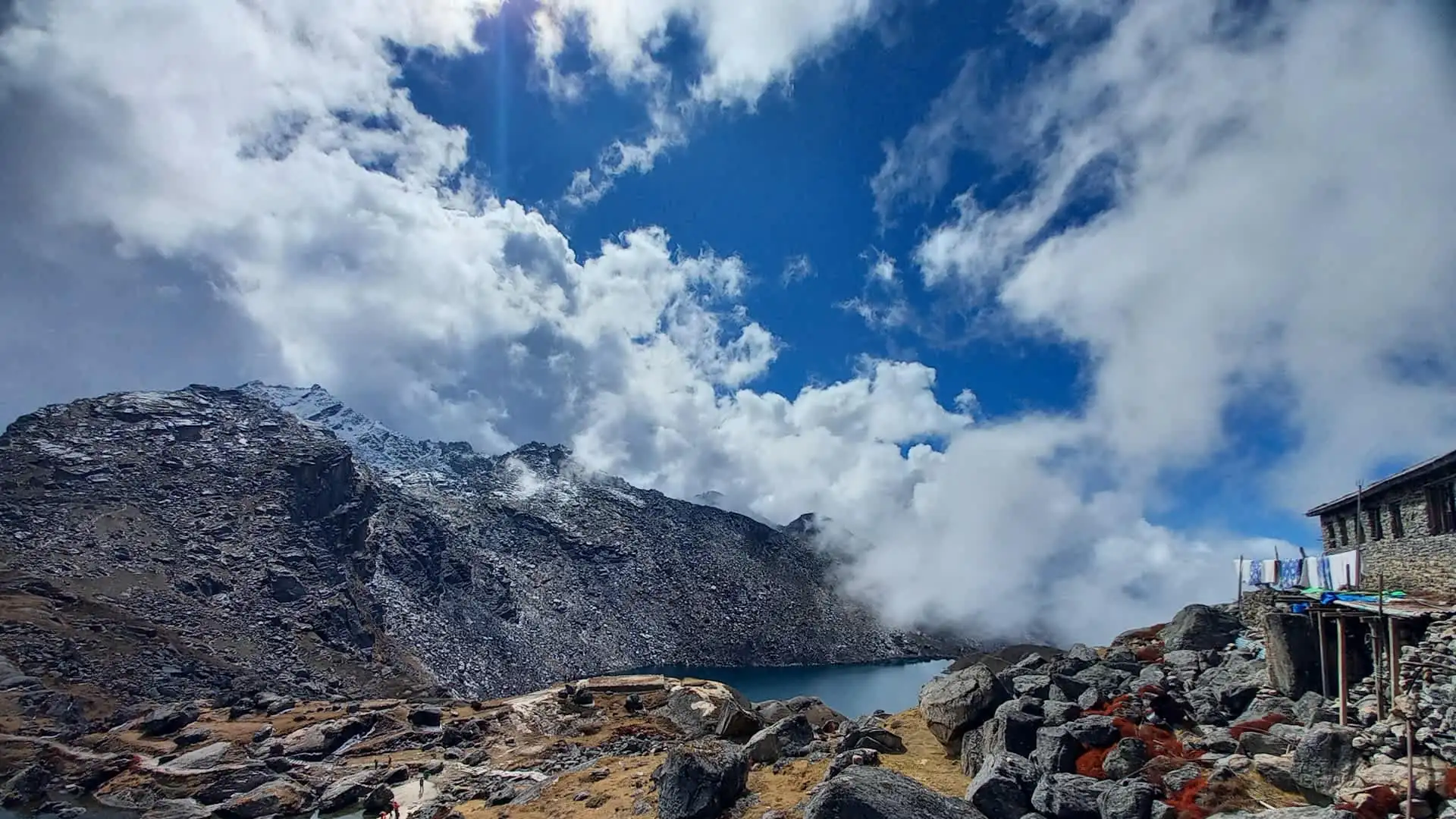
The journey to Gosaikunda changes character quickly. The lower trail runs through forest of oak, rhododendron, and pine, with Tamang villages, stone mani walls, and small monasteries that reflect the strong Buddhist culture of Rasuwa. Higher up, the trees thin out and the landscape opens into yak pastures and rocky basins dotted with small lakes. Near the main lake, the scale shifts again: bare rock, patches of snow, and the dark water of the lake itself.
The region's story also includes hardship. The Langtang Valley village was destroyed by an avalanche of ice, rock, and mud triggered by the April 2015 earthquake, and communities across Rasuwa have worked for years to rebuild homes, lodges, and trails. Staying in local teahouses and eating local food are small, practical ways to support that recovery.
Photography and Sunrise at Gosaikunda Lake Nepal
Early morning is the best time for photographs. The still water often mirrors the surrounding rock in the first light, and the temperature is cold enough that the air tends to be clearer. Bring a warm layer for the walk down to the shore, keep camera batteries in an inner pocket, and give pilgrims space if you are photographing during a festival. If you would like to see the sunrise from the Laurebina side, many trekkers start their crossing before dawn, and the light on the ridge can be spectacular on a clear morning.
Gosaikunda Lake Nepal in Winter: What to Know
Winter turns this trek into a far more serious undertaking. Snow can cover the trail above Chandanbari, temperatures drop sharply, and some teahouses reduce services or close. The lake itself freezes for much of the cold season, which can be beautiful but also makes the route harder to follow. Experienced trekkers with proper cold-weather equipment and a knowledgeable guide do go in winter, but it is not recommended for first-time high-altitude trekkers, and plans should include extra time in case of weather delays.
Safety, Insurance, and Emergency Planning
Because the route climbs above 4,000 meters, travel insurance should explicitly cover trekking to at least 4,600 meters and emergency helicopter evacuation. Mobile coverage is patchy in the high sections, so make sure your guide carries a charged phone and knows the nearest points from which help can be arranged. Carry a basic first aid kit, any personal medication, and enough warm clothing to handle a night of unexpected delay. If a group member shows serious symptoms of altitude illness, the answer is descent, not waiting to see if it passes.
Common Mistakes First-Time Trekkers Make
Treating it as an easy overnight trip. The altitude gain is faster than the distances suggest.
Underestimating the cold. Nights near the lake are cold in every season, and a light sleeping bag is a common regret.
Booking only the shortest itinerary. A slower plan with an extra night often turns a hard trek into a comfortable one.
Ignoring the festival calendar. Arriving unprepared during Janai Purnima can mean crowded lodges and wet trails.
Skipping hydration. Dry mountain air and effort both increase fluid needs.
Leaving trash behind. Plastic and packaging at a sacred lake are deeply disrespectful and harmful to the wetland.
Difficulty by Itinerary Length
Itinerary | Altitude Gain Pace | Who It Suits |
|---|---|---|
5-day direct | Fast | Fit trekkers with recent high-altitude experience |
7-day with Helambu exit | Moderate | Most reasonably fit trekkers, ideally with an acclimatization stop |
10–13 day Langtang plus Gosaikunda | Gradual | First-time trekkers and anyone who prefers a gentler profile |
Best Time to Visit Gosaikunda Lake Nepal
Season | Conditions | Verdict |
|---|---|---|
Spring (March–May) | Clearer skies, rhododendrons blooming on the lower slopes, lake thawing | Very good |
Autumn (September–November) | The most stable weather and clearest mountain views | Excellent |
Janai Purnima (August) | Spiritual atmosphere and crowds, but it falls in monsoon | Special, but wet and busy |
Winter (December–February) | Heavy snow at altitude; the lake freezes for much of the winter | Challenging, for experienced trekkers only |
Monsoon (June–August) | Rain, cloud, leeches, and landslide risk on lower trails | Not recommended for views |
Accounts commonly describe the lake as frozen for around half the year, roughly from late autumn into spring, so timing matters if you want to see open water. Season also affects pricing and availability, with peak months in spring and autumn offering the least room for last-minute bargains.
The Janai Purnima Festival
If you want to witness Gosaikunda's spiritual side, the August full moon festival is the most dramatic time to go. Pilgrims arrive from across Nepal and India, many walking for days, and the lake shore fills with devotees bathing, chanting, and making offerings. The trail and teahouses can be crowded, so it helps to arrange accommodation in advance.
It is also the heart of the monsoon, so expect rain, slippery trails, and limited views of the mountains. Many trekkers deliberately avoid it for that reason, while others choose it precisely for the cultural experience. Whichever you prefer, approach the festival with respect: dress modestly, avoid disturbing rituals, and ask before photographing worshippers.
Permits and Rules
Requirement | Detail |
|---|---|
Langtang National Park entry permit | About NPR 3,000 (roughly USD 22–25) for foreign nationals |
TIMS card | About NPR 1,000 through a registered agency, or NPR 2,000 individually |
Licensed guide | Required for foreign trekkers under Nepal's 2023 regulations |
Park rules are managed by Nepal's Department of National Parks and Wildlife Conservation. The guide requirement is explained in detail in our guide to Nepal's trekking guide requirement, and it is worth confirming current fees and rules with your agency shortly before you travel, since figures can change.
How Much Does the Gosaikunda Trek Cost?
Costs depend on trip length, group size, and service level. Operators commonly quote roughly USD 500 to 1,000 for shorter five-to-eight-day packages and about USD 1,000 to 1,600 for longer, combined Langtang and Gosaikunda itineraries.
Cost Item | Typical Range |
|---|---|
Permits (park entry plus TIMS) | About USD 30–40 combined |
Licensed guide | About USD 25–35 per day |
Porter (optional, often shared) | About USD 18–25 per day |
Teahouse room | Often a few dollars per night, sometimes free with meals |
Meals | Roughly USD 25–35 per day, rising with altitude |
Transport | A shared or private vehicle from Kathmandu to Dhunche or Syabrubesi |
For a deeper breakdown of how guide, porter, transport, and permits add up in this region, our Langtang Valley trek cost guide walks through the same cost structure in detail.
Accommodation and Food
Teahouses line the route, though they become more basic with altitude. Near the lake, lodges are simple, rooms are cold, and bathrooms are often shared. Meals follow the usual Nepali trekking pattern: dal bhat, noodles, soups, eggs, and tea, with prices rising as you climb because supplies are carried up on foot. In festival season, rooms fill quickly, so booking ahead with your operator is wise.
What to Pack
The cold at the lake is serious even in good seasons, so layering and a warm sleeping bag matter more than any single item.
Item | Why It Matters |
|---|---|
Warm sleeping bag | Nights near the lake are cold, often below freezing |
Down jacket and layers | Weather changes quickly at altitude |
Waterproof shell | Rain and snow are possible in several seasons |
Broken-in trekking boots | Long stone steps and rocky paths |
Trekking poles | Helpful on the steep descent from the pass |
Sun protection | UV is strong at altitude |
Headlamp | Early starts and dark teahouses |
Our Mardi Himal trek packing list covers a very similar gear list for a trek in the same altitude range, and it is a good starting reference.
Wildlife and Landscape
Langtang National Park spans a huge altitude range, from subtropical forest to alpine rock, and is home to species such as the red panda, snow leopard, and musk deer, though sightings are rare for most trekkers. The lower slopes carry rhododendron and oak forest, which glows in spring, while the high ground above the tree line turns to rock, scree, and small lakes. Views from the area take in the Langtang and Ganesh Himal ranges on clear days.
Sample Budget for a 7-Day Gosaikunda Trek
To make the numbers concrete, here is an illustrative mid-range budget for one trekker on a shorter, guided route. Treat it as an estimate rather than a quote, since prices vary by operator, season, and group size.
Category | Estimated Cost (USD) |
|---|---|
Permits (park entry plus TIMS) | About 35 |
Licensed guide (7 days) | About 210 |
Porter, shared (7 days) | About 140 |
Teahouse rooms (6 nights) | About 30 |
Meals (7 days) | About 210 |
Transport from and to Kathmandu | About 60–100 |
Approximate total | About 685–725 |
This lands within the broader range operators commonly quote for shorter packages. Extras such as travel insurance, hot showers, charging, and tips are additional, so allow another USD 100 to 200 to be safe.
Who Should Choose Gosaikunda?
Gosaikunda is a good fit if you:
want a short trek from Kathmandu that does not require a flight,
are drawn to a trip with real cultural and religious meaning rather than scenery alone,
prefer quieter trails than the busiest Annapurna and Everest routes,
are comfortable with cold nights and a steady climb, and
are willing to follow a careful acclimatization plan.
It may not be the best choice if you are new to altitude and want the gentlest possible introduction, or if you are short on time and tempted to rush the climb. In that case, a slower combined itinerary or a lower trek such as Mardi Himal is a safer starting point.
How Gosaikunda Fits into a Wider Nepal Trip
Because the trailhead is reachable by road from Kathmandu and the route can end back near the capital, Gosaikunda fits neatly into a larger itinerary. Many travelers pair it with a few days of sightseeing in the Kathmandu Valley before or after the trek, or follow it with a trip to Pokhara or Chitwan. Planning a day or two of buffer before an international flight is wise, since road delays and weather can occasionally push the schedule.
Gosaikunda vs. Other Short Treks
Trek | Max Altitude | Typical Duration | Character |
|---|---|---|---|
Gosaikunda | About 4,380 m (4,610 m at the pass) | 5–8 days | Sacred lake, quiet trails, rapid altitude gain |
Langtang Valley | Around 4,984 m at Tserko Ri | 7–10 days | Valley villages, Kyanjin Gompa, gentler pacing |
Mardi Himal | About 4,200–4,500 m | 5–9 days | Ridge walk and close mountain views from Pokhara side |
If a gentler first high-altitude trek appeals, our Mardi Himal Trek package is a well-established alternative, while Gosaikunda suits travelers who want a quieter route with strong cultural meaning.
Responsible Trekking at Gosaikunda Lake Nepal
Because Gosaikunda is an active place of worship, a few habits show respect and protect the environment. Carry out all your trash, avoid washing with soap in or near the lake, keep noise down near shrines and ritual areas, and ask permission before photographing people at prayer. Park rules and local customs exist for good reasons, and following them helps keep the area beautiful for pilgrims and trekkers alike.
Quick Planning Checklist
Before you book, run through this short list so nothing surprises you on the trail.
Question | What to Confirm |
|---|---|
When will you go? | Choose spring or autumn for the best conditions, or August only if the festival is the goal |
How fast will you climb? | Ask for an itinerary with at least one acclimatization stop before the lake |
What is included? | Permits, guide, porter, transport, meals, and accommodation should be clearly listed |
Is your insurance suitable? | It should cover trekking above 4,000 meters and helicopter evacuation |
Are your documents ready? | Passport copy, photos, and any information your agency needs for the TIMS card |
Have you tested your gear? | Boots, sleeping bag, and layers should be broken in and warm enough for freezing nights |
A few minutes spent on this checklist often makes the difference between a comfortable trek and a stressful one, especially on a route where the altitude arrives quickly.
Planning Your Gosaikunda Trek with Adventure Life Nepal
We build Gosaikunda itineraries around safe acclimatization, adding rest stops at Chandanbari or Laurebina Yak where the schedule allows, and we can combine the lake with the Langtang Valley if you want a longer, fuller trip. If you are weighing a shorter five-day plan against a slower one, tell us your fitness, prior altitude experience, and travel dates, and we will recommend the pace that gives you the best chance of reaching the lake comfortably.
Frequently Asked Questions about Gosaikunda Lake Nepal
1. How high is Gosaikunda Lake? About 4,380 meters (14,370 feet), with the official Ramsar information sheet listing 4,381 meters.
2. Where is Gosaikunda Lake located? In Rasuwa District, Bagmati Province, inside Langtang National Park in north-central Nepal.
3. Why is Gosaikunda Lake sacred? In Hindu tradition, Lord Shiva created the lake with his trident to cool his throat after swallowing poison. It is also sacred to Buddhists and is a major pilgrimage site.
4. When is the best time to visit Gosaikunda Lake? Spring (March to May) and autumn (September to November) offer the most stable weather and best views. August is special for the Janai Purnima festival but falls in monsoon.
5. What is the Janai Purnima festival at Gosaikunda? An annual August full moon pilgrimage when thousands of devotees walk to the lake to bathe, pray, and perform rituals.
6. How many days does the Gosaikunda trek take? Shorter routes take about 5 to 8 days, while combined Langtang and Gosaikunda itineraries run about 10 to 13 days or more.
7. How difficult is the Gosaikunda trek? Moderate to challenging. There is no technical climbing, but altitude and cold are significant, and short itineraries climb quickly.
8. How high is Laurebina Pass? About 4,610 meters, which is higher than the lake itself and usually the highest point on the route.
9. Is Gosaikunda Lake frozen in winter? Commonly described as frozen for around half the year, roughly from late autumn into spring, so open water is most likely in late spring through autumn.
10. How many lakes are there around Gosaikunda? Local tradition counts 108 lakes, while the Ramsar information sheet lists about 16 lakes covering roughly 54 hectares within a 1,030-hectare wetland complex.
11. Is Gosaikunda a Ramsar site? Yes. Gosaikunda and Associated Lakes was designated a Ramsar wetland of international importance in 2007.
12. What permits do I need for the Gosaikunda trek? A Langtang National Park entry permit and a TIMS card, along with a licensed guide as required for foreign trekkers.
13. How much does the Gosaikunda trek cost? Operators commonly quote roughly USD 500 to 1,000 for shorter packages and about USD 1,000 to 1,600 for longer combined itineraries, depending on service level.
14. Do I need a guide for the Gosaikunda trek? Yes. Nepal's 2023 regulations require a licensed guide for foreign trekkers in national parks and conservation areas, which includes Langtang.
15. Is altitude sickness a risk on the Gosaikunda trek? Yes. The route climbs from roughly 2,000 meters to above 4,000 meters in a few days, so a gradual plan and attention to symptoms are important.
16. How do I get to the Gosaikunda trailhead? By road from Kathmandu to Dhunche or Syabrubesi, which typically takes around six to eight hours depending on conditions.
17. Can I combine Gosaikunda with the Langtang Valley trek? Yes. Many trekkers combine the two for a 10 to 13 day itinerary that includes the valley villages and the sacred lake.
18. What mountains can I see from Gosaikunda? On clear days, views include the Langtang and Ganesh Himal ranges, with Langtang Lirung and Ganesh Himal among the best-known peaks in the area.
19. Are there teahouses near Gosaikunda Lake? Yes, simple lodges operate near the lake and along the route, though facilities are basic and rooms can fill during the August festival.
20. Is Gosaikunda a good trek for first-time high-altitude trekkers? It can be, with a slower itinerary and good acclimatization. If you prefer a gentler introduction, a trek such as Mardi Himal may suit you better.
Talk to an Expert
Ready to plan your Gosaikunda trek? Message us on WhatsApp at +977 9841248242 and our team will help you choose the right route and pace.
Author: Dil Bahadur Karki