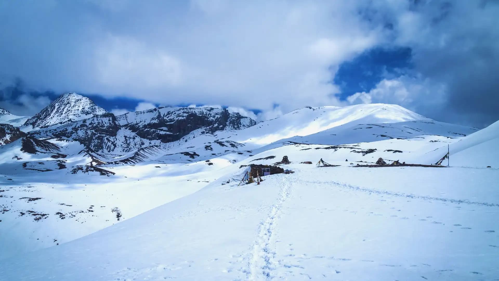
Thorong La Pass – Altitude, Route & What to Expect
Thorong La Pass sits at 5,416 meters (17,769 feet) above sea level, making it the highest point of the classic Annapurna Circuit and one of the highest trekking passes in the world that doesn't require any technical climbing skill. It connects the green, sheltered Manang Valley on its eastern side to the stark, wind-scoured Mustang region on its western side, and crossing it is widely considered the single defining moment of the entire Annapurna Circuit trek.
This guide covers exactly where it sits, how the crossing actually unfolds hour by hour, what the permits and logistics look like in 2026, and what genuinely goes wrong up there when it goes wrong.
Thorong La Pass at a glance
Fact | Detail |
|---|---|
Elevation | 5,416 m (17,769 ft) |
Mountain range | Damodar Himal, north of the Annapurna Himal |
Location | Between Manang and Mustang districts, Nepal |
Nearby peaks | Thorong Ri, Khatung Kang, Yakawa Kang |
Trek it belongs to | Annapurna Circuit Trek |
Standard crossing direction | Manang side (east) to Muktinath side (west) — the near-universal direction |
Typical crossing day | 7–10 hours of walking |
Best seasons | March–May (spring), September–November (autumn) |
Permits required | ACAP + guide (TIMS recommended) |
Coordinates | 28.793°N, 83.939°E |
Where Thorong La Pass Actually Sits
Thorong La lies in the Damodar Himal, a smaller range positioned just north of the main Annapurna Himal, in Nepal's Manang and Mustang districts. Geographically, it marks the point where the Annapurna Circuit crosses from the lush, forested, monsoon-influenced side of the Himalayas into the high, dry rain-shadow zone that extends north toward the Tibetan Plateau — the same broad climatic shift that defines Upper Mustang and the Kingdom of Lo further along the same rain-shadow belt.
On a map, the pass sits almost exactly between the villages of Manang to the east and Muktinath to the west, flanked by two named peaks that trekkers pass directly beneath: Khatung Kang and Yakawa Kang, with Thorong Ri rising on the same ridge system.
The pass is not a single point so much as a broad, exposed saddle — trekkers frequently note that the actual highest ground extends for roughly 1 to 2 kilometers before the trail begins its steep drop toward Muktinath, meaning you spend meaningful time at extreme altitude even after technically "reaching" the pass.
At the top, a simple signboard, prayer flags, and small chortens mark the highest point — a modest, weather-beaten monument for what is, for most trekkers, one of the more physically and emotionally significant moments of their lives.
How High Is 5,416 Meters, in Context
Numbers like 5,416 meters are hard to picture without a reference point. Here's what that elevation actually means in practical terms:
Thorong La is slightly higher than Everest Base Camp on the Nepal side (5,364 m) — a fact that regularly surprises trekkers who assume EBC, given its fame, must be the higher of the two. It isn't.
It sits below Kala Patthar (5,644 m), the viewpoint above Everest Base Camp, but well above Kilimanjaro's summit is not comparable here — Kilimanjaro (5,895 m) is actually higher than Thorong La, though Thorong La is crossed as a single-day pass rather than a summit push.
Atmospheric oxygen at 5,416 meters is roughly half of what's available at sea level, meaning every step above Thorong Phedi or High Camp is taken with meaningfully less oxygen reaching the bloodstream than at lower altitude.
It's higher than the summit of Mont Blanc (4,809 m), the highest peak in the Alps, by more than 600 meters — and trekkers cross it on foot, typically without any technical mountaineering equipment, roped travel, or climbing experience, because the route itself is a walking trail rather than a technical ascent.
That last point is worth sitting with: Thorong La is not a technical climb, but it is a genuine high-altitude undertaking, and treating it as "just a long walk" is the single most common mistake trekkers make when preparing for the crossing.
The Annapurna Circuit and Where Thorong La Fits
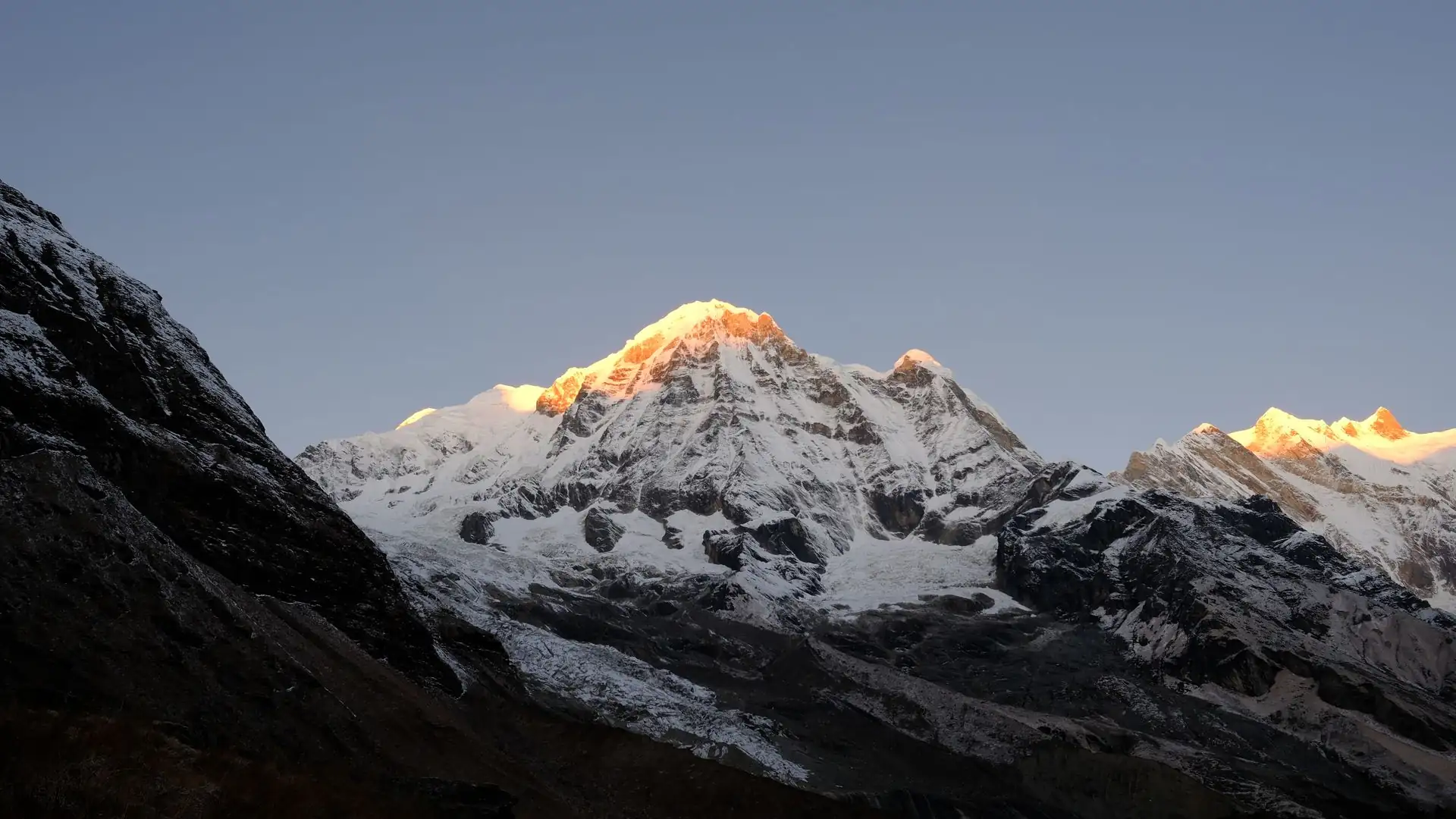
The Annapurna Circuit is a long-distance trek that encircles the Annapurna Massif, historically running somewhere between 160 and 230 kilometers depending on where road access is used to shorten the walking sections and where the trek is considered to begin and end.
Thorong La sits roughly at the trek's midpoint, functioning as the physical and psychological hinge of the entire route — the trail climbs steadily toward it from the Manang side over the better part of a week, and then descends far more rapidly on the Muktinath side, dropping into the dramatically different, drier landscape of the Kali Gandaki valley.
Most trekkers walk the circuit counterclockwise — starting in the lower, wetter Marsyangdi valley near Besisahar and finishing in the Kali Gandaki valley near Jomsom — specifically because this direction produces a slower, more gradual daily altitude gain heading into the pass, and because crossing Thorong La from the Manang side to the Muktinath side involves a shorter, safer final descent than the reverse.
Attempting the circuit clockwise, climbing steeply from Muktinath up to the pass in a single push, is considerably more dangerous and is generally discouraged by guides and trekking agencies alike, precisely because it compresses the acclimatization schedule into far too short a window.
The Route to Thorong La: Manang Side
The standard approach to Thorong La runs through a sequence of villages that double as acclimatization checkpoints, not unlike the staged ascent used on the Everest Base Camp trek. Trekkers typically spend at least one full rest day in Manang village itself (3,519 m) before continuing higher, since Manang is the last genuinely comfortable, well-supplied village before the final push toward the pass.
Stop | Elevation | Typical duration from previous stop |
|---|---|---|
Manang | 3,519 m | Rest/acclimatization day |
Yak Kharka | 4,050–4,060 m | 4–5 hours from Manang |
Thorong Phedi | 4,450–4,525 m | 3–4 hours from Yak Kharka |
High Camp | ~4,850 m | 1–1.5 hours from Thorong Phedi (optional overnight) |
Thorong La Pass (summit) | 5,416 m | 4–6 hours from Thorong Phedi/High Camp |
Muktinath | 3,760 m | 3–4 hours descent from the pass |
Yak Kharka, as the name suggests ("yak pasture" in the local dialect), is a small settlement of stone lodges surrounded by open grazing land, offering trekkers a night at just over 4,000 meters before the terrain steepens further. From there, the trail climbs to Thorong Phedi — literally "the foot of Thorong" — which functions as the last major staging point before the crossing. Phedi's lodges are basic but essential, and this is where most trekkers make their final decision about pacing strategy for the following day.
From Thorong Phedi, trekkers face a genuine choice: stay the night at Phedi itself, or continue a further hour to ninety minutes up to High Camp at approximately 4,850 meters, sleeping closer to the pass to shorten the following day's crossing. Both options carry trade-offs. Staying at Phedi means a longer, harder push on crossing day but a night spent at a comparatively lower, more oxygen-rich altitude, generally allowing better sleep.
Pushing on to High Camp shortens crossing day but means sleeping at a meaningfully higher altitude the night before the hardest physical effort of the trek, which some trekkers find makes for a rougher, more restless night. Neither choice is objectively correct — it depends heavily on how an individual trekker's body has responded to altitude up to that point.
Crossing Day: What Actually Happens
Crossing day begins early — typically between 4:00 and 5:30 a.m., in full darkness, with headlamps. This early start isn't just tradition; it's a practical necessity. Winds at the pass tend to strengthen significantly by mid-to-late morning, and starting before dawn gives trekkers the best chance of summiting and beginning the descent before conditions deteriorate.
It also means trekkers are typically walking the final, coldest stretch to the pass in temperatures that can be well below freezing, even in the main trekking seasons.
The climb from Thorong Phedi or High Camp to the pass itself typically takes four to six hours, covering a vertical gain of roughly 550 to 950 meters depending on the starting point, on a trail that alternates between switchbacking ascents and short, relatively flat stretches.
It is slow, cold, and physically demanding — not technically difficult in the sense of requiring ropes or crampons under normal conditions, but genuinely taxing due to the combined effect of altitude, cold, and sustained uphill effort at a point in the trek when trekkers are already several days into cumulative fatigue.Reaching the pass itself is, by nearly universal account, an intensely emotional moment for trekkers — the prayer flags, the modest signboard, and the sweeping views across the Annapurna and Damodar ranges mark the physical high point of the entire circuit. Most trekkers spend a relatively short time at the summit itself, typically 15 to 30 minutes for photos and rest, before beginning the descent, since prolonged time at 5,416 meters in cold, thin air isn't advisable regardless of how good anyone feels in the moment.
The descent to Muktinath (3,760 m) is steep and comparatively fast — typically three to four hours — dropping over 1,600 meters in a single afternoon. This descent is, in its own way, as demanding as the ascent: the steep, often loose or icy terrain is hard on the knees, and the rapid elevation loss after hours of high-altitude exertion leaves many trekkers more fatigued on the way down than they expected. By the time trekkers reach Muktinath, they've typically been walking for 7 to 10 hours total, crossed the highest point of their trip, and dropped into an entirely different landscape and climate zone than the one they woke up in.
The Two Landscapes Thorong La Divides
Part of what makes the Thorong La crossing so memorable isn't just the altitude — it's the dramatic shift in scenery on either side. The Manang side is comparatively green, sheltered by the main Annapurna range from the worst of the wind, and dotted with Tibetan Buddhist villages, monasteries, and yak pastures that feel, geographically and culturally, connected to the rest of central Nepal's high mountain communities.
The Muktinath and Mustang side, by contrast, sits in the rain shadow of the Annapurna and Dhaulagiri massifs, producing a stark, arid, wind-carved landscape of ochre cliffs and sparse vegetation that looks — and, geologically, essentially is — an extension of the Tibetan Plateau.
Muktinath itself, the first major village after the descent, is one of the most important pilgrimage sites in the Himalayas for both Hindus and Buddhists, home to the Muktinath Temple complex, considered sacred by Hindus as one of the 108 Divya Desams associated with Vishnu, and by Buddhists as an important site connected to Guru Rinpoche (Padmasambhava).
For many trekkers, arriving in Muktinath directly after crossing Thorong La adds a layer of cultural and spiritual significance to what is already, for most, one of the most physically demanding days of the trek.
Difficulty and Physical Demands
Thorong La is regularly described by trekking agencies and past trekkers alike as "challenging but achievable" for reasonably fit trekkers with proper acclimatization — a phrase worth taking seriously on both halves. It does not require technical mountaineering skill, ropes, or specialized climbing equipment under normal seasonal conditions.
It does require solid cardiovascular fitness, mental resilience for a long, cold, early-morning effort, and — critically — a properly paced itinerary that allows the body time to acclimatize before the crossing.
The core physical challenges trekkers face are:
Altitude. Above 4,000 meters, oxygen availability drops enough that most people notice reduced stamina, shortness of breath on exertion, and disrupted sleep, even without developing altitude sickness. By 5,416 meters, oxygen availability is roughly half of sea-level levels.
Cold. Pre-dawn temperatures at the pass regularly drop well below freezing, even during the main spring and autumn trekking seasons, and wind chill at that elevation can make conditions feel significantly colder still.
Duration. A 7-to-10-hour trekking day, much of it at altitudes above 4,500 meters, represents sustained physical effort at a point in the itinerary when cumulative fatigue from the preceding week of trekking is already a factor.
Terrain. While not technical, the trail includes loose scree, occasional icy or snow-covered sections (particularly early or late in the season), and a long, knee-jarring descent on the Muktinath side.
Altitude Sickness: The Real Risk on Thorong La
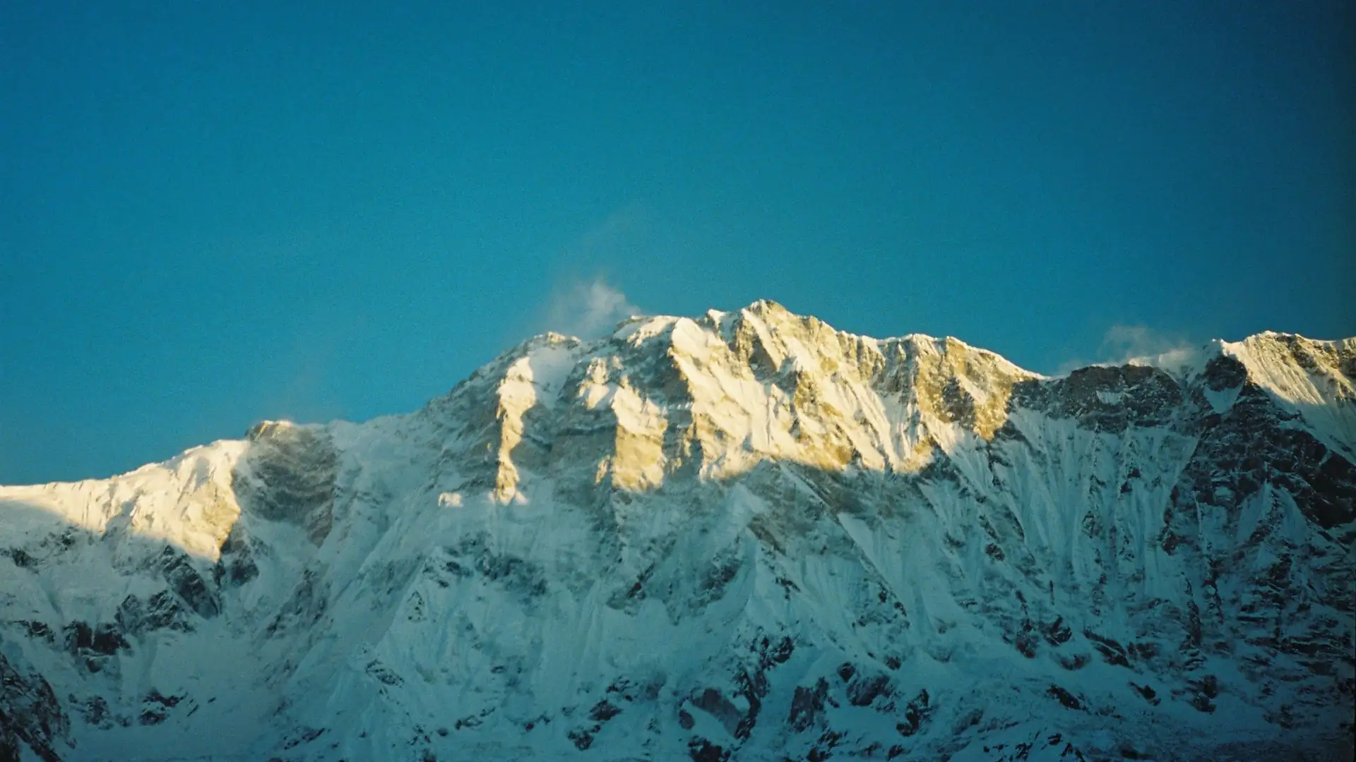
Acute Mountain Sickness (AMS) is the single most important safety consideration on the Thorong La crossing, and it is a risk that depends far more on ascent pace than on general fitness level — a genuinely fit, athletic trekker can develop AMS just as easily as a less experienced one if the itinerary is rushed. Early symptoms include headache, nausea, dizziness, loss of appetite, and disrupted sleep. More severe forms — High Altitude Pulmonary Edema (HAPE) and High Altitude Cerebral Edema (HACE) — are life-threatening and require immediate descent.
The standard mitigation strategy mirrors the approach used on the Everest Base Camp trek: build in acclimatization days (Manang is the key rest stop before the final push), avoid excessive elevation gain in a single day once above 3,000 meters, stay well hydrated, and — most importantly — take any early AMS symptoms seriously rather than pushing through them. A guide experienced in recognizing AMS symptoms, and willing to alter the itinerary or recommend descent if needed, is one of the most valuable safety resources on this crossing, which is part of why Nepal now mandates licensed guides for trekkers in the Annapurna Conservation Area.
The 2014 Thorong La Disaster
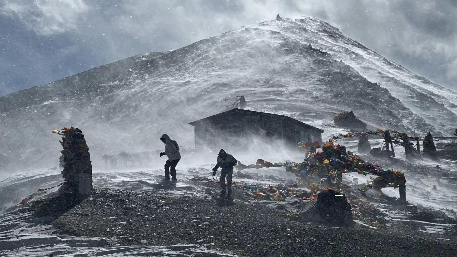
Thorong La's history includes one of the deadliest trekking disasters ever recorded in Nepal, and it's worth understanding both because of its historical weight and because of what it changed about how the crossing is approached today. On October 14, 2014, a sudden and severe blizzard struck the Annapurna region, catching hundreds of trekkers on or near Thorong La during peak post-monsoon trekking season. The storm resulted from the remnants of Cyclone Hudhud merging with an upper-level weather trough over the Himalayas, producing an extreme, fast-moving snow event that dropped roughly 1.8 meters of snow in a matter of hours in parts of the region.
Hundreds of trekkers were caught in the open, on exposed sections of trail near and on the pass itself, with visibility reduced to near zero. Many who tried to descend from the pass in the whiteout conditions became disoriented and succumbed to exposure and hypothermia rather than being able to find shelter. The Nepalese army and volunteer rescue teams, hampered by ongoing severe weather and avalanche risk, worked over several days to reach stranded trekkers, ultimately confirming a final death toll of 43 people — trekkers, guides, and porters from at least 11 countries — making it the worst trekking disaster in Nepal's history at the time.
The disaster led to significant changes in how the Annapurna region manages trekker safety, including improved weather monitoring and communication systems, stronger emphasis on guided trekking rather than fully independent travel, and greater awareness among trekking agencies about building weather contingency and rapid-descent planning directly into Thorong La crossing days.
It remains, more than a decade later, the reference point most guides and agencies use when explaining why weather awareness on crossing day is treated as non-negotiable, regardless of how clear the sky looks at the start of the walk.
Best Time to Cross Thorong La
Because the pass sits above 5,000 meters, timing genuinely matters — far more than on lower sections of the Annapurna Circuit. Two seasons offer the most reliable conditions:
Spring (March to May) brings warming temperatures, blooming rhododendrons on the lower sections of the trail, and generally stable weather windows at altitude, though late-season snowmelt can occasionally make the upper trail muddy or, early in the season, still snow-covered.
Autumn (late September to November) is widely considered the single best season for the crossing — clear skies following the monsoon, stable weather, and excellent visibility of the surrounding peaks, though this is also the season during which the 2014 disaster occurred, a reminder that "best season" does not mean "risk-free."
Winter (December to February) is possible but significantly harder — heavy snow can close the pass entirely for periods, temperatures at High Camp and the pass itself can drop dramatically below freezing, and some teahouses along the route reduce services or close.
Monsoon (June to August) brings low visibility, wet trail conditions on the lower sections, and increased landslide risk on approach routes, and is generally not recommended for a Thorong La crossing.
Season | Conditions | Recommendation |
|---|---|---|
Spring (Mar–May) | Warming, generally stable, occasional late snow at altitude | Recommended |
Autumn (late Sep–Nov) | Clearest skies, most stable weather overall | Most recommended |
Winter (Dec–Feb) | Cold, risk of pass closure due to heavy snow | Experienced trekkers only |
Monsoon (Jun–Aug) | Wet, low visibility, landslide risk on approach | Not recommended |
Permits Required for Thorong La / Annapurna Circuit
As of 2026, trekkers crossing Thorong La as part of the Annapurna Circuit need the Annapurna Conservation Area Permit (ACAP), and Nepal now requires a licensed guide for all trekkers in the Annapurna Conservation Area, booked through a registered trekking agency — fully independent solo trekking without a guide is no longer permitted in the region.
Permit | Cost (2026, foreign trekkers) | Notes |
|---|---|---|
ACAP (Annapurna Conservation Area Permit) | NPR 3,000 (~USD 23) | Issued by NTNC; covers the entire Annapurna Conservation Area, including the Circuit |
TIMS Card | NPR 2,000 (~USD 15–20) | Enforcement varies by checkpoint; many agencies register trekkers regardless |
Licensed guide | Mandatory | Must be booked through a registered agency |
Both permits can be arranged in Kathmandu or Pokhara before departing for Besisahar, the typical starting point of the classic circuit route. SAARC nationals pay a reduced ACAP rate (NPR 1,000), and children under 10 are exempt from ACAP fees.
What to Pack for the Crossing
Given the temperature swings and physical demands of crossing day specifically, a few items matter more than others:
Layered insulation — a proper down jacket, thermal base layers, and windproof outer shell, since pre-dawn temperatures at the pass can be well below freezing even in the warmer trekking seasons.
Trekking poles — genuinely valuable on both the steady climb to the pass and, especially, the long, knee-jarring descent to Muktinath.
Headlamp with spare batteries — essential given the pre-dawn start.
Sunglasses or glacier glasses — snow glare at altitude, particularly later in the morning, can cause real eye strain or snow blindness without adequate protection.
High-calorie snacks and a full water supply — appetite commonly drops at altitude even as energy demands rise, making deliberate eating and hydration important rather than optional.
Basic first-aid and any personal AMS medication discussed in advance with a doctor, carried and understood by both the trekker and their guide.
FAQs About Thorong La Pass
Is Thorong La higher than Everest Base Camp?
Yes. Thorong La sits at 5,416 meters, while Everest Base Camp on the Nepal side sits at 5,364 meters — a difference of about 52 meters.Do I need mountaineering experience to cross Thorong La?
No. The crossing is a high-altitude trek, not a technical climb, and doesn't require ropes, crampons, or climbing skill under normal seasonal conditions. It does require good fitness and proper acclimatization.How long does it take to cross Thorong La on crossing day itself?
Most trekkers take 7 to 10 hours total, including the ascent from Thorong Phedi or High Camp to the pass and the descent to Muktinath.Which direction should I cross Thorong La — Manang to Muktinath, or the reverse?
Manang to Muktinath (counterclockwise on the circuit) is strongly preferred and used by the vast majority of trekkers, since it allows a more gradual altitude gain and a shorter, safer final descent.What's the difference between staying at Thorong Phedi versus High Camp before crossing?
Phedi (4,450–4,525m) offers a lower, more comfortable sleeping altitude but a longer crossing day; High Camp (~4,850m) shortens the crossing day but means sleeping higher the night before the hardest physical effort.Is Thorong La dangerous?
Under normal conditions and with proper acclimatization, most trekkers cross safely. The 2014 disaster, which killed 43 people, remains the clearest reminder that sudden severe weather at this altitude is a genuine risk that requires respect, planning, and a willingness to delay or turn back if conditions deteriorate.What permits do I need for Thorong La?
The ACAP (Annapurna Conservation Area Permit) and a licensed guide are required as of 2026; the TIMS card is recommended and still enforced at some checkpoints.When is the best time to cross?
Autumn (late September to November) generally offers the most stable weather, though spring (March to May) is also a strong option. Winter crossings are possible but significantly harder, and monsoon season is not recommended.Can beginners cross Thorong La?
Yes, with the right preparation — proper acclimatization days built into the itinerary, reasonable fitness, and a guide experienced in altitude management matter more than prior trekking experience.What should I do if I feel symptoms of altitude sickness before or on crossing day?
Inform your guide immediately. Mild symptoms like headache or nausea can worsen quickly at this altitude, and descent is the most effective treatment if symptoms progress.
Conclusion about Thorong La Pass
Thorong La Pass, at 5,416 meters, is more than a statistic — it's the physical and emotional hinge of the entire Annapurna Circuit, the point where the trek's gentler eastern landscapes give way to the stark, high-desert terrain of Mustang, and where days of steady acclimatization finally pay off in a single long, cold, unforgettable crossing.
It doesn't require technical climbing skill, but it does demand real respect: for the altitude, for the weather, and for the pacing that gets trekkers there safely rather than in a rush. The 2014 disaster is a permanent, sobering reminder of what happens when that respect isn't matched by preparation and caution.
For everyone who crosses it properly prepared, though, Thorong La remains exactly what generations of trekkers have described it as — the hardest day of the Annapurna Circuit, and very often the best one.