
Mardi Himal Altitude: Complete Guide & Facts for 2026
Introduction to Mardi Himal Altitude
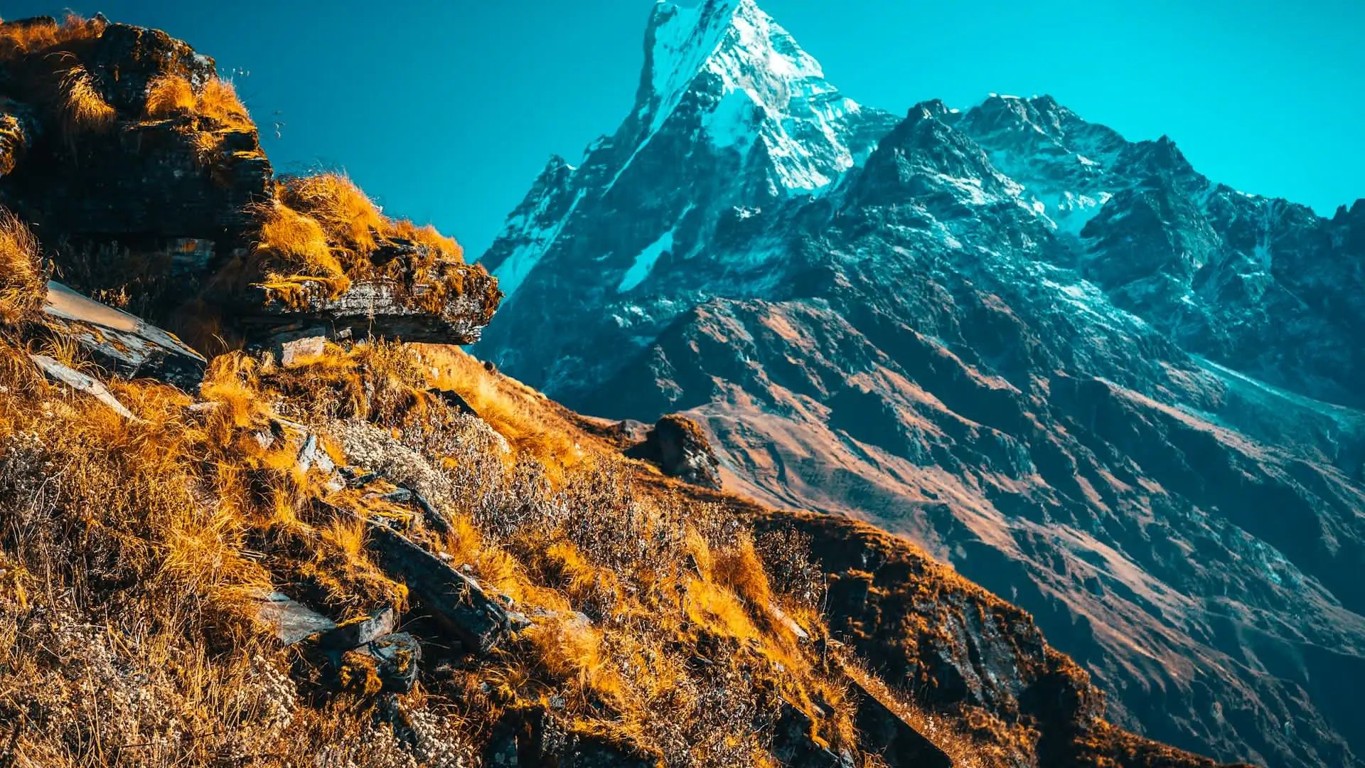
Mardi Himal altitude is a phrase that actually refers to two different numbers, and mixing them up is one of the more common points of confusion for people researching this trek. There's the altitude of Mardi Himal the mountain — 5,587 meters, a genuine Himalayan peak requiring a technical climbing permit to summit.
And there's the altitude most trekkers actually reach on the popular "Mardi Himal Trek" — 4,200 to 4,500 meters, at the Upper Viewpoint and Mardi Himal Base Camp, a non-technical trekking destination that sits well below the mountain's true summit.
This guide sorts out that distinction clearly, then goes deep on what actually matters for anyone planning this trek: the full elevation profile from trailhead to base camp, exactly how much altitude you gain each day, where the real Acute Mountain Sickness (AMS) risk concentrates on this specific route, and how this trek's altitude demands compare to other popular Annapurna region options.
Every elevation figure and risk statistic below is checked against multiple current sources, and where those sources present genuinely different numbers for the same camp or stage — which happens often on a route with several itinerary variants — that variation is presented as an honest range.
Clearing Up the Confusion: Mountain Altitude vs. Trek Altitude
Term | Altitude | What it actually means |
|---|---|---|
Mardi Himal (the mountain summit) | 5,587m (18,330 ft) | A genuine Himalayan peak requiring a technical climbing permit (NMA Group B trekking peak) and rated PD — "Peu Difficile," or Slightly Difficult — on the French Alpine Scale; not reached by standard trekkers |
Mardi Himal Base Camp | 4,500m (14,763-14,764 ft) | The highest point most trekkers actually reach; the endpoint of the standard "Mardi Himal Trek" |
Upper Viewpoint / Mardi Himal Viewpoint | 4,200m | Often cited as the trek's best panoramic vantage point, reached just before or in place of pushing on to base camp |
The overwhelming majority of people who book a "Mardi Himal Trek" are trekking to the base camp or upper viewpoint — not summiting the mountain itself. This guide covers both, but focuses primarily on trek altitude, since that's what applies to the vast majority of travelers researching this route.
Quick Facts: Mardi Himal Altitude at a Glance
Fact | Detail |
|---|---|
Mardi Himal peak (true summit) | 5,587m |
Maximum trek altitude (Base Camp) | 4,500m |
Upper Viewpoint altitude | 4,200m |
Highest sleeping altitude (High Camp) | Roughly 3,540-3,600m |
Trailhead altitude (Kande) | Roughly 1,770m |
Pokhara altitude (starting city) | Roughly 822-827m |
Total elevation gain, Kande to Base Camp | Roughly 2,730m |
Elevation where AMS risk becomes relevant | Roughly 2,500m, around Forest Camp |
Estimated AMS incidence on this trek | Roughly 20-30% of trekkers |
Location of Mardi Himal peak | Between Annapurna South (7,219m) and Machhapuchhre (6,993m) in the Annapurna Conservation Area |
The Mountain Itself: Mardi Himal at 5,587 Meters
Mardi Himal is located in Nepal's Annapurna region, positioned between Annapurna South (7,219m) and Machhapuchhre/Fishtail (6,993m) within the Annapurna Conservation Area. Reaching the true summit requires an NMA (Nepal Mountaineering Association) Group B trekking peak permit and technical climbing skill, with the route rated PD (Peu Difficile, or "Slightly Difficult") on the French Alpine Scale — meaning it involves genuine mountaineering technique, not simply walking, and is entirely separate from the standard trekking itinerary that ends at Base Camp or the Upper Viewpoint.
For the purposes of this guide, and for the vast majority of readers researching "Mardi Himal altitude," the relevant numbers are the trek's maximum trekking altitude (4,500m at Base Camp) rather than the mountain's true summit (5,587m) — a distinction worth keeping firmly in mind throughout.
The Full Elevation Profile: Trailhead to Base Camp
Camp/Waypoint | Elevation | Gain from previous point |
|---|---|---|
Pokhara (starting city) | ~822-827m | — |
Kande (trailhead) | ~1,770m | Reached by drive from Pokhara |
Pothana | ~1,890m | ~120m |
Pitam Deurali | ~1,990-2,150m | ~100-160m |
Forest Camp (Kokar) | ~2,500-2,600m | ~350-560m |
Low Camp | ~2,950-3,050m | ~400-450m |
Badal Danda | ~3,210m | ~225-260m |
High Camp | ~3,540-3,600m | ~370-390m |
Upper Viewpoint | ~4,200m | ~600-660m |
Mardi Himal Base Camp | ~4,500m | ~300-350m from Upper Viewpoint, or ~900-950m directly from High Camp |
Total elevation gain from Kande to Base Camp: roughly 2,730 meters — a genuinely significant climb condensed into what's typically a 4-7 day trek, which is exactly why understanding the daily breakdown below matters so much for planning a safe, comfortable itinerary.
Day-by-Day Altitude Gain: How It Varies by Itinerary Length
Because this trek is offered in several different durations, daily elevation gain varies considerably depending on which itinerary you choose. Here's how three common configurations break down.
4-Day Itinerary (Compressed, Faster-Paced)
Day | Route | Distance | Elevation gain |
|---|---|---|---|
1 | Kande → Forest Camp | ~13.7 km | +1,678m |
2 | Forest Camp → High Camp | ~7.6 km | +1,050m |
3 | High Camp → Base Camp/Viewpoint → descend to Low Camp or Forest Camp | Variable | Gain to 4,500m, then significant descent |
4 | Descend to Siding/Pokhara | Variable | Full descent |
This compressed version is explicitly described by several operators as intended for "pro-trekkers" — experienced, very fit individuals comfortable with rapid elevation gain, since Day 1 alone involves nearly 1,700 meters of climbing.
5-Day Itinerary (Standard, More Common)
Day | Route | Distance | Elevation gain |
|---|---|---|---|
1 | Pokhara → Kande → Pitam Deurali | ~5.5 km | +1,328m |
2 | Pitam Deurali → Low Camp | ~11.7 km | +450m |
3 | Low Camp → High Camp → Upper Viewpoint/Base Camp → back to High Camp | Variable | Gain to 4,200-4,500m, then descent to High Camp |
4 | High Camp → descend toward Siding | Variable | Significant descent |
5 | Siding → Pokhara | Drive | — |
7-Day Itinerary (Extended, More Gradual)
Day | Route | Distance | Elevation gain |
|---|---|---|---|
1 | Pokhara → Kande → Australian Base Camp | ~2.3 km | +1,238m |
2 | Australian Base Camp → Forest Camp | ~11.5 km | +440m |
3 | Forest Camp → Low Camp | Variable | ~400-450m |
4 | Low Camp → High Camp | Variable | ~370-390m |
5 | High Camp → Upper Viewpoint/Base Camp → back to High Camp | Variable | Gain to 4,200-4,500m, then descent |
6 | High Camp → descend toward Siding | Variable | Significant descent |
7 | Siding → Pokhara | Drive | — |
The extended 7-day version spreads the same overall 2,730m of gain across more days, generally offering the safest, most comfortable pacing — a meaningful consideration given how compressed the shorter itineraries are relative to the total elevation involved.
Steepest Single-Day Elevation Gains
This is genuinely useful to know in advance, since these are the days that will feel hardest regardless of overall fitness level.
Section | Elevation gain | Typical time required |
|---|---|---|
High Camp (3,580m) → Upper Viewpoint (4,200m) | ~620m | 3-4 hours |
Pitam Deurali (1,990m) → Forest Camp (2,550m) | ~560m | 3-4 hours |
Kande (1,770m) → Forest Camp (compressed 4-day itinerary) | ~1,678m | Full first day, generally only for very fit trekkers |
High Camp → Mardi Himal Base Camp (direct) | ~900-950m | Longer single push if skipping the Upper Viewpoint as an intermediate stop |
The High Camp-to-Upper Viewpoint stretch is consistently identified as the steepest section relative to a single push, and it's also the section where AMS symptoms, if they're going to appear, are most likely to become noticeable, given the altitude involved.
Where AMS Risk Actually Begins on This Trek
Acute Mountain Sickness typically starts becoming a genuine concern once you cross the roughly 2,500-meter mark — which on the Mardi Himal trail happens right around Forest Camp. This is meaningfully earlier in the itinerary than many first-time trekkers expect, given that the trek's headline elevation (4,500m at Base Camp) feels like the only number that matters.
Elevation | AMS relevance on this specific trek |
|---|---|
Below 2,000m (Kande, Pothana) | Minimal risk for most healthy trekkers |
2,000-2,500m (Pitam Deurali) | Risk beginning to become relevant |
2,500-3,500m (Forest Camp through Badal Danda) | Genuine risk zone; AMS symptoms can begin appearing here |
3,500-4,500m (High Camp through Base Camp) | The trek's highest-risk zone, particularly given the steep single-day pushes to the Upper Viewpoint and Base Camp |
How Common Is AMS on the Mardi Himal Trek?
Estimates vary across sources, but a commonly cited range puts AMS incidence at roughly 20-30% of trekkers on this specific route — a meaningful proportion, driven largely by the trek's combination of relatively steep daily ascents and its short overall duration compared to longer treks with more built-in acclimatization buffer.
Trek | Maximum elevation | General AMS incidence pattern |
|---|---|---|
3,210m | Lower, given the more modest peak elevation | |
Mardi Himal | 4,500m | Roughly 20-30% |
4,130m | Roughly 30-40% | |
5,364m | Higher, roughly 40-60% per some sources, given greater peak elevation and longer duration above 4,000m | |
Annapurna Circuit (Thorong La) | 5,416m | Comparably high given the extreme elevation and sustained multi-day approach above 4,000m |
These figures vary meaningfully between sources and should be treated as general planning context rather than precise, universally agreed statistics — but the consistent pattern across sources is clear: Mardi Himal's relatively steep, compressed ascent profile creates real AMS risk despite its shorter overall duration and lower peak elevation compared to routes like Everest Base Camp.
Why This Trek's Short Duration Is a Genuine Risk Factor
This is worth stating plainly, since it's counterintuitive: the trek's main appeal — its short 4-8 day duration — is also its main altitude-related risk factor. Unlike the Annapurna Circuit, which builds in a dedicated rest day at Manang specifically because the route sustains high-altitude exposure over many days, Mardi Himal's standard itineraries generally don't include a formal, dedicated acclimatization day.
The trek relies instead on its overall shorter duration and generally moderate daily gains to manage risk — a strategy that works well for many trekkers but leaves less margin for error than a longer route with explicit rest-day buffer.
Key relevant elevation gain guideline: a widely cited general safety principle in trekking medicine recommends no more than roughly 300-500 meters of net elevation gain per night once sleeping above 3,000 meters.
On the compressed 4-day Mardi Himal itinerary specifically, several stages exceed this guideline considerably — which is exactly why choosing a longer, 6-8 day itinerary is genuinely worth considering for trekkers without significant prior high-altitude experience, rather than defaulting to the shortest, fastest option available.
Sleeping Altitude vs. Day-Hike Altitude: An Important Distinction
One structural feature of the Mardi Himal trek's altitude profile deserves specific attention: most itineraries have trekkers sleep at High Camp (roughly 3,540-3,600m) and then day-hike up to the Upper Viewpoint (4,200m) or Base Camp (4,500m) before returning to sleep at High Camp again, rather than sleeping at the higher elevation itself.
This pattern is, in principle, a reasonably sound acclimatization strategy — it resembles the "climb high, sleep low" approach recommended in general altitude medicine guidance, since it exposes the body to higher altitude during the day while returning to a lower, more manageable sleeping elevation at night.
However, it's worth understanding this isn't a substitute for gradual acclimatization earlier in the trek — the body still needs to have adjusted reasonably well to 3,500+ meters by the time it pushes to 4,200-4,500m for the day, even if it doesn't sleep at that higher point.
Stage | Sleeping altitude | Day-hike altitude reached |
|---|---|---|
Summit/viewpoint day | High Camp, ~3,540-3,600m | Upper Viewpoint (4,200m) or Base Camp (4,500m) |
Practical implication: if you're feeling any early AMS symptoms at High Camp the night before your push to the viewpoint or base camp, that's a genuine signal to discuss delaying the push or turning back early with your guide — the "climb high, sleep low" structure only provides its acclimatization benefit if the body was reasonably well-adjusted to the sleeping altitude in the first place.
Oxygen Availability at Key Elevations
Understanding roughly how much less oxygen is available at each stage helps put the physical demand of this trek's altitude gain into concrete terms.
Elevation | Approximate oxygen availability relative to sea level |
|---|---|
Sea level | 100% (baseline) |
~1,770m (Kande) | Roughly 82-85% |
~2,500m (Forest Camp) | Roughly 75% |
~3,540m (High Camp) | Roughly 65% |
~4,200m (Upper Viewpoint) | Roughly 60% |
~4,500m (Base Camp) | Roughly 58-60%, commonly described as "roughly 40% less oxygen than sea level" |
These figures are approximate and vary slightly by source and atmospheric conditions, but the trend is unambiguous: by the time you reach Mardi Himal Base Camp, you're breathing air with meaningfully less than two-thirds the oxygen density available at sea level — a genuine physiological demand regardless of how fit or experienced a trekker you are.
Comparing Mardi Himal's Altitude to Other Popular Treks
Trek | Maximum altitude | How it compares |
|---|---|---|
Ghorepani Poon Hill | 3,210m | Lower and generally considered easier from an altitude standpoint |
Mardi Himal | 4,500m | Higher than ABC's base camp itself; a meaningful step up in altitude demand |
4,130m | Slightly lower maximum altitude than Mardi Himal, though generally trekked over a longer, more gradual itinerary | |
5,364m | Considerably higher, with a longer duration and more sustained time above 4,000m | |
Annapurna Circuit (Thorong La) | 5,416m | Considerably higher, with the added factor of a single, mandatory high-pass crossing |
A genuinely notable fact worth highlighting: Mardi Himal Base Camp, at 4,500 meters, sits higher than Annapurna Base Camp (4,130 meters) — a detail that surprises many trekkers who assume Mardi Himal, given its shorter overall duration and lower profile compared to ABC, would also involve less altitude. In practice, it reaches a genuinely higher point, packed into a considerably shorter trip.
Difficulty Grading in Context of Altitude
Mardi Himal is generally graded moderate difficulty, involving 5-7 hours of daily walking with elevation gains of 500-900 meters on the steepest days. It's consistently described as more demanding than the shorter, lower Ghorepani-Poon Hill trek, given its higher terminus altitude (4,200-4,500m) and steeper terrain, but less demanding overall than the full Annapurna Base Camp trek or the Annapurna Circuit, largely due to its considerably shorter overall duration.
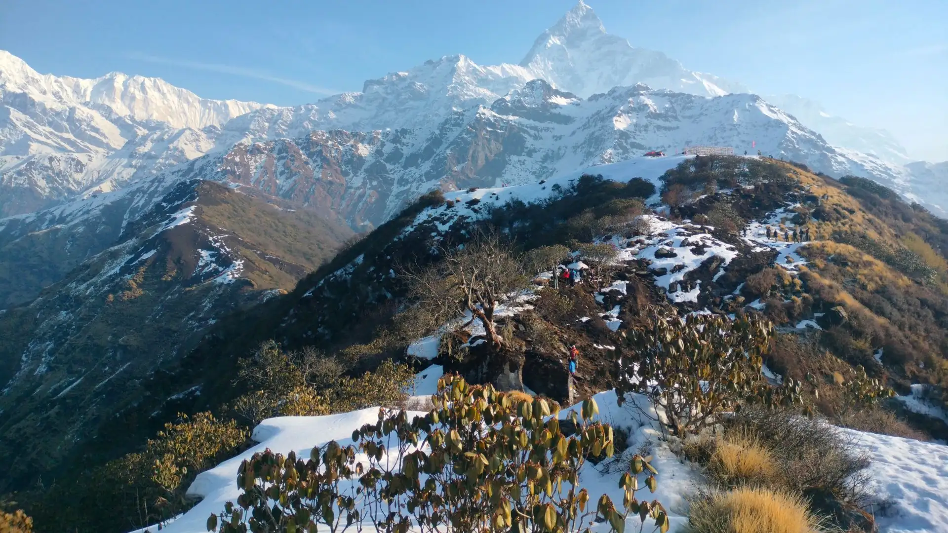
The trek's final stretch — from High Camp onward — follows an exposed high ridge rather than a forested valley trail, meaning trekkers are walking at a genuinely high, open elevation with the full weight of the Annapurna Sanctuary wall visible at eye level, a distinctive character compared to valley-based treks like ABC.
Practical Altitude Preparation for This Specific Trek
Choose Your Itinerary Length Deliberately
Given the trek's relatively compressed elevation gain compared to its short overall duration, choosing a 6-8 day itinerary over the fastest 4-day compressed version is genuinely worth considering for trekkers without significant prior high-altitude experience, since it spreads the same overall 2,730m of gain more gradually.
Watch for Symptoms Specifically From Forest Camp Onward
Since AMS risk becomes relevant around 2,500 meters — right around Forest Camp — this is the point in the trek where paying closer attention to how you're feeling genuinely matters, well before you reach the more dramatic upper elevations.
Use High Camp as Your Decision Point
Given that most itineraries sleep at High Camp before day-hiking to the Upper Viewpoint or Base Camp, treat any symptoms felt at High Camp itself as a meaningful signal — this is the last reasonable point to decide whether pushing higher the next day is a good idea, rather than discovering a problem partway up the steep final stretch.
Stay Hydrated Throughout
Commonly cited guidance recommends roughly 3-4 liters of water per day while trekking at altitude — genuinely relevant on this trek given how much of the total elevation gain happens across a short number of days.
Discuss Diamox With a Doctor If You Have Any Altitude Sensitivity History
Given this trek's relatively steep ascent profile and lack of a dedicated rest day, trekkers with any history of altitude sensitivity, or those simply wanting extra preventive measure, may want to discuss preventive Diamox (acetazolamide) with a doctor before departure — a decision that should always be made with a physician familiar with your health history.
Know the Descent Rule
If symptoms worsen — persistent vomiting, worsening headache unresponsive to basic pain relief, or coordination issues — the standard guidance applies regardless of how close you are to the Upper Viewpoint or Base Camp: stop ascending, and descend if symptoms don't improve within a reasonable window. Confusion, chest tightness, extreme fatigue, or difficulty walking are signs of potentially severe AMS and require immediate descent.
A Note on Guide Support for This Trek
Given the trek's relatively compressed altitude profile and lack of a formal rest day, an experienced guide's real-time judgment matters meaningfully here — including whether a particular day's pace should be adjusted, whether an extra night at Low Camp or High Camp is worth adding if a trekker is showing early symptoms, and general pacing decisions through the steepest sections identified above.
This is a core part of the value an experienced, locally based operator like Adventure Life Nepal brings to Mardi Himal planning specifically — not just route knowledge, but genuine, on-the-ground judgment about how a compressed altitude profile like this one should be paced for your specific fitness level and trekking experience.
Elevation Quick-Reference Table (Full Route)
Location | Elevation |
|---|---|
Pokhara | ~822-827m |
Kande (trailhead) | ~1,770m |
Pothana | ~1,890m |
Pitam Deurali | ~1,990-2,150m |
Forest Camp / Kokar | ~2,500-2,600m |
Low Camp | ~2,950-3,050m |
Badal Danda | ~3,210m |
High Camp | ~3,540-3,600m |
Upper Viewpoint | 4,200m |
Mardi Himal Base Camp | 4,500m |
Mardi Himal peak (technical summit, not part of standard trek) | 5,587m |
Frequently Asked Questions about Mardi Himal Altitude
1. What is the altitude of Mardi Himal?
The mountain's true summit sits at 5,587 meters, but the standard "Mardi Himal Trek" that most travelers book only reaches Base Camp (4,500m) or the Upper Viewpoint (4,200m) — the summit itself requires a technical climbing permit and mountaineering skill, and isn't part of the typical trekking itinerary.
2. What is the highest point most trekkers actually reach on this trek?
Mardi Himal Base Camp, at 4,500 meters — notably higher than Annapurna Base Camp's 4,130 meters, despite Mardi Himal's considerably shorter overall trek duration.
3. At what elevation does altitude sickness become a concern on this trek?
Roughly 2,500 meters, which corresponds to around Forest Camp — meaningfully earlier in the itinerary than the trek's headline elevation might suggest.
4. How much total elevation do you gain on the Mardi Himal trek?
Roughly 2,730 meters, from the trailhead at Kande (roughly 1,770m) to Mardi Himal Base Camp (4,500m).
5. How common is altitude sickness on the Mardi Himal trek?
Estimates commonly range around 20-30% of trekkers experiencing some AMS symptoms, driven largely by the trek's relatively steep, compressed ascent profile relative to its short overall duration.
6. Is Mardi Himal Base Camp higher than Annapurna Base Camp?
Yes — Mardi Himal Base Camp sits at 4,500 meters, compared to Annapurna Base Camp's 4,130 meters, a fact that surprises many trekkers given Mardi Himal's shorter, less prominent reputation.
7. Does the Mardi Himal trek have a dedicated acclimatization/rest day?
Generally no, unlike longer treks such as the Annapurna Circuit, which includes a formal rest day at Manang — this is a genuine factor worth considering, and choosing a longer 6-8 day itinerary over a compressed 4-day version helps compensate for the lack of a dedicated rest day.
8. What's the steepest single day of elevation gain on this trek?
The push from High Camp (3,580m) to the Upper Viewpoint (4,200m), gaining roughly 620 meters in 3-4 hours, is consistently identified as the trek's steepest single stretch.
9. Do trekkers sleep at Mardi Himal Base Camp itself?
Typically no — most itineraries have trekkers sleep at High Camp (roughly 3,540-3,600m) and day-hike up to the Upper Viewpoint or Base Camp before returning to sleep at High Camp, a structure resembling the "climb high, sleep low" acclimatization principle.
10. How does Mardi Himal's altitude compare to Everest Base Camp?
Considerably lower — Mardi Himal's 4,500m maximum is well below Everest Base Camp's 5,364m, and EBC involves a longer duration with more sustained time above 4,000 meters, generally corresponding to higher AMS risk.
11. Should I take Diamox for this trek given its altitude profile?
This is a decision to discuss with a doctor before departure, not decide independently — but given the trek's relatively compressed ascent and lack of a dedicated rest day, some trekkers, particularly those with any history of altitude sensitivity, discuss preventive Diamox as an added precaution.
12. Is Mardi Himal's peak (5,587m) part of the standard trek?
No — the mountain's true summit requires a separate NMA Group B trekking peak permit and technical climbing skill rated PD (Peu Difficile) on the French Alpine Scale, entirely distinct from the non-technical trekking itinerary that ends at Base Camp or the Upper Viewpoint.
13. What should I do if I feel symptoms at High Camp the night before pushing higher?
Treat this as a meaningful signal worth discussing with your guide — given that High Camp is the last major decision point before the steep push to 4,200-4,500m, symptoms felt here shouldn't be dismissed simply because you're close to the trek's highlight.
14. Is a longer itinerary genuinely safer from an altitude perspective on this specific trek?
Yes — a 6-8 day itinerary spreads the same roughly 2,730m of total elevation gain more gradually than the compressed 4-day version, providing more time for the body to adjust and generally reducing AMS risk, particularly for trekkers without significant prior high-altitude experience.
Final Thoughts on Mardi Himal Altitude
Mardi Himal altitude ultimately points to two genuinely different numbers worth keeping straight — the mountain's true 5,587-meter summit, reserved for technical climbers with a specific permit, and the 4,200-4,500 meter trekking destination that draws the vast majority of visitors to this route. That trekking altitude is nothing to underestimate on its own terms: it's genuinely higher than Annapurna Base Camp, compressed into a considerably shorter trip, and reached without the dedicated rest day that longer, higher treks like the Annapurna Circuit build in specifically to manage this kind of altitude exposure.
Understand where the real risk concentrates — starting as early as Forest Camp, intensifying through the steep High Camp-to-viewpoint push — choose an itinerary length that gives your body a fair chance to adjust, and the altitude that makes this trek a genuine high-mountain experience becomes something you're prepared for, rather than something that catches you by surprise on the one push you were most looking forward to.